Westliche Karwendelspitze is a 2385 m above sea level high mountain in the Karwendel on the border between Bavaria and North Tyrol. The summit is part...
1 KB (69 words) - 13:07, 16 November 2019
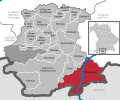
Mittenwald Municipality Mittenwald seen from Westliche Karwendelspitze Coat of arms Location of Mittenwald within Garmisch-Partenkirchen district Mittenwald...
4 KB (457 words) - 15:51, 20 August 2024
Sonnjoch 2,457 m Gamsjoch 2,452 m Erlspitze 2,404 m Kuhkopf 2,390 m Westliche Karwendelspitze 2,385 m Steinfalk 2,348 m Freiungen, west top, 2,332 m Suntiger...
6 KB (563 words) - 21:15, 3 November 2024
station of Karwendelbahn, a cable car connecting Mittenwald with Westliche Karwendelspitze mountain, is a 10-minute walk to the east of the station. As of...
6 KB (466 words) - 13:16, 4 November 2024
Closest city is Mittenwald. Next closest peak in the range is the Westliche Karwendelspitze. There is an easy Via Ferrata passing over the part of the Karwendel...
2 KB (121 words) - 10:21, 17 June 2019
Steintalhörnl (2,468 m), Berchtesgadener Land, Berchtesgaden Alps Westliche Karwendelspitze (2,385 m), Garmisch-Partenkirchen district, Karwendel mountains...
41 KB (2,630 words) - 22:13, 29 November 2023
561 Cima Ovest/Westliche Zinne 2973 306 46°37′07″N 12°17′50″E / 46.61861°N 12.29722°E / 46.61861; 12.29722 (561. Cima Ovest / Westliche Zinne (2973 m))...
94 KB (827 words) - 18:10, 4 August 2024


