
The Shire of Yilgarn is a local government area in the eastern Wheatbelt region of Western Australia about 400 kilometres (250 mi) east of Perth, the state...
11 KB (857 words) - 12:11, 22 January 2024
Northern Yilgarn is an area at the juncture of the Shire of Yilgarn, Shire of Menzies and Shire of Coolgardie in Western Australia, north of Koolyanobbing...
2 KB (197 words) - 22:02, 6 July 2024
Yilgarn is a large craton which constitutes the bulk of the Western Australian land mass. Yilgarn may also refer to: Shire of Yilgarn, an administrative...
872 bytes (145 words) - 11:18, 16 April 2022
Australia. As of 2023[update], 116 places are heritage-listed in the Shire of Yilgarn, of which 15 are on the State Register of Heritage Places. The Western...
6 KB (123 words) - 00:53, 26 February 2023
Mount Palmer, Western Australia (category Shire of Yilgarn)
Mount Palmer was a town in the Yilgarn shire in Western Australia. It was founded in 1934 after the discovery of gold in the area. The Mount Palmer Gold...
4 KB (480 words) - 22:01, 6 July 2024
Marvel Loch Gold Mine (redirect from Yilgarn Star Gold Mine)
owned the Yilgarn Star Joint Venture approximately 16 km (9.9 mi) south of Marvel Loch. The Yilgarn Star Joint Venture operated the Yilgarn Star Open...
15 KB (1,210 words) - 20:43, 25 April 2024
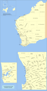
plus seven significant regional centres Shire – predominantly rural or outer suburban areas, plus the Shire of Peppermint Grove Town – predominantly...
59 KB (1,456 words) - 23:12, 21 June 2024

Southern Cross, Western Australia (category Shire of Yilgarn)
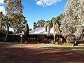
gazetted in 1890. It is the major town and administrative centre of the Shire of Yilgarn. At the 2016 census, Southern Cross had a population of 680. The town...
11 KB (767 words) - 04:42, 1 May 2024

The Shire of Coolgardie is a local government area in the Goldfields–Esperance region of Western Australia, lying roughly west and south of the city of...
9 KB (658 words) - 22:06, 6 July 2024
Yilgarn-Dundas was an electoral district of the Legislative Assembly in the Australian state of Western Australia from 1977 to 1983. The district was...
2 KB (94 words) - 12:05, 8 March 2023

proposed merger with the neighbouring larger Shire of Yilgarn, with 82 percent of voters opposing the merger. The Shire initially had a ward system with two elected...
8 KB (513 words) - 09:11, 12 March 2023

Westonia Shire of Yilgarn Wheatbelt South Shire of Brookton Shire of Corrigin Shire of Cuballing Shire of Dumbleyung Shire of Kondinin Shire of Kulin Shire of...
18 KB (1,526 words) - 04:20, 1 May 2024
Koolyanobbing, Western Australia (category Shire of Yilgarn)
"Shire of Yilgarn - Tourism - Koolyanobbing". 2007. Archived from the original on 28 August 2008. Retrieved 20 September 2008. "Koolyanobbing, Yilgarn...
6 KB (615 words) - 03:23, 30 March 2024

Retrieved 7 July 2019. "Die Hardy Gold Mine, Mount Jackson Goldfield, Yilgarn Shire, Western Australia". Hudson Institute of Mineralogy. Retrieved 7 July...
8 KB (816 words) - 08:53, 23 July 2024

The Shire of Cocos (Keeling) Islands is a local government area which manages local affairs on the Australian external territory of Cocos (Keeling) Islands...
7 KB (613 words) - 14:41, 3 March 2024

September meeting". Broken Hill City Council. Retrieved 5 December 2020. "Byron Shire Council declares a State of Climate Emergency - will Eurobodalla Council...
82 KB (2,829 words) - 01:38, 27 April 2024

The Shire of Ashburton is one of the four local government areas in the Pilbara region of Western Australia, covering an area of 105,647 square kilometres...
12 KB (928 words) - 08:21, 23 February 2023
Retrieved 10 January 2023. Hunt, Lyall, ed. (1988). Yilgarn: Good Country for Hardy People (PDF). Shire of Yilgarn. p. 232. ISBN 0958865752. "Biography for PANIZZA...
7 KB (704 words) - 12:25, 18 June 2024

structure is the eroded remnant of an impact crater, situated in the northern Yilgarn Craton near Yarrabubba Station between the towns of Sandstone and Meekatharra...
5 KB (494 words) - 16:05, 10 May 2024
Western Australia from 1968 to 1971, representing the seat of Merredin-Yilgarn. Stewart was born in Perth to Isabella (née Carmichael) and Alexander Stewart...
4 KB (229 words) - 00:26, 22 July 2023

The Shire of Augusta Margaret River is a local government area in the south-west corner of the South West region of Western Australia, approximately 270...
17 KB (1,425 words) - 02:58, 14 July 2024
granite outcrops in the Wheatbelt, Elachbutting Rock rises from the ancient Yilgarn Craton, the geological plate underlying much of the southern Western Australia...
5 KB (599 words) - 19:37, 25 April 2024

The Shire of Serpentine-Jarrahdale is a local government area in the outer southeastern metropolitan area of Perth, the capital of Western Australia,...
13 KB (979 words) - 07:27, 28 February 2024
Australia. The name is said to have come from gold miners travelling to the Yilgarn goldfields who called their tinned beef "tinned dog" and would discard...
1,001 bytes (90 words) - 02:12, 18 October 2023
Yilgarn-Coolgardie was an electoral district of the Legislative Assembly in the Australian state of Western Australia from 1930 to 1950. Located in the...
3 KB (109 words) - 06:33, 17 July 2021

Perth. The Jack Hills are located in the Narryer Gneiss Terrane of the Yilgarn Craton, Western Australia, and comprise an 80 kilometres (50 mi) long northeast-trending...
9 KB (977 words) - 00:07, 3 May 2024
The Shire of Murchison is a 49,500 km² local government area (LGA), within the Murchison sub-region, in the Mid West region of Western Australia. Encompassing...
12 KB (1,075 words) - 07:21, 3 July 2024

The Shire of Christmas Island is a local government area encompassing the Australian external territory of Christmas Island. Under the Christmas Island...
7 KB (657 words) - 16:59, 22 May 2024

The Shire of Plantagenet is a local government area in the Great Southern region of Western Australia, managed from the town of Mount Barker, 360 kilometres...
13 KB (1,135 words) - 04:10, 29 July 2024

Wyalkatchem and Yilgarn and the Mid West Shire of Wiluna from the seat of Durack, while it would also receive the Wheatbelt Shire of Beverley from the...
11 KB (655 words) - 18:01, 28 April 2024