King's Highway 11, commonly referred to as Highway 11, is a provincially-maintained highway in the Canadian province of Ontario. At 1,784.9 kilometres...
133 KB (9,551 words) - 18:45, 19 August 2024
controlled-access 400-series highway in the Canadian province of Ontario. It stretches 828 kilometres (514 mi) from Windsor in the west to the Ontario–Quebec border...
232 KB (16,261 words) - 06:13, 3 September 2024
151.4 km long, it is the fourth-longest expressway in Ontario's 400-series network, after Highways 417, 400, and 401. The segment between Burlington and...
108 KB (8,359 words) - 20:51, 26 September 2024
King's Highway 2, commonly referred to as Highway 2, is the lowest-numbered provincially maintained highway in the Canadian province of Ontario, and was...
87 KB (5,664 words) - 09:46, 9 September 2024

400-series highways are a network of controlled-access highways in the Canadian province of Ontario, forming a special subset of the provincial highway system...
61 KB (4,474 words) - 21:11, 23 September 2024
The highway is patrolled by the Ontario Provincial Police and has a speed limit of 100 km/h (62 mph), except for the section south of Highway 401, where...
82 KB (6,153 words) - 02:02, 1 October 2024
Ontario. Secondary Highway 527, commonly referred to as Highway 527 is a provincial maintained secondary highway in the Canadian province of Ontario....
30 KB (1,905 words) - 15:53, 3 September 2023
Canadian province of Ontario. It begins at the Manitoba boundary, 50 km (31 mi) west of Kenora, and the main section ends where Highway 417 begins just west...
88 KB (6,787 words) - 23:30, 1 September 2024
The Ontario Provincial Highway Network consists of all the roads in Ontario maintained by the Ministry of Transportation of Ontario (MTO), including those...
119 KB (11,365 words) - 06:13, 3 September 2024
the Canadian province of Ontario. In conjunction with Highway 400, it links Toronto with the city of Greater Sudbury at Highway 17, via Parry Sound. It...
59 KB (4,499 words) - 19:29, 19 August 2024
highway in the Canadian province of Ontario. A continuation of the municipal Don Valley Parkway (DVP) north of Highway 401, it connects Toronto with East...
47 KB (4,682 words) - 18:58, 28 September 2024
Ontario to Highway 11/Trans Canada Highway, and to Highway 101. This provides a very direct route for Timmins-Iroquois Falls traffic. The road is 11 kilometres...
18 KB (1,354 words) - 10:20, 11 August 2022
highways in the Canadian province of Ontario, including the Toronto section. Highway 2A was an alternate route to Highway 2 in Chatham, London and Cornwall;...
23 KB (1,894 words) - 03:07, 16 August 2024
Secondary Highway 519, commonly referred to as Highway 519, is a provincially maintained highway in the Canadian province of Ontario. The highway is 30.5 km...
35 KB (2,703 words) - 03:04, 20 June 2024
Southwestern Ontario and Ontario's cottage country or Northern Ontario to bypass much of the Greater Toronto Area. However, the highway has attracted...
69 KB (5,629 words) - 00:51, 12 September 2024
Queen Elizabeth Way (redirect from Ontario Provincial Highway 451)
a 400-series highway in the Canadian province of Ontario linking Toronto with the Niagara Peninsula and Buffalo, New York. The highway begins at the...
101 KB (9,257 words) - 23:23, 24 August 2024
northeastern Ontario. Secondary Highway 558, commonly referred to as Highway 558, is a secondary highway in the Canadian province of Ontario. Located in...
17 KB (982 words) - 16:49, 10 April 2023
Provincial highways in Ontario include all roads maintained by the Ministry of Transportation as part of Ontario's provincial highway network. Although...
119 KB (2,504 words) - 02:00, 29 September 2024
King's Highway 403 (pronounced "four-oh-three"), or simply Highway 403, is a 400-series highway in the Canadian province of Ontario that travels between...
76 KB (6,803 words) - 09:49, 9 September 2024
3-kilometre (294.1 mi) highway connects Highway 17 west of Wawa with Highway 11 in Matheson before continuing east to the Ontario–Quebec border where it...
20 KB (1,721 words) - 17:31, 9 August 2024

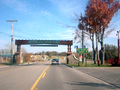
people. Wikimedia Commons has media related to Swastika, Ontario. "Swastika – Ontario Highway 11 Homepage". Highway11.ca. Archived from the original on...
8 KB (749 words) - 09:19, 24 September 2024
largest interchanges in Ontario and were constructed between 1967 and 1971, while the interchanges with Highway 409 and Highway 407 were completed in 1992...
52 KB (4,619 words) - 15:52, 26 September 2024
King's Highway 4, also known as Highway 4, is a provincially maintained highway in the Canadian province of Ontario. Originally much longer than its present...
24 KB (1,303 words) - 09:29, 6 September 2024
King's Highway 8, commonly referred to as Highway 8, is a provincially maintained highway in the Canadian province of Ontario. The 159.7-kilometre (99...
88 KB (6,543 words) - 18:20, 21 August 2024

King's Highway 71, commonly referred to as Highway 71, is a provincially maintained highway in the Canadian province of Ontario. The 194-kilometre-long...
23 KB (2,109 words) - 19:22, 19 August 2024
King's Highway 416, commonly referred to as Highway 416 and as the Veterans Memorial Highway, is a 400-series highway in the Canadian province of Ontario that...
38 KB (3,836 words) - 17:29, 17 September 2024
King's Highway 417, commonly referred to as Highway 417 and as the Queensway through Ottawa, is a 400-series highway in the Canadian province of Ontario. It...
63 KB (5,146 words) - 19:56, 24 September 2024
King's Highway 405, also known as Highway 405 and the General Brock Parkway, is a 400-Series Highway in the Canadian province of Ontario connecting the...
16 KB (1,143 words) - 18:22, 21 August 2024

of Ontario. At its peak, Highway 7 measured 716 km (445 mi) in length, stretching from Highway 40 east of Sarnia in Southwestern Ontario to Highway 17...
84 KB (5,116 words) - 13:48, 22 August 2024

Ontario. The 61-kilometre (38 mi) route connects the Pigeon River Bridge, where it crosses into the United States and becomes Minnesota State Highway 61...
19 KB (1,830 words) - 19:46, 8 April 2024