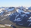
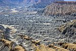
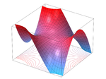
Geomorphometry, or geomorphometrics (Ancient Greek: γῆ, romanized: gê, lit. 'earth' + Ancient Greek: μορφή, romanized: morphḗ, lit. 'form, shape' + Ancient...
22 KB (2,684 words) - 22:59, 28 October 2024
and the identification of specific landforms; this is also known as geomorphometry. In modern usage, this involves generation of elevation data in digital...
17 KB (1,985 words) - 00:18, 1 January 2025
glaciers Notes This concern is not new, see Evans, I.S. & N. Cox, 1974: Geomorphometry and the operational definition of cirques, Area. Institute of British...
14 KB (1,555 words) - 23:37, 12 December 2024
Landforms. Springer. Wikimedia Commons has media related to Landforms. Look up landform in Wiktionary, the free dictionary. Open-Geomorphometry Project...
9 KB (1,082 words) - 00:23, 24 June 2024
Quantitative geomorphology can involve fluid dynamics and solid mechanics, geomorphometry, laboratory studies, field measurements, theoretical work, and full...
54 KB (5,971 words) - 08:17, 3 January 2025
relief depiction (2D relief map) Geographic information system (GIS) Geomorphometry Hypsometry Isostasy Physical terrain model Relief ratio Subterranea...
14 KB (1,586 words) - 06:46, 21 November 2024
many interrelations with remote sensing approaches. In the context of geomorphometry (or just morphometry, Pike, 2000) the applications cover many research...
35 KB (3,727 words) - 18:32, 11 December 2024
Peckham, S.D. (2011) Monkey, starfish and octopus saddles, Proceedings of Geomorphometry 2011, Redlands, CA, pp. 31-34, https://www.researchgate...
3 KB (430 words) - 06:09, 4 January 2025
of field observation, physical experiment, and numerical modeling (Geomorphometry). Early studies in geomorphology are the foundation for pedology, one...
30 KB (3,583 words) - 13:02, 2 November 2024
surface gradient does and serves certain purposes. Aspect (geography) Geomorphometry#Surface gradient Derivatives Grade (slope) Spatial gradient R. Shankar...
2 KB (191 words) - 21:12, 1 November 2023
oceans, seas, coastal areas, lakes and rivers. It is also related to geomorphometry, the quantitative science of analyzing land surfaces. Watershed delineation...
30 KB (3,165 words) - 05:31, 6 May 2024
glaciovolcanic landforms: An object-based mapping approach based on geomorphometry". Journal of Volcanology and Geothermal Research. 311: 29–40. doi:10...
122 KB (10,937 words) - 14:50, 22 December 2024
ISRIC — World Soil Information data centre International Society for Geomorphometry Open Source tools for soil scientists by the California Soil Resource...
13 KB (1,335 words) - 00:37, 3 July 2023
received a master's degree in geomorphology in 1992 and a doctoral in geomorphometry in 1995. Budi began his career as a civil servant at the National Coordinating...
9 KB (684 words) - 05:46, 5 January 2025
Ivan Marchesini; Laura Melelli; Peter Guth (eds.). Proceedings of the Geomorphometry 2020 Conference. Vol. 1. IRPI CNR. pp. 1–4. doi:10.30437/GEOMORPHOMETRY2020_1...
55 KB (6,740 words) - 08:12, 5 January 2025
Ministry of Agriculture and Food (OMAF). MacMillan, R.A., VanDeusen, A.A., 2003. The LandMapR User's Guide. Self-Published Open-Geomorphometry Project...
6 KB (912 words) - 00:08, 11 December 2023
Art, City of Monash, Melbourne, 2012. Exhibition of various winners. Geomorphometries – Contemporary Terrains, Queensland Centre for Photography, October–November...
36 KB (3,242 words) - 00:53, 9 October 2024
Kamp, Ulrich; Bolch, Tobias; Olsenholler, Jeffrey (1 March 2005). "Geomorphometry of Cerro Sillajhuay (Andes, Chile/Bolivia): Comparison of Digital Elevation...
4 KB (512 words) - 19:55, 16 September 2024
2016. Kamp, Ulrich; Bolch, Tobias; Olsenholler, Jeffrey (March 2005). "Geomorphometry of Cerro Sillajhuay (Andes, Chile/Bolivia): Comparison of Digital Elevation...
37 KB (4,074 words) - 07:26, 25 November 2024


