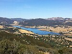
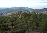
San Benito County (/ˌsæn bəˈniːtoʊ/ ; San Benito, Spanish for "St. Benedict"), officially the County of San Benito, is a county located in the Central...
54 KB (3,241 words) - 20:11, 14 December 2024
Hollister is a city in and the county seat of San Benito County, located in the Central Coast region of California, United States. With a 2020 United...
33 KB (2,590 words) - 05:44, 7 December 2024
San Benito (Spanish for "St. Benedict") is an unincorporated community in San Benito County, California, United States. San Benito is 18 miles (29 km)...
4 KB (152 words) - 10:18, 1 November 2024
Elementary School District North County Joint Union Elementary School District Panoche Elementary School District San Benito High School District Southside...
59 KB (5,195 words) - 11:55, 17 November 2024
California San Benito AVA, a wine region in San Benito County, California San Benito, Texas San Benito de Palermo, a saint in the Catholic church San...
1 KB (164 words) - 05:26, 9 January 2023
community and census-designated place (CDP) in Monterey County and San Benito County, California, United States. The population was 2,708 at the 2020 census...
19 KB (1,656 words) - 21:39, 30 September 2024
the California Route Marker Program, which designates county routes in California. The "G" zone includes county highways in Monterey, San Benito, San Luis...
82 KB (6,526 words) - 03:33, 4 December 2024
Coast of California. The river begins in southeasternmost San Benito County, California and ends in the extreme northwestern part of the county, where it...
7 KB (620 words) - 22:58, 23 July 2024
is a locale northeast of Hollister in the Diablo Range, in San Benito County, California. It lies on a flat just south of Wildcat Canyon at an elevation...
2 KB (202 words) - 22:28, 17 January 2023
properties and districts — listed on the California Historical Landmarks — within San Benito County, Northern California. Note: Click the "Map of all coordinates"...
3 KB (110 words) - 21:08, 13 May 2024
San Benito Mountain is the highest mountain in the Diablo Range of California. The summit is at an elevation of 5,267 feet (1,605 m). The rock is composed...
7 KB (860 words) - 14:48, 21 December 2024
Santa Clara Valley (redirect from South Bay (San Francisco, California))
of San Mateo County, Santa Clara County, and Alameda County, while the narrow southern reaches of the valley extend into rural San Benito County to Hollister...
44 KB (3,869 words) - 21:32, 24 November 2024
Mission San Juan Bautista is a Spanish mission in San Juan Bautista, San Benito County, California. Founded on June 24, 1797, by Fermín de Lasuén of the...
11 KB (955 words) - 07:30, 26 November 2024
Benitoite (category Geology of San Benito County, California)
benitoite for its occurrence near the headwaters of the San Benito River in San Benito County, California. Benitoite occurs in a number of isolated locations...
7 KB (533 words) - 16:39, 8 September 2024
New Idria was an unincorporated town in San Benito County, California. It was named after the New Idria Mercury Mine, which closed in 1972, resulting...
14 KB (1,222 words) - 13:04, 22 November 2024
Pajaro River (category Rivers of San Benito County, California)
of California, forming part of the border between San Benito and Santa Clara Counties, the entire border between San Benito and Santa Cruz County, and...
32 KB (2,978 words) - 14:54, 9 October 2024
San Juan Bautista (Spanish for "Saint John the Baptist") is a city in San Benito County, in the U.S. state of California. The population was 2,089 as of...
21 KB (2,014 words) - 18:15, 14 November 2024
The San Benito County Local Transportation Authority (LTA) is the public transportation agency of San Benito County, California, immediately south of...
6 KB (596 words) - 06:18, 8 November 2023
about eight miles (13 km). After crossing the San Benito County line, SR 156 splits from US 101 near San Juan Bautista while US 101 continues northward...
149 KB (7,373 words) - 09:48, 22 December 2024
San Benito is an American Viticultural Area (AVA) located in San Benito County, California. It was established on November 4, 1987 by the Bureau of Alcohol...
10 KB (1,274 words) - 04:42, 16 May 2024
Black Mountain is a mountain in the Diablo Range of San Benito County, California, west of the Hernandez Reservoir and approximately 20 miles (32 km)...
1 KB (75 words) - 09:28, 13 May 2024
districts listed on the National Register of Historic Places in the 58 counties of California, including 145 designated as National Historic Landmarks. The following...
18 KB (389 words) - 18:27, 22 October 2024
Area code 831 (category San Benito County, California)
of the U.S. state of California. The numbering plan area (NPA) comprises Monterey County, San Benito County, and Santa Cruz County. The area code was created...
7 KB (581 words) - 07:29, 28 September 2024
Museums in California. Wikimedia Commons has media related to Museums in Santa Clara County, California. California State Association of Counties (CSAC)...
60 KB (205 words) - 02:58, 26 October 2024
Costa County), a tributary of Suisun Bay Pacheco Creek (San Benito County), a tributary of the Pajaro River, in San Benito County, California. South...
1 KB (217 words) - 23:38, 28 September 2022
unincorporated community in San Benito County, California. The community is at the intersection of Panoche Road and SR 25. Bolado County Park is just over three...
7 KB (498 words) - 23:43, 13 August 2024
California, United States. It serves as the primary high school for Hollister city residents and most county residents and is within the San Benito High...
12 KB (1,364 words) - 05:12, 5 September 2024
Court of California, County of San Benito, also known as the San Benito County Superior Court or San Benito Superior Court, is the California superior...
10 KB (671 words) - 00:47, 3 September 2024
Pinnacles National Park (redirect from Pinnacles National Monument, California)
Richard P. (1992). Pinnacles Guide: Pinnacles National Monument, San Benito County, California. Glendale, CA: La Siesta Press. ISBN 91-0-856715-8. "Frequently...
39 KB (4,247 words) - 16:58, 5 October 2024
Gabilan Range (category Mountain ranges of San Benito County, California)
mountain range in the inner California Coast Ranges System, located in Monterey County and San Benito County of central California. Pinnacles National Park...
9 KB (787 words) - 02:54, 22 December 2024


