Department of Transport and Main Roads, and about the state-controlled roads that intersect with it. The Bruce Highway runs from Bald Hills to Cairns in...
40 KB (3,168 words) - 15:45, 4 April 2024
Department of Transport and Main Roads, and about the state-controlled roads that intersect with it. The Warrego Highway runs from Ipswich to Charleville...
23 KB (1,837 words) - 00:40, 22 January 2024
Department of Transport and Main Roads, and about the state-controlled roads that intersect with it. The Cunningham Highway runs from Goodna to Goondiwindi...
22 KB (1,702 words) - 04:45, 19 October 2024
Transport and Main Roads, and about the state-controlled roads that intersect with it. The Queensland segment of the New England Highway runs from Yarraman...
12 KB (1,002 words) - 01:05, 22 January 2024

addition to the Bruce, Leichhardt, Gregory and Landsborough Highways, and the Fitzroy Developmental Road, the following state-controlled roads, from east to...
18 KB (1,298 words) - 01:22, 9 December 2024

Marlborough–Sarina Road is a state-controlled district road (number 512) rated as a local road of regional significance (LRRS). It runs from the Bruce Highway in Marlborough...
20 KB (1,472 words) - 13:06, 6 October 2024

Bay Highway is a short state highway of Queensland, Australia running between Goomeri on the Burnett Highway and a junction on the Bruce Highway. From...
9 KB (622 words) - 21:06, 25 July 2024

Gavial–Gracemere Road is a state-controlled district road (number 450). It runs from the Bruce Highway in Midgee to the Capricorn Highway in Gracemere, a...
15 KB (910 words) - 06:03, 27 April 2024
The D'Aguilar Highway is a two-lane highway linking the Bruce Highway near Caboolture with the Bunya Highway in Kingaroy in the state of Queensland, Australia...
22 KB (1,103 words) - 00:39, 1 December 2024
following state-controlled roads intersect with this road: Eumundi–Kenilworth Road Emu Mountain Road Eumundi–Kenilworth Road is a state-controlled district...
13 KB (996 words) - 16:59, 25 July 2024
state-controlled district road (number 837). It runs from Bruce Highway exit and entry ramps in Douglas to the Douglas–Garbutt Road (University Road)...
29 KB (2,306 words) - 18:21, 25 July 2024
Department of Transport and Main Roads, and about the state-controlled roads that intersect with it. The Mount Lindesay Highway runs from Drewvale to Mount...
6 KB (496 words) - 02:20, 5 March 2024

The Bruce Highway is a major highway in Queensland, Australia. Commencing in the state capital, Brisbane, it passes through areas close to the eastern...
118 KB (5,816 words) - 00:38, 11 February 2025

Defense Highways, commonly known as the Interstate Highway System, or the Eisenhower Interstate System, is a network of controlled-access highways that forms...
130 KB (12,970 words) - 21:27, 15 February 2025

following state-controlled roads, from south to north, intersect with the Brisbane Valley Highway: Forest Hill–Fernvale Road Wivenhoe–Somerset Road Coominya...
13 KB (759 words) - 12:20, 15 July 2024
Wallaville, this road was part of the Bruce Highway. This road intersects with the following state-controlled roads: Isis Highway Moore Park Road Bundaberg–Miriam...
13 KB (1,000 words) - 16:41, 25 July 2024

the Bruce, Burnett, Leichhardt, Carnarvon and Gregory Highways, and the Fitzroy and Dawson Developmental Roads, the following state-controlled roads, from...
20 KB (1,285 words) - 20:52, 28 July 2024
Cook Highway, Cairns Western Arterial Road, and the Kennedy Highway, the network consists of the following state-controlled roads: Mulgrave Road Port...
6 KB (503 words) - 12:23, 23 October 2024
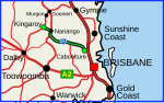
Connection Road is a state-controlled district road (number 1411) rated as a local road of regional significance (LRRS). It runs from the Bruce Highway in Gympie...
14 KB (1,138 words) - 03:15, 17 August 2024

Roads, the following state-controlled roads, from east to west, intersect with the Flinders Highway: Townsville Port Road Townsville Connection Road Woodstock–Giru...
19 KB (1,267 words) - 00:30, 5 May 2024
This road intersects with the following state-controlled roads: Homebush Road Peak Downs Highway Mirani–Eton Road North Eton Road Mackay–Eungella Road Homebush...
13 KB (995 words) - 03:46, 17 August 2024
of the following state-controlled roads: Brighton–Redcliffe Road (see below for component bridges and roads) Clontarf–Anzac Avenue Road (Elizabeth Avenue...
13 KB (1,117 words) - 17:59, 25 July 2024
Bli Bli before reaching the Bruce Highway, which it passes under at a dumbbell intersection. It runs southeast as State Route 10, and then northeast...
11 KB (717 words) - 23:27, 8 May 2024

state-controlled roads: Chinchilla–Tara Road Condamine–Meandarra Road Meandarra–Talwood Road Chinchilla–Tara Road is a state-controlled district road (number...
12 KB (873 words) - 23:11, 15 August 2024
Australia. It is signed as State Route 75. It is a state-controlled regional road (number 435). It has been designated as a road of strategic importance...
14 KB (1,106 words) - 17:43, 25 July 2024

Wallangarra State-controlled roads that intersect with the highway are listed in the main article. At its northern end New England Highway connects to...
37 KB (2,471 words) - 03:28, 16 February 2025

following state-controlled roads, from south to north, intersect with the Bunya Highway: Dalby–Cooyar Road Macalister–Bell Road Kingaroy–Jandowae Road Bunya...
8 KB (438 words) - 02:42, 15 January 2024
district road (number 914). Known as Old Bruce Highway, It runs from Cooroy Connection Road on the Black Mountain / Pomona midpoint to the Bruce Highway in...
10 KB (688 words) - 01:31, 31 October 2023

currently leading a project to replace the controlled intersection at MN 36 and County State-Aid Highway 17 (CSAH 17, Lake Elmo Avenue) in Grant and...
28 KB (2,439 words) - 15:22, 27 July 2024

The Garden State Parkway (GSP) is a controlled-access toll road that stretches the north–south length of eastern New Jersey from the state's southernmost...
211 KB (18,820 words) - 16:19, 11 February 2025