
13 in Bear Creek. KML file (edit • help) Template:Attached KML/Alabama State Route 172 KML is from Wikidata Milepost Map of Franklin & Marion Counties...
5 KB (247 words) - 00:12, 16 February 2024
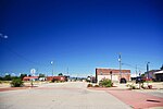
87°49′51″W / 34.27139°N 87.83083°W / 34.27139; -87.83083. U.S. Route 43 and Alabama State Route 172 intersect in the center of town. US 43 connects the town...
14 KB (1,396 words) - 09:57, 27 April 2024

Alabama State Route 172 passes through the town, leading northwest 9 miles (14 km) to Vina and southeast 7 miles (11 km) to Hackleburg. Alabama State...
8 KB (704 words) - 14:53, 29 March 2024

The State Route System in Alabama uses the standard numbering convention: odd numbers signify a north–south state route, and even numbers signify an east–west...
113 KB (297 words) - 05:35, 25 July 2024
Interstate 172 Alabama State Route 172 Arizona State Route 172 (former) California State Route 172 Colorado State Highway 172 Connecticut Route 172 Georgia...
3 KB (205 words) - 23:30, 4 April 2024

State Route 237 (SR 237) is a 4.5-mile-long (7.2 km) route that serves as a connection between SR 172 east of Hackleburg with SR 13 in Phil Campbell....
2 KB (105 words) - 00:16, 16 February 2024

Memphis and Charleston route through North Alabama. US 72 begins at Bellevue Boulevard (US 51) in Memphis. From Memphis, the route follows Union Avenue...
34 KB (2,044 words) - 19:27, 1 August 2024

State Route 17 (SR 17) is a major north-to-south highway within the U.S. state of Alabama. Covering 346.562 miles (557.737 km), it travels the length...
14 KB (503 words) - 19:27, 1 August 2024

State Route 13 (SR 13) is a 335.995-mile-long (540.732 km) state highway in the western part of the U.S. state of Alabama. Except for a portion roughly...
8 KB (500 words) - 19:26, 1 August 2024

towards Tuscaloosa. KML file (edit • help) Template:Attached KML/Alabama State Route 171 KML is from Wikidata Milepost Map of Fayette, Marion & Tuscaloosa...
6 KB (320 words) - 00:11, 16 February 2024

Alabama State Route 13 (SR 13) from its southern terminus to an intersection in southeastern Fayette County. For the rest of its length in the state,...
40 KB (2,524 words) - 01:43, 5 August 2024

file (edit • help) Template:Attached KML/Alabama State Route 241 KML is from Wikidata "Milepost Web". Alabama Department of Transportation. Archived from...
3 KB (174 words) - 00:15, 16 February 2024

U.S. Route 80 (US 80) is a major U.S. Highway in the American state of Alabama. The Alabama Department of Transportation internally designates the majority...
121 KB (9,536 words) - 20:53, 7 August 2024

northerly routing en route to its northern terminus at SR 24 in Belgreen. KML file (edit • help) Template:Attached KML/Alabama State Route 187 KML is...
4 KB (197 words) - 00:14, 16 February 2024

State Route 253 (SR 253) is a 31-mile-long (50 km) route that serves as a connection between US 43/SR 118/SR 171 in Winfield with SR 172 in Hackleburg...
3 KB (144 words) - 00:12, 16 February 2024

State Route 19 (SR 19) is a 37.6-mile-long (60.5 km) state highway in the northwestern part of the U.S. state of Alabama. The southern terminus of the...
5 KB (380 words) - 20:40, 28 July 2024

reaching Tuscaloosa. From the Mississippi–Alabama state line to Tuscaloosa, I-20/I-59 is a four-lane route. At Tuscaloosa, the highway connects with I-359...
27 KB (1,743 words) - 00:54, 5 August 2024

State Route 14 (SR 14) is a major east-to-west state highway in the U.S. state of Alabama. Spanning 218.289 miles (351.302 km), the highway begins at...
15 KB (570 words) - 10:33, 19 August 2024

Template:Attached KML/Alabama State Route 69 KML is from Wikidata Milepost Map - Marshall County, Alabama (PDF) (Map). Alabama Department of Transportation...
14 KB (465 words) - 03:56, 15 June 2024

terminus at SR 27. The entire route is in Henry County. KML file (edit • help) Template:Attached KML/Alabama State Route 173 KML is from Wikidata Milepost...
3 KB (176 words) - 00:15, 16 February 2024

State Route 77 (SR 77) is a 124-mile-long (200 km) north–south state highway in the eastern part of the U.S. state of Alabama. The southern terminus of...
10 KB (635 words) - 04:04, 15 June 2024

State Route 53 (SR 53) is a 172.146-mile-long (277.042 km) west-to-east state highway located in the northern part of the U.S. state of Georgia. The highway...
34 KB (2,920 words) - 13:10, 29 February 2024

State Route 5 (SR 5) is a 198-mile-long (319 km) south–north state highway in the western part of the U.S. state of Alabama. Prior to the renumbering...
18 KB (1,113 words) - 01:33, 3 January 2024

Mississippi Highway 172 (MS 172) is a state highway located in Tishomingo County, Mississippi. The route runs 12.074 mi (19.431 km) from U.S. Route 72 (US 72)...
9 KB (943 words) - 04:19, 22 August 2024

S. Route 231 (US 231) in Alabama runs north–south up through the eastern half of Alabama for 306.273 miles (492.899 km). US 231 enters the state from...
29 KB (1,485 words) - 23:42, 3 August 2024

US 278 is co-signed with a state route for its entire length in Georgia, as are all U.S. Highways in the state. From the Alabama line into Lithia Springs...
22 KB (2,529 words) - 04:23, 15 June 2024

portal KML file (edit • help) Template:Attached KML/Alabama State Route 79 KML is from Wikidata Alabama Department of Transportation. "Milepost Maps". Archived...
9 KB (424 words) - 10:13, 15 May 2024

43 State Route 13 State Route 17 State Route 19 State Route 24 State Route 172 State Route 187 State Route 237 State Route 241 State Route 243 State Route...
19 KB (1,465 words) - 00:39, 6 July 2024

Interstate 85 in Georgia (redirect from Georgia State Route 403)
northeast–southwest in the US state of Georgia. It enters the state at the Alabama state line near West Point, and Lanett, Alabama, traveling through the Atlanta...
46 KB (2,686 words) - 17:41, 23 July 2024

U.S. Route 78 (US 78) is a major east–west U.S. Highway across the central part of Alabama. It is internally designated State Route 4 (SR 4) by the Alabama...
23 KB (1,311 words) - 21:07, 26 August 2024