Basin is a town in, and the county seat of, Big Horn County, Wyoming, United States. The population was 1,288 at the 2020 census. The community is located...
19 KB (1,496 words) - 01:28, 11 August 2024
Wyoming (/waɪˈoʊmɪŋ/ wye-OH-ming) is a landlocked state in the Mountain West subregion of the Western United States. It borders Montana to the north and...
115 KB (9,043 words) - 23:40, 18 October 2024
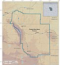
The Bighorn Basin is a plateau region and intermontane basin, approximately 100 miles (160 km) wide, in north-central Wyoming in the United States. It...
8 KB (942 words) - 17:51, 20 July 2023
Albuquerque Basin, New Mexico Appalachian Basin, Eastern United States Big Horn Basin, Wyoming Black Warrior Basin, Alabama and Mississippi Delaware Basin, Texas...
4 KB (338 words) - 04:33, 19 June 2024
The Great Divide Basin or Great Divide Closed Basin is an area of land in the Red Desert of Wyoming where none of the water falling as rain to the ground...
14 KB (1,338 words) - 21:17, 30 June 2024
The Powder River Basin is a geologic structural basin in southeast Montana and northeast Wyoming, about 120 miles (190 km) east to west and 200 miles...
29 KB (3,356 words) - 04:39, 4 October 2024
Basin, Mississippi Basin, Montana Basin, Wyoming, seat of Big Horn County Basin Mountain (New York), a summit of the Adirondack Park Basin Street, New Orleans...
3 KB (491 words) - 12:10, 20 October 2024
Geothermal areas of Yellowstone (redirect from West Thumb Geyser Basin, Wyoming)
Geyser Basin (410), Midway Geyser Basin (59), Lower Geyser Basin (283), Norris Geyser Basin (193), West Thumb Geyser Basin (84), Gibbon Geyser Basin (24)...
35 KB (4,482 words) - 13:18, 24 July 2024
establishment of a Latter-day Saint settlement at Bighorn Basin, Wyoming. During one of his trips to Wyoming in 1901, he met and married his second wife, thus...
29 KB (3,003 words) - 01:28, 22 April 2024
The Wind River Basin or Shoshone Basin is a semi-arid intermontane foreland basin in central Wyoming, United States. It is bounded by Laramide uplifts...
6 KB (646 words) - 18:26, 17 November 2023
Shirley Basin, Wyoming was a company-owned uranium-mining town located about 40 miles (64 km) south of Casper, Wyoming. The town was established in the...
5 KB (179 words) - 22:22, 21 November 2023
of Midwest, Wyoming. Other deposits were found along a 60-mile northwest-southeast trend in the southwest part of the Powder River Basin, and production...
10 KB (1,185 words) - 16:13, 9 June 2024
The Wyoming Basin shrub steppe ecoregion, within the deserts and xeric shrublands biome, is a shrub steppe in the northwestern United States. This ecoregion...
7 KB (515 words) - 05:08, 8 August 2024
The Wyoming Basin physiographic province is a geographic area through which the Continental Divide of the Americas traverses. The province includes the...
2 KB (88 words) - 18:32, 8 December 2023
Paleocene-Eocene Thermal Maximum at Sand Creek Divide, southern Bighorn Basin, Wyoming." University of Michigan Papers on Paleontology 36:1-122 O. C. Marsh...
28 KB (1,461 words) - 19:51, 18 April 2024
compression that accompanies orogenic mountain building. Powder River Basin, Wyoming, US Sideling Hill roadcut along Interstate 68 in western Maryland, US,...
4 KB (410 words) - 20:31, 1 May 2024
The U.S. state of Wyoming lies in the Mountain West subregion of the Western United States and has a varied geography. It is bordered by Montana to the...
37 KB (2,022 words) - 23:54, 3 October 2024
Washakie County. It is located within the Big Horn Basin and along the Big Horn River in northwestern Wyoming. As of the census of 2010, there were 5,487 people...
19 KB (1,421 words) - 01:28, 11 August 2024
Basin, is a geologic structural basin centered in eastern Colorado in the United States, but extending into southeast Wyoming, western Nebraska, and western...
14 KB (1,629 words) - 19:21, 7 December 2023
portions of California, Idaho, Oregon, Wyoming, and Baja California. It is noted for both its arid climate and the basin and range topography that varies from...
34 KB (3,615 words) - 11:52, 1 November 2024
Great Basin Murders is the name given to a series of murders of at least nine women committed between 1983 and 1997 across the states of Wyoming, Utah...
42 KB (4,941 words) - 12:56, 4 November 2024
Tongue River (Montana) (redirect from Tongue River (Wyoming))
well-watered basin in Wyoming, on the eastern edge of the Big Horn Mountains, where Sheridan and Big Horn, Wyoming are located. The drainage basin to the west...
67 KB (9,062 words) - 00:04, 5 September 2024
The Greater Green River Basin (GGRB) is a 21,000 square mile basin located in Southwestern Wyoming. The Basin was formed during the Cretaceous period...
12 KB (1,564 words) - 17:23, 1 August 2024
Big Horn Basin near Meeteetse, Wyoming. Since 1990, black-footed ferrets have been reintroduced to the following sites: Shirley Basin, Wyoming; UL Bend...
54 KB (6,444 words) - 12:35, 2 November 2024
county in the U.S. state of Wyoming. As of the 2020 United States Census, the population was 11,521. The county seat is Basin. Its north boundary abuts...
21 KB (1,878 words) - 05:08, 5 October 2024
Wasatch Formation (category Geologic formations of Wyoming)
fossiliferous geologic formation stretching across several basins in Idaho, Montana, Wyoming, Utah and western Colorado. It preserves fossils dating back...
95 KB (6,471 words) - 17:32, 15 October 2024
Fort Union Formation (category Geologic formations of Wyoming)
sandstones, shales, and coal beds in Wyoming, Montana, and parts of adjacent states. In the Powder River Basin, it contains important economic deposits...
50 KB (1,560 words) - 23:28, 16 July 2024
(Nebraska) White Woman Basin (Kansas) Devil's Lake (Wisconsin) -- cryptorheic Great Divide Basin (Wyoming) San Luis Closed Basin (Colorado) Crater Lake...
12 KB (1,280 words) - 15:07, 10 April 2024
Green River (Colorado River tributary) (redirect from Green River Basin)
watershed of the river, known as the Green River Basin, covers parts of the U.S. states of Wyoming, Utah, and Colorado. The Green River is 730 miles...
27 KB (2,796 words) - 17:37, 18 August 2024
what is now Nevada, and parts of Oregon, California, Idaho, Wyoming, and Utah. The Great Basin region at the time of European contact was ~400,000 sq mi...
14 KB (1,373 words) - 08:06, 1 May 2024


