Beerburrum Road is a continuous 15.2-kilometre (9.4 mi) road route in the Moreton Bay and Sunshine Coast local government areas of Queensland, Australia...
17 KB (751 words) - 16:35, 25 July 2024

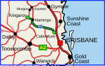
Beerburrum is a rural town and coastal locality in the Sunshine Coast Region, Queensland, Australia. In the 2021 census, the locality of Beerburrum had...
24 KB (2,514 words) - 22:59, 3 September 2024

Bruce Highway (category WikiProject Australian Roads articles with a junction list using templates)
Highway via a service road. After the D'Aguilar Highway interchange the Bruce passes through mainly rural areas and the Beerburrum and Beerwah State Forests...
103 KB (5,393 words) - 07:55, 6 August 2024

local Caboolture services. The line is then double track to Beerburrum. North of Beerburrum, the line is single track with passing loops at most stations...
9 KB (644 words) - 00:50, 28 January 2024
D'Aguilar Highway (redirect from Caboolture Connection Road)
roads, from east to west, intersect with the D'Aguilar Highway: Beerburrum Road Caboolture Connection Road Brisbane–Woodford Road Kilcoy–Beerwah Road...
22 KB (1,111 words) - 16:52, 25 July 2024
Connection Road Maroochydore Road Nambour–Bli Bli Road Yandina–Coolum Road Eumundi–Noosa Road Eumundi–Kenilworth Road Cooroy Connection Road Pomona Connection...
40 KB (3,348 words) - 15:45, 4 April 2024

Burnett Highway (redirect from Murgon–Barambah Road)
Kilkivan–Tansey Road Murgon–Gayndah Road Gayndah–Mount Perry Road Mundubbera–Durong Road Eidsvold–Theodore Road Wuruma Dam Road Monto–Mount Perry Road Gladstone–Monto...
15 KB (926 words) - 06:03, 27 April 2024
Crossing Road Kalbar Connection Road Boonah–Fassifern Road Lake Moogerah Road New England Highway Freestone Road Warwick–Yangan Road Warwick–Allora Road Warwick–Killarney...
22 KB (1,802 words) - 22:38, 9 February 2024
Haigslea–Amberley Road Rosewood–Marburg Road Laidley–Plainland Road Forest Hill–Fernvale Road Gatton–Esk Road Gatton–Helidon Road Toowoomba Second Range...
23 KB (1,932 words) - 00:40, 22 January 2024
two roads named South Pine Road to the north of Brisbane in Queensland, Australia. They are two separate roads rather than a disconnected single road. It...
28 KB (1,684 words) - 17:25, 5 April 2024
Marlborough–Sarina Road is a state-controlled district road (number 512) rated as a local road of regional significance (LRRS). It runs from the Bruce...
18 KB (1,471 words) - 05:56, 19 December 2023
Redcliffe Peninsula road network is a group of roads that provide access to the Redcliffe Peninsula in Queensland, Australia, and enable travel between...
13 KB (1,137 words) - 17:59, 25 July 2024
Eumundi–Noosa Road is a continuous 15.8-kilometre (9.8 mi) road route in the Sunshine Coast and Noosa local government areas of Queensland, Australia...
13 KB (1,026 words) - 16:59, 25 July 2024
Isisford–Blackall Road is a continuous 122-kilometre (76 mi) road route in the Longreach and Blackall-Tambo local government areas of Queensland, Australia...
11 KB (908 words) - 17:16, 25 July 2024
Douglas–Garbutt Road Garbutt–Upper Ross Road North Townsville Road North Ward Road Ross River Road Shaw Road South Townsville Road Townsville Connection Road Townsville...
29 KB (2,361 words) - 18:21, 25 July 2024
22A: Kingaroy–Cooyar Road Oakey–Cooyar Road Pechey–Maclagan Road Esk–Hampton Road Murphys Creek Road Toowoomba Connection Road (former Warrego Highway)...
12 KB (1,052 words) - 01:05, 22 January 2024
Mundubbera–Durong Road is a continuous 105-kilometre (65 mi) road route in the North Burnett and South Burnett local government areas of Queensland, Australia...
14 KB (1,151 words) - 17:43, 25 July 2024
Bundaberg–Port Road (known as Burnett Heads Road) is a state-controlled district road (number 175) in the Bundaberg region of Queensland, Australia. It...
12 KB (828 words) - 16:41, 25 July 2024
Yandina–Coolum Road is a continuous 18.5-kilometre (11.5 mi) road route in the Sunshine Coast local government area of Queensland, Australia. The route...
7 KB (488 words) - 23:33, 8 May 2024
Roma–Condamine Road is a continuous 115-kilometre (71 mi) road route in the Maranoa and Western Downs local government areas of Queensland, Australia...
12 KB (1,042 words) - 03:48, 17 August 2024
Most of the roads retain their original road or street names, and are not well known by their official names. Mulgrave Road, officially road number 809...
6 KB (528 words) - 21:15, 5 April 2024
Tin Can Bay Road is a continuous 56.1 kilometres (34.9 mi) road route in the Gympie region of Queensland, Australia. Part of it is signed as State Route...
14 KB (1,173 words) - 03:15, 17 August 2024
Hughenden–Muttaburra–Aramac–Barcaldine Road is a continuous 359-kilometre (223 mi) road route in the Flinders and Barcaldine local government areas of...
14 KB (1,047 words) - 17:14, 25 July 2024
Atherton–Herberton–Longlands Gap Road is a continuous 33.5-kilometre (20.8 mi) road route in the Tablelands local government area of Queensland, Australia...
8 KB (690 words) - 17:02, 5 August 2024
Gin Road is a state-controlled district road (number 176) in the Bundaberg region of Queensland, Australia. It runs from Bundaberg–Bargara Road (Quay...
13 KB (1,025 words) - 16:41, 25 July 2024
state-controlled roads intersect with section 25A: Camp Cable Road Beaudesert–Boonah Road Camp Cable Road is a state-controlled district road (number 2071)...
6 KB (516 words) - 02:20, 5 March 2024
Bundaberg–Bargara Road is a state-controlled district road (number 174) in the Bundaberg region of Queensland, Australia. It is rated as a local road of regional...
11 KB (768 words) - 16:40, 25 July 2024
Brisbane–Woodford Road is the official name for a continuous 60.5-kilometre (37.6 mi) road route in the Moreton Bay local government area of Queensland...
19 KB (1,058 words) - 16:40, 25 July 2024
Sarina–Homebush Road, Eton–Homebush Road, Marian–Eton Road, and Marian–Hampden Road. The entire route is signed as State Route 5. The four roads are state-controlled...
13 KB (1,015 words) - 03:46, 17 August 2024
Nambour–Bli Bli Road is a continuous 8.1-kilometre (5.0 mi) road route in the Sunshine Coast local government area of Queensland, Australia. It is signed...
11 KB (732 words) - 23:27, 8 May 2024