
Bernardo de Miera y Pacheco (4 August 1713 – 4 or 11 April 1785) was "perhaps the most prolific and important cartographer of New Spain" as well as an...
8 KB (785 words) - 00:23, 26 May 2024

Domínguez–Escalante expedition (redirect from Silvestre Vélez de Escalante)
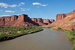
of modern day central California. Domínguez, Vélez de Escalante, and Bernardo de Miera y Pacheco, acting as the expedition's cartographer, traveled with...
37 KB (4,711 words) - 02:43, 20 July 2024
parish in Asturias, Spain Álvaro López Miera (born 1943), Cuban military and political leader Bernardo de Miera y Pacheco (1713–1785), Spanish cartographer...
738 bytes (129 words) - 05:02, 14 June 2024
Domínguez–Escalante expedition, a ten-man expedition including Bernardo de Miera y Pacheco (Miera) acting as the cartographer. On September 13, they encountered...
26 KB (3,038 words) - 02:50, 3 July 2024

The Domínguez–Escalante expedition named it "Laguna de Miera" after Bernardo de Miera y Pacheco, a cartographer on their 1776 expedition. In 1825, trappers...
9 KB (648 words) - 14:18, 11 June 2024

dictatorship of Juan Manuel de Rosas Bernardo de Miera y Pacheco (1713–1785), Spanish cartographer and artist Cosme Pacheco (c.1803–c.1851), Peruvian cavalry...
6 KB (751 words) - 17:14, 7 March 2024
Machiavelli Bernardo Mattarella (1905–1971), Italian politician Bernardo de Miera y Pacheco (1713–1785), cartographer and artist in New Spain Bernardo Mota (born...
4 KB (524 words) - 22:25, 7 April 2024

the top center is a 1745 painting of St. Michael attributed to Bernardo de Miera y Pacheco. Around these two paintings are four oval oil paintings on canvas...
17 KB (1,963 words) - 19:35, 27 March 2024

completely known North American sauropods. The genus name honours Bernardo de Miera y Pacheco, the first European scientist to enter what is now Utah. The...
39 KB (3,917 words) - 16:40, 11 July 2024

“destroyed by enemies” (nomadic Indians) on a famous map made by Don Bernardo de Miera y Pacheco in 1779. According to the United States Census Bureau, the town...
14 KB (1,051 words) - 05:09, 29 May 2024

Historic Places in 1970. The reredos has been attributed to Bernardo de Miera y Pacheco (1713–1785), a Spanish artist and cartographer who came to Santa...
12 KB (1,471 words) - 18:58, 13 April 2024

Hispanos of New Mexico (category People of Santa Fe de Nuevo Mexico)
politician Juan Domínguez de Mendoza (1631–?), Spanish soldier and member of the Novomexicana elite. Bernardo de Miera y Pacheco (1713–1785), cartographer...
53 KB (6,138 words) - 08:45, 16 July 2024

Lillienberg, Swedish count and politician (d. 1798) August 4 Bernardo de Miera y Pacheco, Spanish cartographer (d. 1785) Princess Elisabeth Albertine...
37 KB (3,909 words) - 15:15, 23 June 2024

Francisco Antonio Marín del Valle (category Colonial governors of Santa Fe de Nuevo México)
Mexico. In 1754, he ordered Spanish engineer and cartographer Bernardo de Miera y Pacheco to make a new map of Southern New Mexico. His work was the "first...
5 KB (485 words) - 00:53, 26 May 2024

record of them ever finding Chaco Canyon. When cartographer Bernardo de Miera y Pacheco drew a map in 1774 of Spanish land holdings in the region, he...
97 KB (12,733 words) - 01:07, 17 September 2023

it." To later Hispanic explorers and settlers, such as Bernardo de Miera y Pacheco and José de Zúñiga, the lake was known as Salinas. Famous Apache chief...
10 KB (942 words) - 18:48, 23 June 2024
against Spanish colonists in the New Spain province. 1774 Don Bernardo de Miera y Pacheco identifies the Chaco Canyon area as "Chaca" on a map. The term...
10 KB (1,098 words) - 20:23, 1 August 2023
Year Date Event 1778 Bernardo de Miera y Pacheco, cartographer for the Dominguez–Escalante Expedition, publishes his map of the expedition across the...
62 KB (430 words) - 22:56, 17 January 2024
Discovery of reputed Roman Baths, Strand Lane, London. 1774: Don Bernardo Miera y Pacheco identifies the Chaco Canyon area as "Chaca" on a map. The term...
4 KB (278 words) - 20:06, 20 June 2024
Lillienberg, Swedish count and politician (d. 1798) August 4 Bernardo de Miera y Pacheco, Spanish cartographer (d. 1785) Princess Elisabeth Albertine...
292 bytes (30,881 words) - 21:27, 16 November 2023
for his exploration of the area where the city was founded. Bernardo de Miera y Pacheco (born August 4, 1713 or 1714–died April 11, 1785) Cartographer...
47 KB (6,311 words) - 17:25, 1 April 2024
de San Buenaventura. The map-maker of the expedition, Captain Bernardo Miera y Pacheco, erroneously indicated that the river flowed southwest to what...
27 KB (2,796 words) - 19:27, 13 May 2024
Mexico Southwestern archaeology Territorial evolution of New Mexico Santa Fe de Nuevo México U.S. provisional government of New Mexico Territory of New Mexico...
94 KB (599 words) - 01:59, 24 June 2024
2012). "Francisco Vázquez de Coronado". New Mexico History. Retrieved March 5, 2022. Hernán Cortés (1866). "Cartas y relaciones de Hernán Cortés al emperador...
267 KB (3,541 words) - 05:32, 23 July 2024
Zabala y Lera Eduardo Callejo de la Cuesta Modesto López Otero Jacinto Benavente Bernardo de Granda Calleja Eduardo Chicharro y Agüera Manuel Benedito y Vives...
52 KB (5,561 words) - 21:44, 16 June 2024

was given to it at the time, and it was not shown on the map by Bernardo Miera y Pacheco, the cartographer for the expedition. Escalante had been on the...
77 KB (8,350 words) - 13:29, 12 July 2024
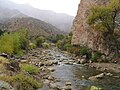
forced to turn back to Santa Fe. The expedition's cartographer, Don Bernardo Miera y Pacheco, sketched a map showing an outlet from Sevier Lake to the Pacific...
52 KB (5,938 words) - 04:27, 22 April 2024
lifetime: judging Donald Trump". EL PAÍS English. Retrieved April 26, 2024. "Miera, Judge Alberto, undated and 1982–1988". Minnesota Historical Society. Retrieved...
244 KB (9,012 words) - 12:27, 9 July 2024