The Burnshirt River is a 12.9-mile-long (20.8 km) stream in Worcester County, Massachusetts. It is a tributary of the Ware River, draining ultimately into...
2 KB (184 words) - 04:40, 28 October 2023
Bumps River Bungay River Burnshirt River Canoe River Castle Neck River Cedar Swamp River Centerville River Charles River Chickley River Chicopee River Childs...
20 KB (1,631 words) - 16:33, 4 August 2024
Washington Bumps River - Massachusetts Bungay River - Massachusetts Burnshirt River - Massachusetts Burnt River - Oregon Bush River - South Carolina Buttahatchee...
13 KB (1,019 words) - 19:24, 13 February 2023

following the ROW of the former Ware River Railroad, is available by an on-road connection, roughly following the Burnshirt River. The southern terminus is on...
76 KB (6,358 words) - 21:47, 27 September 2024

approved on February 15, 1826, somewhere between the westerly side of the Burnshirt River bridge and the present day Everett Road in Barre. The erection of a...
17 KB (2,481 words) - 04:50, 6 February 2024

embankment dam with masonry work on the eastern branch of the Farmington River in southwestern Barkhamsted, Connecticut and central Hartland, Connecticut...
5 KB (408 words) - 10:26, 20 September 2024

Connecticut Lakes (category Connecticut River)
Hampshire, United States, situated along the headwaters of the Connecticut River. They are accessed via the northernmost segment of U.S. Route 3, between...
19 KB (1,221 words) - 23:57, 9 April 2024

height of land between the Connecticut River/Long Island Sound watershed to the west and the Merrimack River/Gulf of Maine watershed to the east. Water...
4 KB (294 words) - 12:13, 26 October 2023
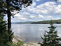
Lake Francis is a reservoir on the Connecticut River in northern New Hampshire, United States. The lake is located in Coos County, east of the village...
5 KB (385 words) - 14:44, 31 December 2022

a 8.5-mile (13.7 km)-long subterranean river in Boston. The largest tributary stream of the lower Charles River, it runs mostly through conduits. Stony...
24 KB (2,638 words) - 14:26, 26 January 2022