
State Highway 64 (SH 64) is a 74-mile-long (119 km) two-lane state highway connecting the towns of Dinosaur and Meeker in the western part of the U.S....
5 KB (455 words) - 17:03, 9 November 2023
The state highways of Colorado are a system of public paved roads funded and maintained by the Colorado Department of Transportation (CDOT) in the U.S...
110 KB (607 words) - 00:28, 7 July 2024

the county seat, and west 33 miles (53 km) to Vernal, Utah. Colorado State Highway 64 has its northern terminus in Dinosaur and leads southeast 18 miles...
11 KB (867 words) - 17:40, 28 April 2024

State Highway 7 (SH 7) is an 81.64-mile (131.39 km) state highway in Colorado, United States. It is located in the north-central portion of the state...
11 KB (640 words) - 01:03, 20 March 2023

U.S. Route 40 (redirect from Colorado State Highway 40N)
enters Colorado. US 40 enters Colorado, 2 miles (3.2 km) west of Dinosaur. In Dinosaur, there is an intersection with Colorado State Highway 64. After...
77 KB (8,335 words) - 19:13, 15 July 2024

State Highway 9 (SH 9) in the U.S. state of Colorado is a 138-mile-long (222 km) state highway through central Colorado. SH 9's southern terminus is at...
7 KB (440 words) - 02:48, 21 January 2023

State Highway 14 (SH 14) in the U.S. state of Colorado is an east–west state highway approximately 237 miles (381 km) long, making it the longest[citation...
9 KB (652 words) - 17:21, 8 February 2024
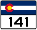
State Highway 141 (SH 141) is a 162.297 mi (261.192 km) long state highway in far western Colorado, United States. Though nominally oriented north–south...
5 KB (314 words) - 05:15, 8 February 2024

State Highway 82 (SH 82) is an 85.3-mile-long (137.3 km) state highway in the U.S. state of Colorado. Its western half provides the principal transportation...
69 KB (7,238 words) - 16:29, 14 July 2024

State Highway 13 (SH 13) in the U.S. state of Colorado is a north–south mountain route that travels from Rifle to the Wyoming border near Baggs, Wyoming...
7 KB (455 words) - 01:25, 9 November 2023

State Highway 139 (SH 139) is a 72.065-mile-long (115.977 km) state highway in western Colorado, United States. SH 139's southern terminus is at Interstate...
4 KB (267 words) - 03:45, 9 November 2023

State Highway 71 (CO 71 or SH 71) is a 224-mile-long (360 km) state highway passing several other highways in northern and central Colorado. SH 71's southern...
7 KB (282 words) - 17:05, 9 November 2023
the US state of Colorado, Interstate 25 (I-25) follows the north–south corridor through Colorado Springs and Denver. The highway enters the state from the...
50 KB (3,226 words) - 06:08, 14 June 2024
State Route 64 (unbuilt) Colorado State Highway 64 Connecticut Route 64 Florida State Road 64 County Road 64A (Hardee County, Florida) County Road 64...
6 KB (411 words) - 23:07, 4 April 2024

U.S. Route 491 (redirect from Colorado State Highway 106)
US 64. After passing Shiprock, the route continues north to the Colorado state line. The New Mexico portion has been designated the "John Pinto Highway"...
36 KB (3,483 words) - 07:13, 28 June 2024

State Highway 96 (SH 96) is a state highway in eastern Colorado. Its western terminus is an intersection with SH 69 in Westcliffe. Its eastern terminus...
9 KB (334 words) - 05:30, 8 February 2024

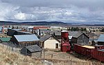
along Colorado State Highway 64. It offers camping, fishing, and boating. Colorado portal List of municipalities in Colorado "Active Colorado Municipalities"...
27 KB (1,857 words) - 00:31, 26 July 2024

Colorado (/ˌkɒləˈrædoʊ, -ˈrɑːdoʊ/ KOL-ə-RAD-oh, -RAH-doh, other variants) is a landlocked state in the Mountain West subregion of the Western United States...
210 KB (18,373 words) - 09:05, 27 July 2024

U.S. Route 85 (redirect from State Highway 3 (Colorado 1923))
US 64 south of Raton. The highways travel concurrently to Raton. US 64 / US 87 in Raton. US 85/US 87 travels concurrently to Fountain, Colorado. Colorado...
21 KB (2,217 words) - 21:49, 27 July 2024

U.S. Route 287 in Oklahoma (redirect from Oklahoma State Highway 287)
north-south highway that starts at the Texas state line north of Kerrick, Texas, and ends at the Colorado state line south of Campo, Colorado. In Oklahoma...
4 KB (278 words) - 14:50, 17 February 2024

U.S. Route 84 (redirect from Colorado State Highway 84)
Numbered Highway that started as a short Georgia–Alabama route in the original 1926 scheme. Later, in 1941, it had been extended all the way to Colorado. The...
31 KB (3,341 words) - 20:40, 16 July 2024

northwest to the Nebraska state line. The corridor along the eastern tier of Colorado was defined as several secondary highways in the 1910s. By 1914, the...
18 KB (1,302 words) - 23:31, 7 November 2023
U.S. Route 385 (redirect from State Highway 51 (Texas 1939))
overlapping US-287 and SH-3, the state's longest state highway. SH-3 ends at the state line while US-287/385 continue north into Colorado. The section of US-385...
13 KB (1,167 words) - 00:21, 18 January 2024
grassland basin of Colorado known as South Park, sitting on the west edge of the basin at the junction of U.S. Highway 285 and State Highway 9. It is on a...
19 KB (1,249 words) - 17:35, 8 July 2024

U.S. Route 160 (redirect from Colorado State Highway 40 (pre-1968))
the New Mexico state highway network, requiring New Mexico Department of Transportation crews to travel through either Arizona or Colorado to access it...
19 KB (1,877 words) - 01:40, 16 May 2024

U.S. Route 550 (redirect from State Highway 19 (Colorado 1923))
S. Route 550 (US 550) is a spur of U.S. Highway 50 that runs from Bernalillo, New Mexico to Montrose, Colorado in the western United States. The section...
17 KB (1,287 words) - 07:59, 23 July 2024

Interstate 76 (I-76) is an east–west Interstate Highway in the Western United States that runs from I-70 in Arvada, Colorado – near Denver – to an interchange with...
29 KB (1,865 words) - 02:49, 3 July 2024

the U.S. state of Colorado, US 6 is an east–west highway stretching from Utah to Nebraska. Much of the route overlaps other highways in Colorado, and, as...
28 KB (385 words) - 16:26, 8 July 2024

U.S. Route 285 (redirect from Colorado State Highway 163)
north–south United States highway, running 846 miles (1,362 km) through the states of Texas, New Mexico and Colorado. The highway's southern terminus is in...
13 KB (1,270 words) - 18:08, 25 February 2024
S. Highway System that travels from Tuba City, Arizona, to Poplar Bluff, Missouri. In the state of Colorado, US 160 starts at the New Mexico state line...
12 KB (480 words) - 00:19, 15 June 2024