
Cropmarks or crop marks are a means through which sub-surface archaeological, natural and recent features may be visible from the air or a vantage point...
9 KB (967 words) - 02:16, 24 November 2023
England. "Cropmark near bend in the road (1044205)". Research records (formerly PastScape). Retrieved 27 February 2011. Historic England. "Cropmark to east...
6 KB (275 words) - 03:44, 17 February 2023

relief) are a form of archaeological feature visible from the air. Unlike cropmarks, frost marks and soil marks they require upstanding features to work and...
2 KB (173 words) - 00:04, 24 December 2022

to crop circles or crop formations, archaeological remains can cause cropmarks in the fields in the shapes of circles and squares, but these do not appear...
55 KB (6,168 words) - 14:32, 24 July 2024
from cropmarks on an aerial photograph taken in July 1972, and included on a list of sixteen possible causewayed enclosures based on observed cropmarks, published...
31 KB (3,910 words) - 11:00, 31 July 2024

Archived from the original on 29 June 2021. Retrieved 4 September 2019. Cropmark (15 April 2021). "Supervisory activities". alia.lu. Archived from the original...
116 KB (11,712 words) - 10:59, 24 July 2024

Metlands cursus are in Bures St Mary, Suffolk, and were detected from cropmarks. They are situated just above the floodplain of the north bank of the...
6 KB (764 words) - 09:28, 17 July 2024

stone axe, some flint arrowheads and a carved stone ball near the town. A cropmark which is understood to have been used as a possible mortuary enclosure...
111 KB (10,289 words) - 12:22, 25 July 2024

The Cemlyn Cropmark is the first Roman military site on the island dated around the time of the second invasion in 77 CE. The cropmark was discovered...
29 KB (3,872 words) - 12:42, 18 March 2024
confirmed amphitheatre found at Wroxeter. Speculation as to purpose of cropmark enclosure includes such. Venta Icenorum Caistor St Edmund England 52°34′48″N...
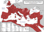
59 KB (372 words) - 23:20, 21 June 2024
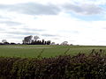
Mount Pleasant Henge Mount Pleasant Henge, visible as a white cropmark. Conquer Barrow is in the background Shown within Dorset Region Dorset, England...
4 KB (459 words) - 20:12, 9 February 2024

including Beaker Folk traces at Point Clear to the south and round houses (as cropmarks) near the A133 extension from Weeley to the north. There may have been...
42 KB (4,878 words) - 22:25, 30 July 2024
57°20′04″N 2°30′02″W / 57.3345°N 2.5006°W / 57.3345; -2.5006 Site notes Condition Cropmark Excavation dates 1976–1977 Archaeologists Kenneth St Joseph...
4 KB (321 words) - 07:32, 17 February 2024

Scheduled Ancient Monument. It has a large enclosure attached that shows as a cropmark. Excavation has shown this to be contemporary with the small enclosure...
4 KB (305 words) - 10:28, 26 November 2023

the Middle Ages, typically leaving no trace apart from earthworks or cropmarks.[citation needed] If there are fewer than three inhabited houses the convention...
5 KB (535 words) - 12:23, 24 July 2024
masonry used in construction of Priory Farm (50 m to the north); only cropmarks visible on site The Priory Church of Saint Saviour at Bridgend in Horbling...
24 KB (2,841 words) - 14:10, 17 June 2024

Neolithic period, as evidenced by a Cursus monument, identified from cropmarks near Woodhill. This cursus is of a similar scale to the well characterised...
109 KB (11,936 words) - 18:18, 23 July 2024
ploughing since World War II has levelled it and it is only visible today as a cropmark. The Lesser Cursus has been a Scheduled Monument since 1925, and was excavated...
13 KB (1,280 words) - 13:30, 17 December 2023
Retrieved 2 April 2024. Jones, G. D. B. (2002). "Tarradale: Investigation of a Cropmark Site near Muir of Ord, Ross and Cromarty" (PDF). Highland Council Historic...
2 KB (199 words) - 22:36, 2 April 2024

visible in aerial photographs and satellite imagery as a row of negative cropmarks in the grass on the Chapel Triangle. In his 1944 book, Sunday After The...
80 KB (7,756 words) - 01:39, 13 July 2024

stacking Intervalometer, bulb ramping, bulb timer (up to 8 hours) Custom cropmarks/on-screen graphics On-screen focus and DOF info, CMOS temperature, clock...
32 KB (3,779 words) - 22:01, 18 July 2024

planning a survey. Remains of older buildings often show in fields as cropmarks; just below the topsoil, the remains may affect the growth of crops or...
24 KB (3,361 words) - 13:13, 30 July 2024
corners of a printed page to indicate where the page is to be trimmed Cropmark, in archaeology, differential growth indicating buried sites, also spelt...
287 bytes (71 words) - 17:30, 24 April 2022

Coordinates 57°33′23″N 2°51′22″W / 57.5563°N 2.8562°W / 57.5563; -2.8562 Site notes Condition Cropmark Excavation dates 1959 Archaeologists Kenneth St Joseph...
4 KB (360 words) - 17:32, 16 July 2024
survey photograph that showed circular ridges under a wheat field. The cropmarks were easy to see in a season of drought. The structure's visibility also...
12 KB (1,270 words) - 11:07, 4 May 2024
levels will cast shadows when the sun is low and are best from above. Cropmarks: buried ditches will hold more water and buried walls will hold less water...
24 KB (2,760 words) - 20:47, 28 July 2024
Archaeological record Archaeological sequence Biofact Collecting Colluvium Cropmarks Cultural resources management Cut Dark earth Dating methodology Dendrochronology...
7 KB (417 words) - 15:19, 10 June 2024

similar to one excavated at Paddock Hill, near Thwing. The site consists of cropmarks indicating circular 20 to 26 feet (6 to 8 m) ditch surrounding a 160 feet...
61 KB (8,133 words) - 10:37, 3 June 2024
Coordinates 57°33′10″N 2°54′03″W / 57.5527°N 2.9007°W / 57.5527; -2.9007 Site notes Discovery year 1949 Condition Cropmark Archaeologists Kenneth St Joseph...
2 KB (84 words) - 12:49, 21 March 2019

civilization in Scotland in the Neolithic. However the increasing use of cropmarks to identify Neolithic sites in lowland areas has tended to diminish the...
21 KB (2,385 words) - 02:00, 12 October 2023