
D207 is a state road in Hrvatsko Zagorje region of Croatia connecting Hum na Sutli border crossing to Slovenia to the city of Đurmanec and the A2 motorway...
5 KB (187 words) - 13:22, 28 February 2024

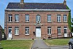
are three hamlets: La Commune, Les Malcadets, and Aprigny all along the D207 road. The rest of the commune is entirely farmland. The north-east border of...
7 KB (634 words) - 08:15, 21 August 2024
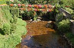
France. A village situated 5 miles (8 km) northwest of Saint-Omer, on the D207 road. "Houlle" is also the name of a small river close to the village, tributary...
3 KB (203 words) - 09:30, 26 August 2024

Highways in Croatia (redirect from D401 road)
Avenue in Zagreb, designated as Ž1040, a county road. Other than the motorway routes, the national road classification includes the following enumerated...
62 KB (2,634 words) - 11:06, 27 August 2024

46°15′43″N 15°52′10″E / 46.262°N 15.869499°E / 46.262; 15.869499 The state road D1 (Croatian: Državna cesta D1) is a national highway in Croatia. It is a...
32 KB (590 words) - 09:57, 17 February 2024

motorway Krapina interchange via D1 state road. The road is 28.7 km (17.8 mi) long. The D206, like all state roads in Croatia, is managed and maintained by...
6 KB (183 words) - 14:01, 28 February 2024
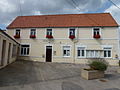
fall towards the plains of Lapalisse. Access to the commune is by the D207 road from Saint-Pierre-Laval in the north-east passing through the village...
13 KB (1,312 words) - 12:05, 24 August 2024

north to Maspie-Lalonquere-Juillacq. The D224 road also goes east from the village to Momy and the D207 road forms part of the western border of the commune...
20 KB (1,623 words) - 09:08, 25 September 2024

A2 (Croatia) (redirect from A2 road (Croatia))
Krapina and Pregrada via the D206, Đurmanec via the D207 and Trakošćan via the D508. The D1 state road runs as a parallel, toll-free route along the motorway...
34 KB (2,951 words) - 03:57, 10 July 2024

A4 motorway Varaždin interchange. The road is 46.0 km (28.6 mi) long. The road, as well as all other state roads in Croatia, is managed and maintained...
8 KB (197 words) - 13:02, 28 February 2024
(Axxi). "Public Schools Annual Report 1940–41". www.library.ubc.ca. p. 213 (D207). "Public Schools Annual Report 1904–05". www.library.ubc.ca. p. 91 (Axxiii)...
33 KB (2,503 words) - 03:17, 25 April 2023

Test: Part Deux". Sport Rider. December 1999. Retrieved February 3, 2016. "Road Tests: Used". Visor Down. August 17, 2008. Retrieved February 3, 2016. Burns...
19 KB (1,499 words) - 02:26, 6 August 2024

Mercury. Retrieved 19 March 2017. University of Wollongong Archives (WUA), D207 Towradgi Public School McIlwain, Kate (12 March 2012). "Education reform...
7 KB (764 words) - 14:43, 30 July 2024
about 5 miles (8 km) west of Saint-Omer, at the junction of the D208 and D207 roads and bordered by the A26 motorway. The church of St.Pierre, dating from...
2 KB (122 words) - 13:25, 27 August 2024
used in an encoding which combines KPS 9566 with ASCII. Several triangular "road mark" symbols denoting upcoming mountains or inclines ahead or to one side...
342 KB (8,518 words) - 23:55, 6 September 2024

the Chemin de Lapoutge going north from the D7 for about 6 km. The Highway D207 coming south from Simacourbe forms the eastern boundary of the commune. The...
12 KB (881 words) - 13:17, 22 August 2024
Bijapur Upload Photo N-KA-D206 Inscriptions Nandwadi Bijapur Upload Photo N-KA-D207 Fortwalls Navarasapur Bijapur Upload Photo N-KA-D208 Sankaralinga temple...
39 KB (126 words) - 12:49, 27 November 2023