
State Road 544 (SR 544) is a west–east state road in the U.S. state of Florida. It runs 11.6 miles (18.7 km) from Auburndale to Haines City. SR 544 breaks...
5 KB (408 words) - 16:57, 16 February 2024

State Road 296 (SR 296) is a major thoroughfare in the Pensacola, Florida metropolitan area. It is an east–west route running roughly through midtown...
7 KB (626 words) - 17:38, 11 May 2024

U.S. Route 92 (redirect from State Road 600 (Florida))
intersection of Florida State Road 559 (Main Street). Across from the south side of Auburndale Cemetery the western terminus of Florida State Road 544 branches...
40 KB (3,370 words) - 01:31, 26 June 2024
The following is a list of state roads in the U.S. state of Florida. Only the length of state-maintained roads is given; occasionally a locally maintained...
111 KB (96 words) - 00:53, 25 May 2024
Florida's state roads were renumbered. The old system numbered routes in the order they were legislated, while the new system used a grid. State Road...
23 KB (67 words) - 16:42, 5 August 2024

Overseas Highway (redirect from Pre-1945 Florida State Road 4A)
Miami (State Road 4A would remain as a hidden designation until the 1945 Florida State Road renumbering, when the hidden designation became State Road 5)...
54 KB (4,513 words) - 15:42, 11 July 2024

State Road 17 (SR 17), also formerly known as U.S. Route 27 Alternate (US 27 Alt.), is a north–south state road in the U.S. state of Florida. It is split...
8 KB (330 words) - 22:30, 13 September 2022
earliest evidence found of the old state road system is on a 1917 State Road Department map; in 1923 the Florida State Legislature began writing the routes...
31 KB (307 words) - 11:57, 30 July 2024
The following is a list of county roads in Polk County, Florida. All county roads are maintained by the county in which they reside. General Highway Map...
11 KB (66 words) - 13:59, 23 May 2024

Thomas E. Will Memorial Highway by the Florida Legislature in 1937 when that portion was known as State Road 26 (SR 26). Thomas E. Will, the founder...
64 KB (3,892 words) - 12:06, 28 April 2024
State Road 549 (SR 549) is a north–south state road in the U.S. state of Florida. It runs 1.5 miles (2.4 km) through the downtown of Winter Haven as 1st...
2 KB (196 words) - 16:48, 21 May 2024

For Florida Department of Transportation (FDOT) inventory purposes, it is designated as State Road 93 (SR 93) for most of its length in Florida (with...
61 KB (4,219 words) - 07:17, 5 August 2024

State Road 542 (SR 542) is a west–east route in Central Florida, serving Polk County. It runs 6 miles from downtown Winter Haven to west of downtown Dundee...
4 KB (322 words) - 16:56, 16 February 2024
List of highways numbered 9A (redirect from Florida state road 9A)
Route 9A (former) Delaware Route 9A Florida State Road 9A (Jacksonville) Florida State Road 9A (Miami) Maine State Route 9A Massachusetts Route 9A (former)...
1,000 bytes (94 words) - 15:51, 26 June 2024
U.S. Route 319 (redirect from Florida State Road 375)
Florida State Legislature in 1992. US 319 does not make an appearance on Georgia road maps until October 1937, when the spur from the Florida state line...
40 KB (2,117 words) - 18:23, 25 July 2024

intersection of State Road 62, the road passes by the Florida Gulf Coast Railroad Museum and then intersects CR 683 (Moccasin Wallow Road). After the road crosses...
52 KB (3,944 words) - 01:00, 1 August 2024

(I-595), also known as the Port Everglades Expressway and unsigned Florida State Road 862 (SR 862), is a 12.86-mile (20.70 km) auxiliary Interstate Highway...
19 KB (1,271 words) - 06:41, 31 May 2024
"Florida State Road 407" (Map). Google Maps. Google. Retrieved September 12, 2012. KML file (edit • help) Template:Attached KML/Florida State Road 407...
4 KB (352 words) - 21:02, 1 August 2021
State Road 421 (SR 421) is a major thoroughfare that runs east–west through Port Orange, Florida from Interstate 95 (I-95) east to U.S. Route 1 (US 1)...
6 KB (679 words) - 16:58, 16 February 2024

State Road 546 (SR 546) is a 5.837-mile-long (9.394 km) state highway in Lakeland, Polk County, Florida, that runs from Interstate 4 (I-4) to U.S. Route...
9 KB (1,050 words) - 20:43, 1 April 2024
counties in the state, connecting numerous towns and cities along its route, including nine county seats. The road is maintained by the Florida Department...
108 KB (6,471 words) - 12:32, 4 August 2024
State Road 120 (SR 120) is a state highway in the U.S. state of Florida. Known as North 23rd Avenue, the state highway runs 2.5 miles (4.0 km) from U.S...
4 KB (253 words) - 23:02, 22 March 2024

Jacksonville metropolitan area. As is the case with all Florida roads with American Association of State Highway and Transportation Officials (AASHTO) route...
56 KB (3,625 words) - 21:54, 2 March 2024

all AASHTO designated highways in Florida, US 441 always carries a FDOT designated hidden state road number: State Road 7 (SR 7) from the US route's southern...
55 KB (2,972 words) - 19:38, 31 May 2024

State Road 739 (SR 739) is a 17-mile-long (27 km) commercial highway running from San Carlos Park, Florida to North Fort Myers that is also known as U...
22 KB (2,171 words) - 16:01, 25 July 2024

Daytona Beach. I-95 runs for 382 miles (615 km), making Florida's portion the longest of any state the Interstate passes through. The southernmost 87 miles...
61 KB (2,326 words) - 07:24, 5 August 2024

National Preserve, Everglades National Park, Florida Panther National Wildlife Refuge, Picayune Strand State Forest, as well as rural communities in the...
44 KB (4,813 words) - 17:51, 3 August 2024

County (/poʊk/) is a county located in the central portion of the U.S. state of Florida. The county population was 725,046, as of the 2020 census, and estimated...
72 KB (6,895 words) - 17:41, 18 June 2024
List of highways numbered 346 (redirect from County Road 346 (Florida))
Avenel-Nagambie Road Manitoba Provincial Road 346 Newfoundland and Labrador Route 346 Quebec Route 346 Japan National Route 346 Georgia State Route 346 (former)...
2 KB (136 words) - 22:56, 4 April 2024
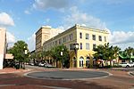
Winter Haven is a city in Polk County, Florida, United States. It is located about 51 miles (82 km) east of Tampa and about 47 miles (76 km) southwest...
45 KB (4,059 words) - 07:21, 24 June 2024