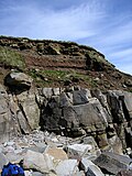
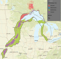
The geology of Ohio formed beginning more than one billion years ago in the Proterozoic eon of the Precambrian. The igneous and metamorphic crystalline...
12 KB (1,644 words) - 08:57, 14 July 2024
are a till plain landform in Northern Ohio, located near the shore of Lake Erie and produced by the retreat of the Wisconsin glaciation. Since glacial...
1,016 bytes (123 words) - 23:07, 1 March 2023
Bedrock (redirect from Subsurface (geology))
– the drift-thickness map of Ohio" (PDF). Ohio Geology. No. 1. Ohio Department of Natural Resources, Division of Geological Survey. pp. 1, 3–5. Archived...
5 KB (473 words) - 19:28, 18 October 2024
Ohio (/oʊˈhaɪ.oʊ/ oh-HY-oh) is a state in the Midwestern region of the United States. It borders Lake Erie to the north, Pennsylvania to the east, West...
197 KB (17,774 words) - 13:22, 22 November 2024
Midcontinent Rift System (category Geology of Ohio)
is a 2,000 km (1,200 mi) long geological rift in the center of the North American continent and south-central part of the North American plate. It formed...
16 KB (1,636 words) - 18:37, 21 November 2024
It is one of the most biodiverse temperate forests in the world. Geologically, Appalachian Ohio corresponds closely to the terminal moraine of an ancient...
19 KB (1,499 words) - 02:25, 31 October 2024
The geology of the Appalachians dates back more than 1.2 billion years to the Mesoproterozoic era when two continental cratons collided to form the supercontinent...
23 KB (2,593 words) - 16:15, 12 June 2024
Cincinnati Arch (category Geology of Ohio)
American Continent. The geology is characterized by layers of shale interspersed with layers of fossiliferous limestone. Layers of shale are believed to...
8 KB (857 words) - 16:34, 8 March 2024
Lake Tight (category Geology of Ohio)
near what is now Chillicothe, Ohio. The lake has been the repeated topic of research over the past 100 plus years. In geologic terms, the lake's life span...
5 KB (486 words) - 15:30, 25 January 2024
S. Hageman, an early settler. U.S. Geological Survey Geographic Names Information System: Hagemans Crossing, Ohio "Warren County". Jim Forte Postal History...
2 KB (184 words) - 22:09, 29 October 2023
The Ohio River is a 981-mile-long (1,579 km) river in the United States. It is located at the boundary of the Midwestern and Southern United States, flowing...
82 KB (8,307 words) - 22:28, 13 November 2024
1821. U.S. Geological Survey Geographic Names Information System: Crosswick, Ohio The History of Warren County, Ohio: Containing a History of the County ;...
1 KB (92 words) - 21:59, 29 October 2023
U.S. Route 22" (County Route 22A). U.S. Geological Survey Geographic Names Information System: Belvedere, Ohio Rand McNally, The Road Atlas '06, Chicago...
4 KB (86 words) - 06:05, 10 November 2024
Michigan Basin (category Geology of Ohio)
a geologic basin centered on the Lower Peninsula of the U.S. state of Michigan. The feature is represented by a nearly circular pattern of geologic sedimentary...
9 KB (835 words) - 08:12, 22 April 2024
tavern's signboard for the benefit of the illiterate. U.S. Geological Survey Geographic Names Information System: Blue Ball, Ohio McNutt, Randy (May 15, 1999)...
2 KB (130 words) - 19:34, 31 October 2023
Lake Monongahela (category Geology of Ohio)
Virginia, and Ohio. It formed during the Pre-Illinoian ice epoch when the retreat of the ice sheet northwards blocked the drainage of these valleys to...
12 KB (1,456 words) - 14:53, 22 October 2021
Gasport Formation (category Geology of Ohio)
The Gasport Formation is a geologic formation in the Appalachian Basin and Michigan Basin. This is one of the reef formations separating the Appalachian...
4 KB (277 words) - 16:27, 4 October 2024
Early Lake Erie (category Geology of Ohio)
characteristics of the reef area of western Lake Erie. *Ohio Department of Natural Resources, Division of Geological Survey Report of Investigation 82...
12 KB (1,367 words) - 07:44, 15 November 2024
Lake Warren (category Geology of Ohio)
York; Parker E. Calkin; Department of Geological Sciences, State University of New York at Buffalo; The Ohio Journal of Science 70(2): 78, March, 1970 Chapter...
8 KB (831 words) - 13:51, 14 February 2024
Carolina Geology of North Dakota Geology of Ohio Geology of Oklahoma Geology of Oregon Geology of Pennsylvania Geology of Rhode Island Geology of South Carolina...
7 KB (758 words) - 00:27, 8 December 2020
Lake Maumee (category Geology of Ohio)
Office; 1915 Geology and Geomorphology of Glacial Lake Maumee Formation of the Great Lakes Glacial Lakes in Michigan The Quaternary of Northern Ohio: An Outline...
13 KB (1,414 words) - 06:22, 25 February 2023
Erie Plain (category Geology of Ohio)
Leverett, Frank; Van Horn, Frank R. (1931). Geology and Mineral Resources of the Cleveland District, Ohio. Washington, D.C.: U.S. Government Printing...
16 KB (2,064 words) - 16:22, 17 July 2023
Ohio, United States. It lies at the intersection of U.S. Route 422 with State Route 305 and has a post office with the ZIP code 44470. It is part of the...
5 KB (209 words) - 01:16, 16 March 2024
the community his family's name. U.S. Geological Survey Geographic Names Information System: Hopkinsville, Ohio "Warren County". Jim Forte Postal History...
2 KB (138 words) - 00:12, 6 February 2024
A geologic map or geological map is a special-purpose map made to show various geological features. Rock units or geologic strata are shown by color or...
12 KB (1,578 words) - 02:41, 5 September 2024
downhill skiing area in Western Ohio. Zane Shawnee Caverns is another popular attraction nearby, shaped by the same geologic processes that produced Campbell...
7 KB (773 words) - 23:29, 31 August 2024
Fleming was established in 1866. U.S. Geological Survey Geographic Names Information System: Fleming, Ohio DeLorme, Ohio Atlas & Gazetteer, 7th ed., 2004,...
2 KB (158 words) - 14:56, 23 February 2024
Lake Arkona (category Geology of Ohio)
State of Ohio, Department of Natural Resources, Division of Geological Survey; Columbus, Ohio; 1959 Spencer, J. W., High-level shores in the region of the...
8 KB (879 words) - 22:46, 4 September 2021
Warren County, Ohio, United States, on the east shore of the Little Miami River about five miles northeast of Lebanon and six miles south of Waynesville...
2 KB (266 words) - 00:01, 6 February 2024
"Pennsylvania and Ohio Canal (historical)". Geographic Names Information System. United States Geological Survey, United States Department of the Interior...
69 KB (3,902 words) - 04:47, 4 November 2024


