
Gilmer County is a county located in the north central portion of the U.S. state of Georgia. As of the 2020 census, the population was 31,353. The county...
26 KB (2,256 words) - 06:08, 4 June 2024
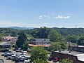
a city in Gilmer County, Georgia, United States. The population was 1,862 at the 2020 census. The city is the county seat of Gilmer County. Agriculture...
18 KB (1,382 words) - 11:52, 28 September 2024
Gilmer County is the name of two counties in the United States: Gilmer County, Georgia Gilmer County, West Virginia This disambiguation page lists articles...
156 bytes (53 words) - 14:58, 28 December 2019

East Ellijay is a city in Gilmer County, Georgia, United States. The population was 546 at the 2010 census, down from 707 in 2000. East Ellijay was originally...
10 KB (611 words) - 14:34, 25 May 2024
After the boll weevil came through and destroyed Georgia's cotton crops in the 1920s, Gilmer County's economy was bolstered by its apple orchards. A festival...
3 KB (189 words) - 13:02, 31 October 2023
Gilmer may refer to: Gilmer, Illinois Gilmer, Roanoke, Virginia Gilmer, Texas Gilmer, Washington Gilmer, West Virginia Gilmer County, Georgia Gilmer County...
543 bytes (88 words) - 16:14, 24 May 2023

Chattahoochee–Oconee National Forest (category Protected areas of Gilmer County, Georgia)
Columbus, Georgia. In 1911, the United States Forest Service purchased 31,000 acres (125 km2) of land in Fannin, Gilmer, Lumpkin and Union Counties from the...
14 KB (1,452 words) - 01:10, 8 October 2024

Springer Mountain (category Mountains of Gilmer County, Georgia)
National Forest on the border of Fannin and Gilmer counties. Located in the Blue Ridge Mountains in northern Georgia, the mountain has an elevation of about...
9 KB (926 words) - 19:33, 17 May 2024

Mountain is located in Georgia USA on the boundary between Dawson and Gilmer counties. The summit is the highest point in Dawson County. It is in the Chattahoochee...
4 KB (276 words) - 23:46, 10 July 2024

an unincorporated community and census-designated place (CDP) in Gilmer County, Georgia, United States. Its population was 99 as of the 2020 census. Cherry...
11 KB (450 words) - 00:14, 1 May 2024

Douglas, Cobb, Cherokee, Pickens, Gilmer, and Fannin counties in the western and northern parts of the U.S. state of Georgia. The highway travels from its...
70 KB (7,322 words) - 04:26, 13 July 2024
Ai is an unincorporated community in Gilmer County, Georgia, United States. A post office called Ai was established in 1920, and remained in operation...
4 KB (111 words) - 15:24, 29 December 2023
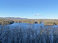
Carters Lake (Blue Ridge Mountains) (category Protected areas of Gilmer County, Georgia)
Coosawattee River in the Blue Ridge Mountains in Gilmer and Murray counties in the U.S. state of Georgia. It is the state's deepest lake. While the reservoir...
5 KB (348 words) - 04:55, 3 June 2023
The Gilmer County School District is a public school district in Gilmer County, Georgia, United States, based in Ellijay. It serves the communities of...
2 KB (104 words) - 05:50, 25 July 2023

Rockingham Gilmer (April 11, 1790 – November 16, 1859) was an American politician. He served two non-consecutive terms as the 34th governor of Georgia, the...
11 KB (840 words) - 20:32, 8 January 2024
Information System: List of mountains in Georgia named Rocky Mountain TopoQuest Map of the Rocky Mountain in Gilmer County U.S. Geological Survey Geographic...
5 KB (630 words) - 05:58, 22 August 2024

Gilmer High School is located in North Georgia in the city of Ellijay, Georgia, United States. It serves Gilmer County. It was established in August 1956...
9 KB (738 words) - 19:47, 12 September 2024

Cheaha Mountain (category Landforms of Cleburne County, Alabama)
and other amenities. The nearest higher peak is Brushy Top in Gilmer County, Georgia, 106.72 miles (171.75 km) away. The highest point is marked with...
7 KB (612 words) - 22:13, 1 September 2024

The Gilmer County Courthouse was the courthouse for Gilmer County, Georgia, United States, from 1934 until 2003. It was built in 1898 as the Hyatt Hotel...
3 KB (244 words) - 21:09, 6 August 2023

Bugaboo Scrub Fire (redirect from 2007 Georgia/Florida wildfires)
in Georgia history. It raged from April to June 2007 and ultimately merged with other fires becoming the largest fire in the history of both Georgia and...
9 KB (955 words) - 08:31, 14 April 2024

Coosawattee River (category Rivers of Gilmer County, Georgia)
Georgia, United States. The river is noted as beginning at the confluence of the Ellijay and Cartecay rivers in the city of Ellijay in central Gilmer...
7 KB (507 words) - 23:18, 20 July 2023
Conasauga is an extinct town in Gilmer County, in the U.S. state of Georgia. Conasauga is the site of a former historic Cherokee settlement. "Conasauga"...
2 KB (162 words) - 15:25, 23 July 2023

Pickens County from portions of Cherokee and Gilmer Counties. Pickens received several more land additions from Cherokee (1869) and Gilmer Counties (1858...
16 KB (979 words) - 00:41, 8 October 2024

Cartecay River (category Rivers of Gilmer County, Georgia)
River is a 19.1-mile-long (30.7 km) river that runs into Ellijay, Georgia, in Gilmer County. It is the site of a class II whitewater run. The Cartecay and...
3 KB (203 words) - 22:48, 18 January 2024
Tickanetley is an unincorporated community in Gilmer County, in the U.S. state of Georgia. Tickanetley originally was the name of a Cherokee Indian village...
1 KB (115 words) - 06:13, 10 November 2023

Big Bald Mountain (category Mountains of Gilmer County, Georgia)
Big Bald Mountain is the highest peak in Gilmer County, Georgia, U.S. and is in the Rich Mountain Wilderness, which is administered as a component of the...
4 KB (318 words) - 23:51, 10 July 2024
Pisgah is an unincorporated community in Gilmer County, in the U.S. state of Georgia. A post office called Pisgah was established in 1887, and remained...
1 KB (108 words) - 17:18, 15 July 2024

Anderson. In Georgia, the highway travels within portions of Catoosa, Whitfield, Murray, Gilmer, Fannin, Union, Towns, and Rabun counties. It travels through...
25 KB (3,064 words) - 22:36, 2 September 2024

inset – via GDOT Maps. Georgia Department of Transportation (1977). General Highway Map: Gilmer County, Georgia (Map). Atlanta: Georgia Department of Transportation...
82 KB (7,572 words) - 13:34, 7 February 2024

of the Chattahoochee National Forest in Gilmer County, Georgia. It is the second-highest peak in Gilmer County; only Big Bald Mountain is taller, with...
6 KB (501 words) - 13:15, 1 August 2022