
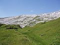
The Glärnisch is a mountain massif of the Schwyz Alps, overlooking the valley of the Linth in the Swiss canton of Glarus. It consists of several summits...
3 KB (300 words) - 11:57, 8 May 2022

Glarus. It lies north-east of the higher Glärnisch (2,914 m). Unlike its higher neighbour, the Vorder Glärnisch can be ascended via a trail on its north-west...
1 KB (75 words) - 18:08, 16 April 2022
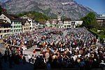
Netstal and Riedern. Glarus lies on the river Linth between the foot of the Glärnisch (part of the Schwyzer Alps) to the west and the Schilt (Glarus Alps) to...
25 KB (2,371 words) - 11:10, 22 June 2024
List of minor planets: 2001–3000 (redirect from 2914 Glärnisch)
Horta October 12, 1931 Uccle E. Delporte · 10 km MPC · JPL 2914 Glärnisch 1965 SB Glärnisch September 19, 1965 Zimmerwald P. Wild · 6.0 km MPC · JPL 2915...
233 KB (302 words) - 23:17, 5 July 2024

Lake Lucerne at the foot of the Axenberg cliffs (an offshoot ridge of Glärnisch, 1,022 m), in the Sisikon municipality, canton of Uri, Switzerland. It...
3 KB (253 words) - 19:09, 13 February 2023
Other mountains include the Hausstock (3,158 meters (10,361 ft)) and the Glärnisch (2,910 meters (9,550 ft)). The canton contains part of a thrust fault...
17 KB (1,188 words) - 17:55, 26 July 2024

Alps is the Glärnisch, at an elevation of 2,915 metres (9,564 ft), which actually lies within the canton of Glarus. Just south of the Glärnisch is the Bös...
6 KB (180 words) - 18:19, 13 July 2024

Zürichsee-Schifffahrtsgesellschaft (redirect from Glärnisch (ship))
island in Lake Zurich Glärnisch Motor ship 1955 Escher Wyss & Cie. since 2007 serving as Restaurant ship in Wädenswil Glärnisch, a Swiss mountain Stäfa...
19 KB (1,122 words) - 07:11, 9 July 2024

Alps Schwyz, Zug, Uri, Glarus, Graubünden, Lucerne Tödi, Bächistock, Glärnisch, Rigi, Mythen Seeztal Appenzell Alps Appenzell Innerrhoden, Appenzell...
36 KB (3,643 words) - 14:41, 29 April 2024

Elevation 2,764 m (9,068 ft) Prominence 691 m (2,267 ft) Parent peak Glärnisch Coordinates 46°53′16.5″N 8°47′29.9″E / 46.887917°N 8.791639°E / 46...
2 KB (106 words) - 21:26, 15 May 2022

Rautispitz The Rautispitz from Näfels (Glärnisch in background) Highest point Elevation 2,283 m (7,490 ft) Prominence 465 m (1,526 ft) Parent peak Mutteristock...
1 KB (60 words) - 17:56, 16 April 2022

460 104 Toggenburg Re 460 105 Fürstenland Re 460 106 Munot Re 460 107 Glärnisch Re 460 108 Engadin Re 460 109 Alpstein Re 460 110 Mariaberg Re 460 111...
15 KB (1,308 words) - 22:32, 13 July 2024

Elevation 2,573 m (8,442 ft) Prominence 373 m (1,224 ft) Parent peak Glärnisch Coordinates 46°57′42″N 8°54′42″E / 46.96167°N 8.91167°E / 46.96167;...
1 KB (66 words) - 02:31, 18 December 2022

Kindergarten Zopf 1 and 2 The Primarschulen are: Au Eidmatt Gerberacher-Berg Glärnisch KLEINgruppenschule Untermosen The Oberstufenschule Wädenswil (OSW) is:...
23 KB (1,863 words) - 23:46, 22 March 2024
Victor Horta (1861–1947), Belgian architect MPC · 2913 2914 Glärnisch 1965 SB Glärnisch mountain, summit of the Swiss Alps MPC · 2914 2915 Moskvina 1977...
148 KB (438 words) - 00:54, 23 June 2024
Championship Hyattsville Prince George's Sport & Learning Complex IBJJF 1 Zurich International Open IBJJF Jiu-Jitsu Championship Wädenswil Sporthalle Glärnisch...
21 KB (581 words) - 12:28, 15 June 2024

Bös Fulen (2,802 m or 9,193 ft), Rüchigrat (2,657 m or 8,717 ft) and Glärnisch (2,915 m or 9,564 ft). Luchsingen has an area, as defined by its former...
9 KB (836 words) - 11:51, 21 February 2024

among these is the Vrenelisgärtli ("Verena's garden") glacier of the Glärnisch massif. The Verena Gorge Hermitage north of Solothurn, ostensibly the...
10 KB (1,046 words) - 17:30, 16 June 2024

Dammastock Titlis Pilatus Tödi Oberalpstock Ringelspitz Piz Sardona Säntis Glärnisch Rigi Rheinwaldhorn Piz Medel Monte Generoso Campo Tencia Basodino Pizzo...
112 KB (1,337 words) - 21:15, 20 July 2024

metres (4,665 ft), above the village of Luchsingen and below the peaks of Glärnisch. Its surface area is 0.17 square kilometres (0.066 sq mi). List of mountain...
1 KB (82 words) - 14:40, 22 March 2022

seen from the Uetliberg, looking southeast. In the background left the Glärnisch. Highest point Coordinates 47°17′N 8°30′E / 47.283°N 8.500°E / 47.283;...
3 KB (349 words) - 18:35, 23 April 2024

Glarus 1425 4.81 Mürtschenstock 2441 Rhine Oberblegisee Glarus 1422 16.63 Glärnisch 2915 Rhine Golzernsee Uri 1409 6.10 Schwarz Stöckli 2614 Rhine Lac de...
26 KB (243 words) - 10:57, 23 June 2024
Highest point Elevation 2,319 m (7,608 ft) Prominence 199 m (653 ft) Parent peak Glärnisch Coordinates 46°59′32″N 8°53′58″E / 46.99222°N 8.89944°E / 46.99222;...
2 KB (114 words) - 03:08, 22 October 2021

Jona Former municipality Jona in November 2010, view on Obersee and Glärnisch Flag Coat of arms Location of Jona Jona Show map of Switzerland Jona Show...
9 KB (794 words) - 10:33, 20 May 2024
Evilard of the Swiss plateau and the Alps from Mont Blanc to the region of Glärnisch and Alpstein is quite impressive. The municipality reaches to the height...
19 KB (2,217 words) - 21:48, 23 July 2024
Name Elevation (m) Elevation (ft) Glärnisch (highest) 2,915 9,564 Bös Fulen (Böser Faulen) 2,802 9,193 Schächentaler Windgällen 2,764 9,068 Ortstock 2...
5 KB (131 words) - 18:18, 13 July 2024

2868 Upupa 30 October 1972 list 2914 Glärnisch 19 September 1965 list 2950 Rousseau 9 November 1974 list 2970 Pestalozzi 27 October 1978 list 2989 Imago...
13 KB (512 words) - 18:20, 10 September 2023
for Foostock, Glarus Alps, Switzerland Ruchen, one of the summit of the Glärnisch massif, Schwyzer Alps, Switzerland This disambiguation page lists articles...
468 bytes (85 words) - 21:51, 18 December 2018
A-d-H-Provence FR 636 Glärnisch 2915 967 46°59′42″N 08°59′43″E / 46.99500°N 8.99528°E / 46.99500; 8.99528 (636. Glärnisch (2915 m)) Schwyz Alps I/B-13...
94 KB (827 words) - 18:53, 6 July 2023

Elevation 2,802 m (9,193 ft) Prominence 368 m (1,207 ft) Parent peak Glärnisch Isolation 4.3 km (2.7 mi) Listing Canton high point Coordinates 46°58′2″N...
2 KB (89 words) - 21:52, 11 May 2022