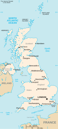
Gowkhall (for a period known as Balclune) is a hamlet in Fife Scotland, 3.6 miles (5.794 km) west of Dunfermline. The nearest village of size is Carnock...
6 KB (846 words) - 20:24, 22 August 2021
Brucefield Carnegie Carnock Comrie Crombie Crossford Crossgates Garvock Gowkhall Halbeath Headwell High Valleyfield Hill of Beath Kingseat Linburn Low Valleyfield...
20 KB (711 words) - 11:06, 19 July 2024
and Coastal Villages Kincardine Blairhall, Bowershall, Cairneyhill, Carnock, Comrie, Culross, Gowkhall, Oakley, Saline, Steelend, Torryburn, Valleyfield...
18 KB (699 words) - 18:24, 13 June 2024
Gateside Gauldry Glenrothes, Glenrothes with Thornton railway station Gowkhall Grange of Lindores Guardbridge Halbeath High Valleyfield Hillend Hill of...
8 KB (554 words) - 07:13, 19 July 2024
several tiers of elected government. Abbeyview, Bellyeoman, Carnock and Gowkhall, Central Dunfermline, Izatt Avenue & Nethertown and Touch and Garvock Community...
111 KB (10,289 words) - 12:22, 25 July 2024
Caledonian Insurance Company, 19 George Street, Edinburgh (1840) Luscar House, Gowkhall, Fife (1842) House demolished Aug 2003 - Stables remain, Elizabethan-Jacobean...
15 KB (1,558 words) - 06:11, 24 January 2024
in the 1970s. B912 A907 at Dunfermline B917 B913 A91 at Dollar A907 at Gowkhall B914 B913, at Saline M90 J4 B915 A823 B914 B916 A921 at Dalgety Bay A823...
36 KB (77 words) - 16:09, 8 July 2024
church is Carnock Primary School, this school serves both Carnock and Gowkhall. The school was built in 1864 with an extension added in 1912 by James...
10 KB (1,001 words) - 05:36, 26 June 2024
pattern in the area for such weaving communities, another example being Gowkhall a few miles north. The Earls of Elgin owned land in the Crossford area...
13 KB (1,497 words) - 13:06, 9 June 2024
9812 Upload Photo Gowkhall Bridge (Over Kirtle Water) 55°05′06″N 3°10′33″W / 55.084905°N 3.175884°W / 55.084905; -3.175884 (Gowkhall Bridge (Over Kirtle...
5 KB (274 words) - 21:00, 28 March 2023
LB Number Image Gowkhall, Luscar House And Stables 56°05′20″N 3°31′27″W / 56.088944°N 3.524205°W / 56.088944; -3.524205 (Gowkhall, Luscar House And...
3 KB (277 words) - 12:57, 10 April 2022
Burntisland* Cairneyhill* Cameron* Cardenden* Carnbee & Arncroach* Carnock & Gowkhall* Central Dunfermline* Ceres & District* Charlestown, Limekilns and Pattiesmuir*...
43 KB (3,753 words) - 11:06, 26 April 2024
Derbyshire 53°20′N 1°59′W / 53.34°N 01.98°W / 53.34; -01.98 SK0183 Gowkhall Fife 56°05′N 3°31′W / 56.08°N 03.52°W / 56.08; -03.52 NT0589 Gowkthrapple...
57 KB (26 words) - 05:40, 31 May 2023
Category C(S) 16946 Upload Photo Gowkhall Bridge 55°05′06″N 3°10′33″W / 55.084905°N 3.175884°W / 55.084905; -3.175884 (Gowkhall Bridge) Category B 16948 Upload...
7 KB (274 words) - 14:16, 10 April 2022


