originally as an eruptive vent. The road runs into Hilina Pali Road, a winding eight-mile (13 km) road that dead ends. The road passes Pauahi crater, and fresh...
10 KB (1,008 words) - 11:59, 4 August 2023

transparency, 3 data pages, 2 photo caption pages HAER No. HI-51, "Hilina Pali Road, Volcano, Hawaii County, HI", 8 photos, 1 color transparency, 3 data...
33 KB (3,007 words) - 18:49, 16 July 2024

them forming a small, fifteen-centimeter-high escarpment across the Hilina Pali road. Another powerful tremor occurred on March 7, causing some damage to...
24 KB (3,220 words) - 11:33, 9 July 2024

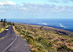
Hilina Pali Road...
38 KB (233 words) - 01:21, 8 August 2023
fissures and a trend of aligning normal faults. The Kaoiki Pali is an example of a Hilina slump induced normal fault, striking northeast and stretching...
12 KB (1,467 words) - 00:24, 27 January 2024

Kīlauea (section Hilina fault system)
from charcoal sandwiched beneath an ash layer on a fault scarp known as Hilina Pali; however, samples dated from higher up the scarp indicate ash deposition...
101 KB (10,294 words) - 03:45, 21 August 2024
Waterfall Hiking trails in Hawaiʻi commons:Category:Hiking trails in Hawaii Hilina Slump Hilo Hilo Art Museum Hilo Bay Hilo High School Hilo International...
66 KB (6,754 words) - 20:29, 8 October 2023