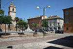
11°15′36″E / 43.777323°N 11.260037°E / 43.777323; 11.260037 The Istituto Geografico Militare (IGM), or Military Geographic Institute, is an Italian public...
1 KB (118 words) - 20:39, 26 August 2023
Intergalactic medium Kingman Airport (Arizona) (IATA Code: IGM) Istituto Geografico Militare, Italian national mapping agency Intersex genital mutilation...
594 bytes (93 words) - 19:56, 29 June 2019
September 2008. Istituto Geografico Militare (IGM) official maps of Italy, 1:25.000 and 1:100.000 scale, on-line version Istituto Geografico Centrale (IGC)...
5 KB (432 words) - 10:53, 22 October 2024
Courmayeur is marked as lying entirely within Italy on the Italian Istituto Geografico Militare (IGM) map, while on the French Institut Géographique National...
4 KB (323 words) - 06:29, 26 October 2024
media related to Bergamo Alps. Italian official cartography (Istituto Geografico Militare - IGM); on-line version: www.pcn.minambiente.it Bergamasque Prealps...
5 KB (166 words) - 21:38, 3 November 2024
Abu Shakra Dolomites on Hike.uno Italian official cartography (Istituto Geografico Militare - IGM); on-line version: www.pcn.minambiente.it Report on the...
22 KB (1,316 words) - 16:32, 3 November 2024
Exclusive Economic Zone: 541,915 km2 (209,235 sq mi) Although the Istituto Geografico Militare of Florence has repeatedly declared that it is impossible to...
42 KB (5,118 words) - 17:52, 15 November 2024
Institut Géographique National (IGN) map [1], although on Italian Istituto Geografico Militare (IGM) map [2] the summit appears to lie on the frontier between...
5 KB (355 words) - 09:55, 30 April 2024
Morocco ANCFCC Republic of Ireland Ordnance Survey Ireland Italy Istituto Geografico Militare Japan Geospatial Information Authority of Japan (GSI) Netherlands...
10 KB (1,053 words) - 17:50, 22 October 2024
maps take data from the Italian national mapping agency, the Istituto Geografico Militare, which is based upon past treaties in force. In 1890, Pierre...
62 KB (6,356 words) - 19:16, 23 November 2024
official cartography (Istituto Geografico Militare - IGM); on-line version: www.pcn.minambiente.it I.G.C. (Istituto Geografico Centrale) - Carta dei sentieri...
5 KB (539 words) - 21:15, 22 October 2024
Retrieved 2 February 2015. Silvio Govi (ed.). L'Universo. Vol. 50. Istituto geografico militare."Due cavi per l'Elba". Enel.tv. 1967. Retrieved 2 February 2015...
97 KB (8,843 words) - 00:38, 20 October 2024
from Biella and Andorno Micca. Italian official cartography (Istituto Geografico Militare - IGM); on-line version: www.pcn.minambiente.it Provincia di...
1 KB (94 words) - 17:40, 17 April 2022
storia patria per le Venezie, 1971 Italian official cartography (Istituto Geografico Militare - IGM); on-line version: www.pcn.minambiente.it French official...
4 KB (317 words) - 09:35, 1 November 2024
Annunziata is today the seat of Istituto Geografico Militare (IGM). In 2007, in the west part of the cloister occupied by the Istituto, the group found a monumental...
14 KB (1,282 words) - 16:45, 24 September 2024
Cambridge University Press. p. 741. Italian official cartography (Istituto Geografico Militare - IGM); on-line version: www.pcn.minambiente.it French official...
7 KB (352 words) - 16:32, 3 November 2024
His Gauss-Boaga Projection is the standard projection used in Italian topography by the Istituto Geografico Militare. Biography at SISM (in Italian)...
928 bytes (47 words) - 22:35, 4 July 2023
on-line version: map.geo.admin.ch Italian official cartography (Istituto Geografico Militare - IGM); on-line version: www.pcn.minambiente.it Natural Wonders...
18 KB (525 words) - 16:33, 3 November 2024
Europe List of mountain passes Italian official cartography (Istituto Geografico Militare - IGM); on-line version: www.pcn.minambiente.it French official...
8 KB (351 words) - 21:36, 3 November 2024
September 2023. Sandro Toniolo, I perché e i nomi della geografia, Istituto Geografico Militare, Florence 2005, p. 88-89, n. 170-171. Press, Stanford University...
48 KB (5,230 words) - 16:30, 20 October 2024
Bessel's geodetic apparatus, in the museum of Istituto Geografico Militare, Florence, Italy...
30 KB (2,908 words) - 21:48, 18 November 2024
Statistics. Retrieved 16 March 2019. L'Universo (in Italian). Istituto geografico militare. 1980. p. 293. "PREMI". Savino Marè (in Italian). Retrieved 2022-06-16...
4 KB (357 words) - 13:24, 29 October 2024
Mountains portal Istituto Geografico Militare (IGM) official maps of Italy, 1:25.000 and 1:100.000 scale, on-line version Istituto Geografico Centrale (IGC)...
2 KB (180 words) - 19:41, 25 August 2024
Regnum Cottius Donnus Ambin group Italian official cartography (Istituto Geografico Militare – IGM); on-line version: www.pcn.minambiente.it French official...
11 KB (696 words) - 18:36, 7 November 2024
000 maps". Istituto Geografico Militare. Retrieved 2020-02-23. Divisione geodetica. "067905 PUNTA CORNOUR". Istituto Geografico Militare. Retrieved 2020-02-22...
6 KB (555 words) - 14:25, 30 January 2022
summits of the Venetian prealps are: Italian official cartography (Istituto Geografico Militare - IGM); on-line version: www.pcn.minambiente.it Lessinia "Topographic...
4 KB (135 words) - 12:46, 13 June 2024
Saint-Exupéry flew this aircraft before the fall of France. The Istituto Geografico Militare acquired aerial photographs to sustain its war effort against...
46 KB (6,445 words) - 13:08, 12 October 2024
Mountains portal Istituto Geografico Militare (IGM) official maps of Italy, 1:25.000 and 1:100.000 scale, on-line version Istituto Geografico Centrale - Carta...
4 KB (404 words) - 13:47, 24 July 2021
1888. On April 2, 1891, Viganò became deputy director of the Istituto Geografico Militare and held this office until December 24, 1893. At the same time...
9 KB (930 words) - 04:30, 20 November 2024
Cartografia ufficiale italiana in scala 1:25.000 e 1:100.000 (Map). Istituto Geografico Militare. Géoportail (French official maps) (Map). Institut géographique...
6 KB (489 words) - 08:37, 2 November 2024


