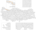
Karasu is a municipality and district of Sakarya Province, Turkey. Its area is 411 km2, and its population is 70,600 (2022). It is on the Black Sea coast...
4 KB (219 words) - 08:11, 26 October 2023
(disambiguation) Karasu, Tajikistan, Vahdat District Karasu, Sakarya, a town in Sakarya Province Karasu, Karacabey, a village in Bursa Province Karasu, Yenice...
4 KB (480 words) - 06:21, 26 March 2024
Sakarya on June 22, 1954 by Law 6419. Adapazarı took the name of Sakarya since it was the centre of the districts f Akyazı, Geyve, Hendek and Karasu....
7 KB (663 words) - 08:55, 1 November 2024
Sakarya University of Applied Sciences (Turkish: Sakarya Uygulamalı Bilimler Üniversitesi), was established with the Decree Law published in the Official...
4 KB (254 words) - 22:09, 25 September 2024
State road D.010 (Turkey) (category Transport in Sakarya Province)
in the west at the intersection D.014, 5 km (3.1 mi) southeast of Karasu, Sakarya Province, and terminates at the intersection D.060, 25 km (16 mi) northeast...
7 KB (325 words) - 04:08, 1 November 2024
(D650) D.550 Edirne – Çanakkale – Edremit – İzmir – Aydın – Muğla D.650 Karasu – Sakarya – Bilecik – Kütahya – Afyon – Sandıklı – Burdur – Antalya D.750 Zonguldak...
16 KB (1,372 words) - 10:51, 28 October 2024
Acarlar Floodplain Forest (category Landforms of Sakarya Province)
forest located in Sakarya Province, northwestern Turkey. It is a combination of seaside, lagoon, dunes and forest. Situated between Karasu and Kaynarca north...
9 KB (873 words) - 21:25, 31 October 2024
Adapazarı (redirect from Adapazarı, Sakarya)
(pronounced [ɑˈdɑpɑzɑɾɯ]) is a municipality and the capital district of Sakarya Province, Turkey. Its area is 324 km2, and its population is 281,489 (2022)...
17 KB (1,260 words) - 19:32, 31 October 2024
River - tributary (also known as Gökırmak and in Classical times, Amnias) Sakarya River is the third longest river in Turkey, also known as Sangarius. 824 km...
5 KB (510 words) - 23:09, 3 December 2023
Erenler is a municipality and district of Sakarya Province, Turkey. Its area is 136 km2, and its population is 92,249 (2022). It covers the southeastern...
4 KB (308 words) - 19:52, 24 September 2024
Kaynarca, formerly Şeyhler, is a municipality and district of Sakarya Province, Turkey. Its area is 343 km2, and its population is 24,483 (2022). The...
3 KB (174 words) - 08:12, 26 October 2023
This is the List of municipalities in Sakarya Province, Turkey as of October 2007[update]. List is sorted alphabetically A-Z, as Districts->Municipalities...
2 KB (100 words) - 20:34, 13 July 2024
Söğütlü (category Populated places in Sakarya Province)
Söğütlü is a municipality and district of Sakarya Province, Turkey. Its area is 145 km2, and its population is 14,724 (2022). The mayor is Koray Oktay...
3 KB (115 words) - 08:36, 26 October 2023
Taraklı (redirect from Taraklı, Sakarya)
Taraklı, formerly known as Dablar is a municipality and district of Sakarya Province, Turkey. Its area is 292 km2, and its population is 6,894 (2022)...
5 KB (314 words) - 08:37, 26 October 2023
end of the Anatolian Plateau is also located in the province. Sakarya River and Karasu are the most important rivers in the province. Bilecik province...
8 KB (537 words) - 06:37, 1 November 2024
Sapanca (category Populated places in Sakarya Province)
Sapanca is a municipality and district of Sakarya Province, Turkey. Its area is 173 km2, and its population is 44,712 (2022). It lies on the south bank...
3 KB (188 words) - 17:38, 12 July 2024
Kocaali (category Populated places in Sakarya Province)
Kocaali is a municipality and district of Sakarya Province, Turkey. Its area is 254 km2, and its population is 22,882 (2022). The mayor is Ahmet Acar...
4 KB (256 words) - 08:13, 26 October 2023
Hendek (category Populated places in Sakarya Province)
Hendek is a municipality and district of Sakarya Province, Turkey. Its area is 646 km2, and its population is 90,153 (2022). The municipality was founded...
4 KB (235 words) - 17:44, 12 July 2024
Below is the list of populated places in Sakarya Province of Turkey by the districts. Adapazarı 15 Temmuz Camili Abalı Acıelmalı Akıncılar Alandüzü Aşırlar...
10 KB (771 words) - 13:33, 15 January 2024
Akyazı (category Populated places in Sakarya Province)
Akyazı is a municipality and district of Sakarya Province, Turkey. Its area is 628 km2, and its population is 94,494 (2022). The mayor is Bilal Soykan...
6 KB (377 words) - 04:15, 22 October 2024
650 (Israel) D.650, a north-south state road in Turkey running from Karasu, Sakarya Province to Antalya. US 650 (former) SR 650 MD 650 SR 650 (former)...
961 bytes (95 words) - 23:07, 4 April 2024
Recep Çetin (category People from Karasu)
defender lasted from 1979 to 2002. A native of the town of Karasu in the Marmara Region's Sakarya Province, Recep Çetin began his football career in 1979...
5 KB (272 words) - 12:30, 22 October 2024
Geyve (category Populated places in Sakarya Province)
Geyve is a municipality and district of Sakarya Province, Turkey. Its area is 662 km2, and its population is 50,799 (2022). The closest international...
15 KB (1,428 words) - 17:28, 12 July 2024
Situated on a hillside at a point where the Karasu, flowing down from Kandilli Dağ, enters the Sakarya River, this small town was known in antiquity...
6 KB (608 words) - 14:09, 13 August 2024
Otoyol 7 (category Transport in Sakarya Province)
people were killed and 57 others injured in a multiple-vehicle collision in Sakarya Province, Turkey. KGM otoyollar Haritası - İstanbul Project details Kuzey...
13 KB (308 words) - 10:14, 21 August 2024
Serdivan (category Districts of Sakarya Province)
Serdivan is a municipality and district of Sakarya Province, Turkey. Its area is 130 km2, and its population is 162,699 (2022). It covers the western...
4 KB (263 words) - 14:47, 25 August 2024
Arifiye (category Populated places in Sakarya Province)
Arifiye is a municipality and district of Sakarya Province, Turkey. Its area is 75 km2, and its population is 49,340 (2022). It covers the southernmost...
5 KB (451 words) - 10:57, 14 June 2024
Bilecik is located in a mountainous area west of the Karasu, a left-hand tributary of the Sakarya River.: 461 It is located in the Southern Marmara section...
14 KB (904 words) - 14:40, 18 August 2024
Ferizli (category Populated places in Sakarya Province)
Ferizli is a municipality and district of Sakarya Province, Turkey. It takes its name from Feriz or Feyzi Ağa who lived in the region. The name used as...
4 KB (251 words) - 11:30, 8 August 2024
State road D.650 (Turkey) (category Transport in Sakarya Province)
D.650 is a north-to-south state road in Turkey. It starts at Karasu at the Black Sea coast and ends at Antalya at the Mediterranean Sea coast. Since it...
2 KB (76 words) - 12:53, 18 August 2024


