
Kentucky Route 480 (KY 480) is a 13.481-mile-long (21.696 km) state highway in Kentucky that runs from Kentucky Route 61 in southern Shepherdsville to...
4 KB (123 words) - 17:49, 16 February 2024

have portions within the State Primary and State Secondary systems. Kentucky Route 400 is a 1.377-mile-long (2.216 km) supplemental road in the city of...
131 KB (12,134 words) - 17:05, 29 April 2024

KML file (edit • help) Template:Attached KML/Kentucky Route 13 KML is not from Wikidata Kentucky Route 13 is a 5.516-mile-long (8.877 km) rural secondary...
107 KB (11,131 words) - 17:26, 1 May 2024

the Middle Fork Kentucky River to both routes' termini at KY 30 south of Shoulderblade. Kentucky Route 316 is a 7.755-mile-long (12.480 km) rural secondary...
95 KB (9,567 words) - 02:37, 9 July 2024

KY 480 eastward to the end of state maintenance where it continues as Sparrow Drive. It is located slightly west of I-65 exit 116. Kentucky Route 6318...
58 KB (4,880 words) - 00:24, 14 May 2024

U.S. Route 31E (US 31E) is the eastern parallel route for U.S. Highway 31 from Nashville, Tennessee, to Louisville, Kentucky. US 31E begins as the Ellington...
33 KB (1,342 words) - 01:29, 5 December 2023

Kentucky Route 401 (KY 401) is a 10.240-mile-long (16.480 km) state highway in the U.S. state of Kentucky. The highway travels through mostly rural areas...
2 KB (168 words) - 02:27, 5 November 2023

Interstate 71 (redirect from Interstate 71 (Kentucky))
course, with some east–west sections, and is mainly a regional route serving Kentucky and Ohio. It links I-80 and I-90 to I-70 and ultimately (via I-65)...
46 KB (1,987 words) - 16:37, 27 June 2024

U.S. Route 42 (US 42) is an east–west United States highway that runs southwest–northeast for 350 miles (560 km) from Louisville, Kentucky to Cleveland...
48 KB (2,017 words) - 18:34, 9 July 2024

U.S. Route 60 (US 60) is a major U.S. Highway in the American state of Kentucky. In the early days of the U.S. Highway System, US 60 was originally to...
75 KB (1,848 words) - 23:01, 8 March 2024
The route passes along the following roads and through the following counties and communities: State Route 80 (Virginia) from Elkhorn City, Kentucky to...
14 KB (1,207 words) - 12:37, 28 April 2023

Route 62 (US 62) in Kentucky runs for a total of 391.207 miles (629.587 km) across 20 counties in western, north-central, and northeastern Kentucky....
53 KB (1,265 words) - 05:12, 14 June 2024
where Route 52 split to the northwest. Route 62 began at Ashland, Kentucky (near Huntington) and followed the Midland Trail across northeastern Kentucky to...
50 KB (5,497 words) - 21:07, 27 May 2024
Interstate 271 (section Route description)
routed back on to the turnpike and replaced by I-480. I-290 was to have followed the northern end of I-271. I-271 itself was to have followed I-480 and...
15 KB (809 words) - 00:47, 14 December 2023

Kentucky Route 94 (KY 94) is a 79.816-mile-long (128.451 km) state highway in Kentucky that runs from Tennessee State Route 78 at the Tennessee state...
12 KB (163 words) - 17:48, 16 February 2024
List of highways numbered 1000–1499 (redirect from Route 1128)
listed below are all in the United States, primarily Louisiana, Texas, and Kentucky, though there are some roads in this range in Georgia and New Mexico. The...
55 KB (154 words) - 14:05, 5 April 2024
List of highways numbered 1500–1999 (redirect from Route 1500)
roads listed below are all in the United States, primarily Texas, and Kentucky, though there are some roads listed in Louisiana, North Dakota, and South...
29 KB (93 words) - 14:03, 5 April 2024
A special Kentucky Route (neologistically a bannered Kentucky Route) is a special route of the system of the system of state highways in the Commonwealth...
7 KB (494 words) - 18:21, 14 March 2022

north of the Kentucky–Tennessee state line. The city is concentrated around the intersection of U.S. Route 431 (Main Street) and Kentucky Route 591 (Gallatin...
9 KB (795 words) - 14:50, 19 August 2023
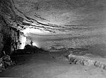
Mammoth Cave National Park (redirect from Sand Cave, Kentucky)
from I-65 at Exit 48. The parkway connects with Kentucky Route 70 from the north and Kentucky Route 255 from the south within the park. Human activity...
67 KB (7,843 words) - 21:50, 9 July 2024

southbound I-65 traffic enters Kentucky from Jeffersonville, Indiana, via the John F. Kennedy Memorial Bridge. The route is reportedly one of the heaviest...
27 KB (1,714 words) - 19:49, 8 May 2024

Carr Creek State Park (category State parks of Kentucky)
Carr Creek State Park is a park located along Kentucky Route 15 in Knott County, Kentucky, United States. The park itself encompasses 29 acres (12 ha)...
2 KB (117 words) - 10:07, 1 August 2023

County, Kentucky, United States. As of the 2020 census the city's population was 322,570, making it the second-most populous city in Kentucky (after Louisville)...
104 KB (8,610 words) - 23:55, 8 July 2024

Kentucky Route 30 (KY 30) is an east–west state highway in Kentucky managed by the Kentucky Transportation Cabinet. It goes through Laurel, Jackson, Owsley...
13 KB (440 words) - 17:48, 16 February 2024
Middle Fork Kentucky River is a river in Kentucky in the United States. It is a fork of the Kentucky River that it joins just upstream of Beattyville....
24 KB (3,317 words) - 22:42, 18 February 2024

U.S. Route 25 (US 25) runs for 176.882 miles (284.664 km) across the state of Kentucky from the split between US 25E and US 25W in North Corbin to US 42/US 127...
27 KB (424 words) - 23:20, 24 November 2023

Kentucky Route 120 (KY 120) is a 38.523-mile-long (61.997 km) state highway in Kentucky. It runs from U.S. Route 60 (US 60) and KY 91 in Marion to KY 138...
4 KB (72 words) - 17:50, 16 February 2024

U.S. Route 27 (US 27) in Kentucky runs 201.120 miles (323.671 km) from the Tennessee border to the Ohio border at Cincinnati. It crosses into the state...
29 KB (438 words) - 23:10, 8 March 2024

Kentucky Route 12 (KY 12) is a State Highway located in Shelby and Franklin counties, in the northern region of the U.S. state of Kentucky. The highway...
9 KB (791 words) - 17:51, 16 February 2024

Kentucky Route 91 (KY 91) is a 49.783-mile-long (80.118 km) state highway that traverses three counties in western Kentucky. It begins in Hopkinsville...
9 KB (326 words) - 22:43, 20 May 2024