Giovanni Contarini called the land later called America by Waldseemüller the Antipodes. Waldseemüller drew upon the 1506 world map of Nicolaus de Caverio, where...
51 KB (7,080 words) - 02:22, 6 July 2024
Early world maps (redirect from Albi Mappa Mundi)
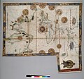
surprising detail, and was one of the primary sources used to make the Waldseemüller map in 1507. The Caverio map is currently at the Bibliothèque Nationale...
73 KB (8,659 words) - 20:51, 7 December 2024
made by Martin Waldseemüller and his colleagues at St. Dié in Lorraine in 1507. Where Schöner departs most conspicuously from Waldseemüller is in his globe's...
46 KB (5,918 words) - 23:29, 24 November 2024
retrieved 29 July 2023, translation of: Cuoghi, Diego (2003), "I Misteri Della Mappa di Piri Reis", Gli enigmi della storia, Milan: Edizioni Piemme. Deissmann...
59 KB (6,928 words) - 18:22, 26 December 2024
lacked the Americas. 1507: German cartographer Martin Waldseemüller's world map (Waldseemüller map) was the first to use the term America for the Western...
143 KB (17,613 words) - 16:17, 10 December 2024
Sinus Magnus ("Great Gulf"), the actual Gulf of Thailand. The 1507 Waldseemüller map shows Catigara in this location. Following the 1519–1521 circumnavigation...
74 KB (10,345 words) - 06:56, 10 February 2024


