Markham Street is a north–south residential street located in the city of Toronto, Ontario, Canada, one block west of Bathurst Street. Its northern end...
7 KB (832 words) - 22:08, 10 November 2024
Broadview Avenue and Gerrard Street, as well as suburban Chinatowns in Scarborough and North York. In the Greater Toronto Area, Markham, Mississauga, and Richmond...
26 KB (2,734 words) - 02:16, 10 November 2023
Markham (/ˈmɑːrkəm/) is a city in York Region, Ontario, Canada. It is approximately 30 km (19 mi) northeast of Downtown Toronto. In the 2021 Census, Markham...
90 KB (7,358 words) - 23:45, 21 October 2024
Scarborough. Beyond Toronto in Markham, Birchmount Road continues firstly as a residential street to Denison Street, then from Denison Street to Highway 407...
110 KB (10,712 words) - 00:33, 16 November 2024
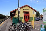
Markham GO Station is a railway station on the GO Transit Stouffville line network located on Markham Main Street North in Markham, Ontario in Canada....
6 KB (433 words) - 05:30, 15 November 2024
Ontario Highway 48 (redirect from Markham Road (Markham/Toronto))
Greater Toronto Area into farmland. A future extension of Donald Cousens Parkway will bypass former Highway 48 (Main Street) through downtown Markham in 2018...
23 KB (1,933 words) - 15:08, 8 August 2024
Steeles Avenue (redirect from Steeles Avenue (Toronto))
Steeles, York Region's proposed Markham Bypass to Morningside Avenue has been stalled. The areas around the street in Toronto and York Region consists of...
25 KB (1,852 words) - 15:24, 3 November 2024
Yonge Street (/jʌŋ/ YUNG) is a major arterial route in the Canadian province of Ontario connecting the shores of Lake Ontario in Toronto to Lake Simcoe...
67 KB (6,882 words) - 14:33, 24 October 2024
in the City of Markham east of Ontario Highway 48 / Main Street Markham/ York Regional Road 68 was incorporated into the new Markham—Stouffville riding...
16 KB (933 words) - 16:48, 6 February 2024
Municipality of York, and Markham was newly incorporated as a town when Markham Village merged with Unionville and Thornhill east of Yonge Street. An electoral system...
17 KB (839 words) - 05:42, 3 September 2024
Kennedy Road is a north-south street in Toronto and York Region, Ontario, Canada. It is one of three major streets in Scarborough, and is home to the business...
8 KB (579 words) - 04:24, 21 September 2024
Thornhill, Ontario (category Neighbourhoods in Markham, Ontario)
City of Markham, with Yonge Street forming the boundary between Vaughan and Markham. Thornhill is situated along the northern border of Toronto, centred...
31 KB (2,857 words) - 21:44, 3 November 2024
McCowan Road (category Streets in Toronto)
North of Sheppard Avenue, CP Rail's Toronto marshalling yards use McCowan as a western limit, and stretch east of Markham Road. McCowan Road runs from Kingston...
13 KB (869 words) - 12:09, 28 September 2024
consist of all communities in the area bounded by Markham and Richmond Hill in the east, Metro Toronto in the south, the periphery of the regional municipality...
57 KB (4,304 words) - 15:40, 20 November 2024
to Markham Rd., which is now the Best Road in Ontario". The Star. Toronto. Retrieved October 28, 2010. Bibliography Filey, Mike (1992). Toronto Sketches:...
74 KB (7,696 words) - 01:03, 21 November 2024
ISSN 0362-4331. Retrieved 1 March 2021. "The Zerofootprint Foundation · 392 Markham Street, Toronto, ON M6G 2K9". opengovca.com. Retrieved 1 March 2021. "Canadian...
8 KB (718 words) - 21:49, 30 September 2024
York Region Transit (redirect from Markham Transit)
Five contracted Toronto Transit Commission (TTC) bus routes run within York Region's boundaries (one in Vaughan and four in Markham). Some YRT routes...
31 KB (3,577 words) - 20:55, 29 October 2024
Billy Bishop Toronto City Airport (IATA: YTZ) on the Toronto Islands, southwest of downtown. Buttonville Municipal Airport (IATA: YKZ) in Markham provides...
257 KB (21,550 words) - 19:43, 17 November 2024
the township of Markham, north of the town of York (now Toronto), after his friend William Markham, the Archbishop of York. Markham Township was originally...
10 KB (1,210 words) - 17:33, 9 January 2024
German Mills Creek (category Rivers of Toronto)
Creek is a river in the municipalities of Markham, Richmond Hill, Toronto and Vaughan in the Greater Toronto Area of Ontario, Canada. It is part of the...
5 KB (349 words) - 05:58, 25 January 2022
Rouge River (Ontario) (redirect from Rouge River (Toronto))
The Rouge River is a river in Markham, Pickering, Richmond Hill and Toronto in the Greater Toronto Area of Ontario, Canada. The river flows from the Oak...
17 KB (1,703 words) - 13:48, 30 October 2024
Brimley Road (redirect from Brimley Road (Toronto))
Brimley Road is a north-south street in Toronto and the Regional Municipality of York, Ontario, Canada. In Toronto, it is located entirely within Scarborough...
11 KB (1,142 words) - 02:32, 26 July 2024
Victoria Park Avenue (redirect from Victoria Park Avenue (Toronto))
of the busiest north-south streets in Scarborough, along with Markham Road and Kennedy Road. It is served by the Toronto subway at Victoria Park station...
8 KB (562 words) - 08:36, 23 October 2024
course near the shore of Lake Ontario, the street is the terminus of many arterial roads in eastern Toronto, both east–west and north-south, with a few...
19 KB (1,695 words) - 08:05, 20 September 2024
Milliken, Ontario (redirect from Milliken, Markham)
Milliken and Milliken Mills are neighbourhoods in the cities of Toronto and Markham. Milliken is situated in the north west section of Scarborough, whereas...
18 KB (1,638 words) - 23:47, 8 October 2024
Unionville, Ontario (category Neighbourhoods in Markham, Ontario)
(2.5 mi) west of Markham Village (Markham's historic downtown), and 33 km (20.5 mi) northeast of Downtown Toronto, centred around the intersection of...
28 KB (2,903 words) - 23:55, 8 October 2024
Communities lining the northern reaches of the street, and those nearby across the city boundary in Markham, are constrained by the topographic and legislative...
8 KB (775 words) - 17:55, 25 July 2024
William Berczy (category People from Markham, Ontario)
a short street near Highway 7 and Ninth Line and Berczy Creek Way is a short road near 16th Avenue and Warden Avenue in Markham. In Toronto a roadway...
14 KB (1,310 words) - 14:29, 17 August 2024
Honest Ed's (category Buildings and structures in Toronto)
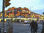
access to the store Toronto police directed the lines to go down Markham Street again, to ensure the store was taxed as a Markham Street business instead...
21 KB (2,504 words) - 20:02, 6 November 2024
synagogues in the Greater Toronto Area, a region with a large Jewish population. Most are located along Bathurst Street in Toronto, North York and Thornhill...
6 KB (602 words) - 06:59, 27 October 2024


