
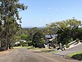
coordinates) Moggill is a suburb in the City of Brisbane, Queensland, Australia. In the 2021 census, Moggill had a population of 5,029 people. Moggill is about...
52 KB (5,010 words) - 17:39, 25 July 2024

Moggill is an electoral district in the Legislative Assembly of Queensland in the state of Queensland, Australia. The electorate is held by Dr Christian...
7 KB (261 words) - 02:07, 11 April 2023

The Moggill Ferry is a cable ferry crossing the Brisbane River between the suburbs of Moggill in Brisbane and Riverview in Ipswich, both in Queensland, Australia...
3 KB (236 words) - 09:24, 19 December 2023

Moggill Road is a major road in Brisbane, Queensland, Australia. It commences at High Street at Toowong and terminates at the Moggill Ferry in Moggill...
8 KB (321 words) - 09:43, 23 January 2024

The Moggill branch of the Queensland Country Women's Association meets at the Bellbowrie Community Church at 3077 Moggill Road. The Bellbowrie Sports...
19 KB (1,663 words) - 23:53, 12 June 2024

of the Shire of Moggill. It was unveiled on 3 July 1920 by General Spencer Browne and Edward Macartney, the Member of the Queensland Legislative Assembly...
25 KB (2,379 words) - 17:20, 25 July 2024
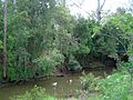
coordinates) GPX (secondary coordinates) Moggill Creek is a creek in Brisbane, the largest city in Queensland, Australia. The creek rises on the Taylor...
6 KB (500 words) - 00:09, 20 March 2024

south-west (Dinmore). The Riverview–Moggill Ferry Road (Riverview Road) runs from the Warrego Highway to Moggill Ferry Road (Moggill Sub–Arterial Road) within Riverview...
10 KB (852 words) - 08:06, 15 June 2024
Warrego Highway state-controlled roads (redirect from Riverview–Moggill Ferry Road)
state-controlled roads intersect with section 18A: Riverview–Moggill Ferry Road River Road (Queensland) Mount Crosby Road Ipswich–Warrego Highway Connection...
23 KB (1,837 words) - 00:40, 22 January 2024

Jack Woodward in about 1943. Moggill Pony Club was formed in April 1961. It is one of the oldest pony clubs in Queensland. Brisbane Independent School...
24 KB (2,311 words) - 17:57, 25 July 2024

to replace Moggill Ferry is proposed within the Moggill Pocket Arterial Road Transport Corridor. Land has been set aside by the Queensland government...
8 KB (636 words) - 16:30, 25 July 2024

The Shire of Moggill is a former local government area of Queensland, Australia, located in western Brisbane. Toowong Division was one of the original...
3 KB (341 words) - 16:28, 18 July 2024

Christian Rowan (category Members of the Queensland Legislative Assembly)
physician. He has been the Liberal National Party State Member for Moggill in the Queensland Legislative Assembly since 2015. Rowan is a specialist physician...
9 KB (594 words) - 23:36, 7 September 2024
Australia with her horse Floreno. She runs an equestrian business in Moggill, Queensland, Australia. "Alexis HELLYER". FEI.org. 1 August 2018. Retrieved 22...
2 KB (70 words) - 05:50, 25 July 2024

City of Brisbane (redirect from City of Brisbane, Queensland)
Karana Downs Kenmore Kenmore Hills Kholo Lake Manchester Middle Park Milton Moggill Mount Coot-tha Mount Crosby Mount Ommaney Oxley Pinjarra Hills Pullenvale...
45 KB (1,939 words) - 23:52, 18 July 2024
of Moggill in the Queensland state elections. 2020 State General Election – Moggill – District Summary, ECQ. 2017 State General Election - Moggill - District...
17 KB (78 words) - 20:36, 17 July 2024
Queensland Governor Matthew Nathan officially opened the Industrial School for Boys on a site between Moggill Road and Jerrang Road (now 724 Moggill Road...
29 KB (3,058 words) - 16:46, 25 July 2024

Retrieved 20 October 2018. Moggill Historical Society Inc. Web Archive, State Library of Queensland. Historical society for Moggill district including Pinjarra...
8 KB (725 words) - 23:18, 12 June 2024

January 2015. Retrieved 25 January 2015. "Queensland MP Bruce Flegg defeated in preselection battle for Moggill". ABC News. Australian Broadcasting Corporation...
108 KB (3,843 words) - 13:29, 3 September 2024
Algester Bulimba Chatsworth Greenslopes Inala Lytton Maiwar Mansfield Miller Moggill Mount Ommaney South Brisbane Stretton Toohey Buderim Caloundra Glass House...
22 KB (1,183 words) - 09:54, 30 April 2024

mostly clustered along Moggill Road. It is a popular neighbourhood among the students of the University of Queensland and the Queensland University of Technology...
26 KB (2,533 words) - 21:39, 12 June 2024
West) Les Yewdale (Rockhampton North) Norm Lee (Yeronga) Bill Lickiss (Moggill) Brian Austin (Nicklin) Bill Glasson (Gregory) Peter McKechnie (Carnarvon)...
27 KB (258 words) - 04:54, 13 September 2024
Moggill FC is an Australian football (soccer) club from Bellbowrie, a suburb of Brisbane. The club was formed in 1974, and currently competes in WFQPL3...
8 KB (485 words) - 00:38, 4 May 2024

The 2024 Queensland state election is scheduled to be held on 26 October 2024 to elect all members to the Legislative Assembly of Queensland pursuant...
75 KB (2,549 words) - 08:57, 23 September 2024
November 1922, the Queensland Governor Matthew Nathan officially opened the Industrial School for Boys on a site between Moggill Road and Jerrang Road...
47 KB (4,495 words) - 10:36, 25 September 2024

Toowong (redirect from Toowong, Queensland)
Church 20A Jephson Street: Toowong Fire Station 3 Moggill Road: St Arvans (house) 55 Moggill Road: Brisbane Boys' College Buildings Mount Coot-tha...
56 KB (6,011 words) - 12:06, 6 September 2024

Bruce Highway (redirect from A1 highway (Queensland))
The Bruce Highway is a major highway in Queensland, Australia. Commencing in the state capital, Brisbane, it passes through areas close to the eastern...
103 KB (5,373 words) - 07:55, 6 August 2024

2011 Bellbowrie and Moggill Flood Film, State Library of Queensland 27803 Brisbane flood photographs 2011, State Library of Queensland 28191 Colin Kennard...
91 KB (8,287 words) - 00:36, 1 September 2024

Brisbane (redirect from Brisbane, Queensland)
inner-south, Oxley Creek in the south, Bulimba Creek in the inner south-east and Moggill Creek in the west. The city is on a low-lying floodplain, with the risk...
206 KB (17,631 words) - 08:17, 28 September 2024

Western Freeway, Brisbane (category Highways in Queensland)
forms part of Metroad 5. There is one interchange, at Indooroopilly onto Moggill Road. A bicycle path runs the length of the freeway, allowing commuting...
7 KB (578 words) - 16:09, 14 September 2024