Mysore division, officially Mysuru division, is an administrative division in the southern Indian state of Karnataka. It is one of four administrative...
14 KB (1,085 words) - 17:58, 30 December 2024
of Mysore district and Mysore division. As the traditional seat of the Wadiyar dynasty, the city functioned as the capital of the Kingdom of Mysore for...
108 KB (9,095 words) - 17:59, 30 December 2024
Mysore Palace, also known as Amba Vilas Palace, is a historical palace and a royal residence. It is located in Mysore, Karnataka, India. It used to be...
9 KB (812 words) - 15:02, 3 December 2024
their Divisions in Indian Railways" (PDF). Indian Railways. Archived from the original (PDF) on 19 March 2015. Retrieved 13 January 2016. "Mysore Railway...
4 KB (206 words) - 08:42, 1 January 2025
administrative headquarters of Mysore division. Chamarajanagar District was carved out of the original larger Mysore District in the year 1998. The district...
40 KB (3,599 words) - 17:59, 30 December 2024
Mysore was the previous capital city in the state of Karnataka, India. It is the headquarters of the Mysore district and Mysore division and lies about...
21 KB (2,559 words) - 16:13, 29 May 2024
Mysore is one of the most important cities in Karnataka due to its tourism and proximity with the capital city of Bangalore. It is the second largest urban...
14 KB (1,278 words) - 10:54, 6 May 2023
Ettina Bhuja (category Mysore Division geography stubs)
Ettina Bhuja is a mountain peak in the Western Ghats, located in Chikmagalur district, Karnataka, about 25 km from Mudigere. It is a popular and easy trekking...
2 KB (80 words) - 09:48, 31 July 2024
There are also automatic ticket vending machines. The Mysore Railway Division and the Mysore Railway station have a reputation for cleanliness. According...
7 KB (524 words) - 15:39, 28 November 2024
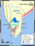
The Fourth Anglo-Mysore War was a conflict in South India between the Kingdom of Mysore against the British East India Company and the Hyderabad Deccan...
16 KB (1,593 words) - 02:22, 2 January 2025
The Kingdom of Mysore was a geopolitical realm in southern India founded in around 1399 in the vicinity of the modern-day city of Mysore and prevailed...
96 KB (11,397 words) - 00:04, 25 December 2024
Venky Mysore is the CEO of Red Chillies Entertainment and CEO and managing director of the Indian Premier League team Kolkata Knight Riders. He was instrumental...
6 KB (444 words) - 21:18, 18 March 2024
dynasty Mysore State, the name of Karnataka before 1973 Mysore division, in the southern Indian state of Karnataka Mysore district, in Mysore division for...
2 KB (368 words) - 16:55, 14 November 2023
Mullayyana Giri (category Mysore Division geography stubs)
Mullayyanagiri is the highest peak in Karnataka, India. Mullayyanagiri is located in the Chandra Dhrona Hill Ranges of the Western Ghats of Chikkamagaluru...
4 KB (320 words) - 17:37, 27 December 2024
Wadiyar dynasty (redirect from Wodeyars of Mysore)
the Wadiyars of Mysore (also spelt Wodeyer, Odeyer, and Wadeyar), is a late-medieval Indian royal family of former maharajas of Mysore from the Urs clan...
35 KB (2,282 words) - 14:01, 22 December 2024
in rail transportation of Mysore division of Karnataka state. The corridor passes through the Western Ghats and the Mysore Plateau, connecting the mainland...
7 KB (552 words) - 12:41, 5 November 2024
Brahmagiri (Karnataka) (category Mysore Division geography stubs)
Wayanad through the village of Meppadi. The nearest railway station is at Mysore and Thalassery and the nearest airports are Kozhikode International Airport-120 km...
5 KB (499 words) - 07:21, 8 September 2024
The Third Anglo-Mysore War (1790–1792) was a conflict in South India between the Kingdom of Mysore and the British East India Company, the Kingdom of Travancore...
36 KB (4,106 words) - 01:38, 2 December 2024
Gonikoppal (category Mysore Division geography stubs)
and is also the commercial hub of Kodagu district due to its proximity to Mysore District and the neighboring Kerala state. Gonikoppal is the fastest developing...
6 KB (454 words) - 09:30, 1 August 2024
Medical Equipment & Systems division. In November 2012, it was sold to Skanray Technologies Pvt Ltd. Currently, L&T Mysore division manufactures Single-phase...
36 KB (3,226 words) - 16:08, 29 December 2024
Abbey Falls (category Mysore Division geography stubs)
of Karnataka, India. It is located 8 km from the Madikeri, 122 km from Mysore, 144 km from Mangalore and 268 km from Bangalore. The waterfall is on the...
3 KB (216 words) - 10:07, 15 September 2023
Jhari Falls (category Mysore Division geography stubs)
Shivganga Unchalli Vajrapoha Lakes Harangi Hebbal Lake, Bangalore Hebbal Lake, Mysore Hesaraghatta Honnamana Kere Karanji Krishna Raja Sagara Kukkarahalli Lingambudhi...
3 KB (175 words) - 21:55, 13 July 2024
Suvarnavathi River (category Mysore Division geography stubs)
river begins at Badibadga in the Nasurghat hills of southern Karnataka's Mysore district as the convergence of two streams, the Niredurgihalla and Araikaduhalla...
6 KB (718 words) - 11:31, 1 October 2024
Gorigandi (category Mysore Division geography stubs)
Gorigandi is a village in Chikkamagaluru district, Karnataka, India. "More". The Times of India. 18 September 2008. Retrieved 11 January 2012.[dead link]...
603 bytes (26 words) - 14:22, 10 October 2024
Napoklu (category Mysore Division geography stubs)
Napoklu is a village in Madikeri taluk in Kodagu district of Karnataka, India. As per census survey of India 2011, the location code number of Napoklu...
4 KB (147 words) - 09:25, 1 September 2024
Ponnampet (category Mysore Division geography stubs)
existence". Star of Mysore. 29 November 2020. Retrieved 29 December 2020. Government of Mysore (1864). Report on the Administration of Mysore for 1863-64. p...
7 KB (460 words) - 09:34, 1 August 2024
Chelavara Falls (category Mysore Division geography stubs)
Chelvara Falls is a natural waterfall formed by small stream, a tributary of Kaveri near Cheyyandane village which is on Virajpet - Talakaveri State Highway...
1 KB (149 words) - 09:40, 22 April 2023
Samse (category Mysore Division geography stubs)
Samse is a village in the southern state of Karnataka, India. It is located in the Kalasa taluk of Chikkamagaluru district in Karnataka. As of 2001 India...
3 KB (84 words) - 21:54, 13 July 2024
Hebbe Falls (category Mysore Division geography stubs)
Shivganga Unchalli Vajrapoha Lakes Harangi Hebbal Lake, Bangalore Hebbal Lake, Mysore Hesaraghatta Honnamana Kere Karanji Krishna Raja Sagara Kukkarahalli Lingambudhi...
2 KB (166 words) - 16:56, 27 July 2024
Mysuru Local Planning Area (redirect from Mysore Urban Agglomeration)
2031 by Mysore Urban Development Authority. Mysuru Planning Area is divided into 45 planning districts spanning across the Taluks of Mysore, Nanjangud...
12 KB (900 words) - 20:22, 27 November 2022


