
New Hampshire Route 32 (NH 32) is a state highway in the U.S. state of New Hampshire. The highway runs 14.139 miles (22.755 km) from the Massachusetts...
4 KB (291 words) - 02:44, 25 March 2023

Connecticut Route 12, Connecticut Route 32, Massachusetts Route 32, U.S. Route 202, New Hampshire Route 114, New Hampshire Route 103, and New Hampshire Route 103B...
158 KB (6,445 words) - 17:10, 1 February 2024

New Hampshire Route 9 (abbreviated NH 9 and also known as the Franklin Pierce Highway) is a 109.910-mile-long (176.883 km) state highway located in southern...
24 KB (1,535 words) - 00:04, 12 May 2024

Connecticut Route 32, north to the New Hampshire state line in Royalston, where the highway continues as New Hampshire Route 32 (NH 32). Route 32 connects...
13 KB (1,006 words) - 03:32, 11 March 2023

New Hampshire Route 1A is an 18.32-mile (29.48 km) long state highway located in southeast New Hampshire. The route runs along the Atlantic coastline...
8 KB (538 words) - 23:05, 24 June 2023

New Hampshire Route 16 (NH 16) is a 154.771-mile (249.080 km), north–south state highway in New Hampshire, United States, the main road connecting the...
22 KB (1,594 words) - 01:32, 28 April 2024

New Hampshire Route 112 (abbreviated NH 112) is a 56.39-mile-long (90.75 km) east–west state highway in northern New Hampshire. The highway winds across...
13 KB (1,067 words) - 02:53, 25 March 2023

New Hampshire Route 11 is a 108.223-mile-long (174.168 km) east–west state highway in New Hampshire, running completely across the central part of the...
24 KB (1,613 words) - 16:42, 20 February 2024

New Hampshire Route 101 (NH 101) is a state-maintained highway in southern New Hampshire extending from Keene to Hampton Beach. It is the major east–west...
37 KB (3,355 words) - 13:01, 24 May 2024

New Hampshire Route 12 is a 62.773-mile (101.023 km) long north–south state highway in southwestern New Hampshire. Its southern terminus is at the Massachusetts...
18 KB (1,312 words) - 08:15, 16 April 2024

New Hampshire Route 114 (abbreviated NH 114) is a 60.433-mile-long (97.257 km) secondary north–south highway in central New Hampshire. The highway runs...
15 KB (1,397 words) - 13:50, 22 September 2023

U.S. Route 3 (US 3) is a United States Numbered Highway running 277.90 miles (447.24 km) from Cambridge, Massachusetts, through New Hampshire, to the Canada–United...
55 KB (3,184 words) - 21:33, 14 July 2024

Vermont and New Hampshire, the route is signed east–west, the conventional direction for even-numbered U.S. Routes. In the state of New York, US 4 begins...
10 KB (913 words) - 05:00, 23 June 2024

Interstate 93 (redirect from Interstate Route 93 (New Hampshire))
travels through the New Hampshire state capital of Concord. I-93 begins at an interchange with I-95, US Route 1 (US 1) and Route 128 in Canton, Massachusetts...
77 KB (5,923 words) - 21:27, 14 July 2024

U.S. Route 1 (US 1) is a north–south U.S. Route is the U.S. state of New Hampshire through Hampton and Portsmouth. It lies between Interstate 95 (I-95)...
16 KB (1,200 words) - 12:20, 29 April 2024

New Hampshire Route 10 is a 122.25-mile-long (196.74 km) north–south state highway in western New Hampshire, United States. Its southern terminus is in...
18 KB (1,257 words) - 02:38, 25 March 2023

New Hampshire Route 108 is a 42.430-mile-long (68.284 km) north–south state highway in Rockingham and Strafford counties in southeastern New Hampshire...
15 KB (873 words) - 04:58, 7 November 2023

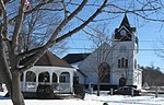
with Winchester. The town is crossed by New Hampshire Route 10, New Hampshire Route 12 and New Hampshire Route 32. Keene (north) Marlborough (northeast)...
14 KB (989 words) - 17:08, 3 May 2024

town by area in New England. U.S. Route 3 is the only major highway in the town, although the northern terminus of New Hampshire Route 145 also lies within...
20 KB (1,512 words) - 12:46, 10 June 2024

New Hampshire (/ˈhæmpʃər/ HAMP-shər) is a state in the New England region of the Northeastern United States. It borders Massachusetts to the south, Vermont...
127 KB (11,673 words) - 14:49, 13 July 2024

New Hampshire Route 132 (abbreviated NH 132) is a 40.012-mile-long (64.393 km) north–south highway in Belknap and Merrimack counties in central New Hampshire...
10 KB (698 words) - 03:07, 25 March 2023

New Hampshire Route 107 is a 69.108-mile-long (111.219 km) north–south state highway in eastern New Hampshire. It connects Laconia in the Lakes Region...
19 KB (1,335 words) - 12:26, 4 June 2024

New Hampshire Route 119 (NH 119) is a state highway in the U.S. state of New Hampshire. The highway begins in Hinsdale at the Connecticut River, across...
10 KB (748 words) - 03:23, 19 March 2023

S. Route 3 New Hampshire Route 3A New Hampshire Route 28 New Hampshire Route 28A NH 28 Bypass, known as Londonderry Turnpike. New Hampshire Route 101...
81 KB (6,679 words) - 20:16, 14 July 2024
census-designated place (CDP), and is located along the Lamprey River near New Hampshire Route 27. The town was first settled by families from Exeter as a parish...
15 KB (1,316 words) - 17:05, 3 May 2024

(/ˈplæstaʊ/, traditionally /-toʊ/) is a town in Rockingham County, New Hampshire, United States. The population was 7,830 at the 2020 census. Plaistow...
13 KB (1,163 words) - 17:04, 3 May 2024

crossed by Interstate 95, U.S. Route 1, U.S. Route 4, New Hampshire Route 1A, New Hampshire Route 16, and New Hampshire Route 33. Boston is 55 miles (89 km)...
51 KB (3,711 words) - 12:54, 13 July 2024

along New Hampshire Route 27 just west of New Hampshire Route 125. Epping was originally part of Exeter, one of the four original New Hampshire townships...
23 KB (1,744 words) - 06:23, 29 March 2024
state routes in the U.S. state of New Hampshire. All routes in the state are maintained by the New Hampshire Department of Transportation. New Hampshire route...
49 KB (75 words) - 19:33, 4 May 2024
32 (St. Louis County, Minnesota) Mississippi Highway 32 Missouri Route 32 Nebraska Highway 32 Nevada State Route 32 (former) New Hampshire Route 32 New...
7 KB (478 words) - 22:57, 4 April 2024