
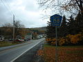
New York State Route 5A (NY 5A) is an east–west state highway located within Oneida County, New York, in the United States. It is a 5.59-mile (9.0 km)...
12 KB (1,105 words) - 20:34, 26 April 2024

and Albany was designated as New York State Route 5A. By 1926, NY 5 was moved onto the routing of NY 5A while the old routing of NY 5 became NY 7. It was...
91 KB (7,590 words) - 19:59, 26 August 2024
New York State Route 5A is an east–west state highway in Oneida County, New York, United States, that was established in the mid-1930s. New York State...
355 bytes (90 words) - 15:25, 5 April 2014
Route 5A (Monmouth County, New Jersey) New York State Route 5A County Route 5A (Allegany County, New York) County Route 5A (Columbia County, New York) County...
2 KB (157 words) - 15:52, 26 June 2024
Vermont Route 5A New York State Route 5A British Columbia Highway 5A Florida State Road 5A GCR Class 5A, a class of British 0-6-0T steam locomotive 5A (drum...
780 bytes (141 words) - 08:52, 28 April 2024

Interstate 790 (redirect from Interstate 790 (New York))
city of Utica, New York, in the United States. It runs for 2.41 miles (3.88 km) from an interchange with New York State Route 5A (NY 5A) and NY 5S in downtown...
12 KB (1,135 words) - 23:14, 27 April 2024

A reference route is an unsigned highway assigned by the New York State Department of Transportation (NYSDOT) to roads that possess a signed name (mainly...
124 KB (1,299 words) - 17:28, 25 July 2024

numbered state highways in the U.S. state of New York. Signed state highways in New York, referred to as "touring routes" by the New York State Department...
167 KB (908 words) - 11:59, 30 April 2024

New York State Route 8 (NY 8) is a 207.45-mile-long (333.86 km) north-south state highway in the central part of New York in the United States. It runs...
29 KB (2,531 words) - 06:28, 23 August 2024

New York State Route 69 (NY 69) is a state highway extending for 57.42 miles (92.41 km) across the central portion of the U.S. state of New York. The western...
17 KB (1,388 words) - 00:20, 3 October 2023

New York State Route 12 (NY 12) is a state highway extending for 222.27 miles (357.71 km) through central and northern New York in the United States....
49 KB (4,046 words) - 02:17, 18 March 2023

Hutchinson River Parkway (redirect from New York State Route 907W)
Bruckner Boulevard) in the Bronx and U.S. Route 1 (US 1) in Pelham Manor was designated as New York State Route 1X (NY 1X) from 1941 to 1946. NY 1A was...
30 KB (2,219 words) - 17:14, 25 July 2024
County routes in Allegany County, New York, are signed with the Manual on Uniform Traffic Control Devices-standard yellow-on-blue pentagon route marker...
23 KB (212 words) - 16:59, 9 February 2024
yellow-on-blue pentagon route marker. County routes in New York "County Roads Listing - Schoharie County" (PDF). New York State Department of Transportation. June...
23 KB (66 words) - 16:40, 9 February 2024

New York State Route 145 (NY 145) is a state highway in eastern New York in the United States. The highway extends for 47 miles (76 km) from NY 23 in the...
21 KB (2,131 words) - 22:26, 12 May 2024

second-longest highway in the state after New York State Route 17 (NY 17). Although most of the route is part of the tolled New York State Thruway, two non-tolled...
44 KB (2,803 words) - 19:30, 26 August 2024

The New York metropolitan area, broadly referred to as the Tri-State area and often also called Greater New York, is the largest metropolitan area in the...
292 KB (19,741 words) - 21:59, 25 August 2024

New York State Route 298 (NY 298) is an east–west state highway located entirely within Onondaga County, New York, in the United States. It runs in a...
12 KB (1,300 words) - 20:05, 26 August 2024
yellow-on-blue pentagon route marker. County routes in New York List of former state routes in New York (301–400) List of reference routes in New York NY 363 and its...
39 KB (208 words) - 20:13, 13 February 2024

New York State Route 840 (NY 840) is an east–west state highway located entirely within Oneida County, New York, in the United States. It is a 4.02-mile...
11 KB (1,069 words) - 08:39, 6 February 2023

New York State Route 318 (NY 318) is an east–west state highway in the Finger Lakes region of New York in the United States. The western terminus of the...
16 KB (1,629 words) - 14:37, 12 May 2024

New York State Route 321 (NY 321) is a 8.45-mile-long (13.60 km) state highway in Onondaga County, New York, in the United States. The southern terminus...
13 KB (1,204 words) - 00:18, 24 August 2024

of any county routes are listed below. County routes in New York List of former state routes in New York (201–300) The eastern half of CR 2 frequently...
21 KB (229 words) - 17:02, 9 February 2024

New York State Route 5S (NY 5S) is a 72.92-mile-long (117.35 km) east–west state highway located in the Mohawk Valley of New York in the United States...
30 KB (2,554 words) - 12:59, 23 August 2024

County routes in Nassau County, New York are maintained by the Nassau County Department of Public Works. Route numbers were originally posted on unique...
78 KB (536 words) - 22:04, 30 August 2024

Each route entry below contains a link to its relation in OpenStreetMap (OSM). County routes in New York List of former state routes in New York (301–400)...
41 KB (368 words) - 16:30, 9 February 2024

New York State Route 130 (NY 130) is a state highway entirely within Erie County, New York, in the United States. It runs east–west from U.S. Route 62...
9 KB (860 words) - 16:52, 14 July 2024

replaced with Vermont Route 5A. Route 3, or the New York, Hartford, Providence, and Cape Cod Route, began at the New York state line in Danbury, Connecticut...
158 KB (6,445 words) - 17:10, 1 February 2024

Metropolitan Transportation Authority (MTA) operates a number of bus routes in the Bronx, New York, United States. Many of them are the direct descendants of streetcar...
196 KB (4,358 words) - 07:50, 25 August 2024

Route 62 (US 62) is a part of the U.S. Highway System that travels from the United States–Mexico border at El Paso, Texas, to Niagara Falls, New York...
37 KB (3,468 words) - 16:55, 14 July 2024