
Panguitch (/ˈpæŋɡwɪtʃ/ PANG-gwitch) is a city in and the county seat of Garfield County, Utah, United States. The population was 1,725 at the 2020 census...
19 KB (1,529 words) - 18:30, 11 July 2024

Panguitch Lake (/ˈpæŋɡwɪtʃ/) was originally a large natural lake (777 acres) that has now been expanded by the creation of a 24-foot (7 m) dam to become...
5 KB (451 words) - 22:27, 12 April 2024
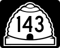
Utah State Route 143 (redirect from Brian Head-Panguitch Lake Scenic Byway)
state of Utah. The entire highway has been designated the Brian Head-Panguitch Lake Scenic Byway as part of the Utah Scenic Byways program. This road...
16 KB (1,580 words) - 00:33, 13 December 2022
Panguitch Municipal Airport (IATA: PNU, FAA LID: U55) is a public use airport located three nautical miles (6 km) northeast of the central business district...
3 KB (271 words) - 22:07, 16 December 2023

densely populated county in Utah. Its county seat and largest city is Panguitch. The Utah Territory legislature created the county on March 9, 1882, with...
16 KB (1,219 words) - 08:33, 20 May 2024

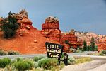
west to east for 123 miles (nearly 200 km), the highway starts south of Panguitch at an intersection with US-89, crosses part of Dixie National Forest and...
11 KB (1,015 words) - 07:24, 2 May 2024

Resting place Panguitch City Cemetery 37°48′57.96″N 112°24′56.88″W / 37.8161000°N 112.4158000°W / 37.8161000; -112.4158000 (Panguitch City Cemetery)...
17 KB (1,651 words) - 23:30, 19 June 2024

over 25 cinder cones mostly between Panguitch Lake and Navajo Lake although older volcanics occur south of Panguitch. Some cones such as Hancock Peak, Henrie...
24 KB (2,108 words) - 18:17, 17 November 2023

The Panguitch Historic District is a historic district that comprises the center of Panguitch, Utah, United States, that is listed on the National Register...
4 KB (403 words) - 02:04, 8 August 2023

825 Huntington 0.30% 4,462 sq mi (11,560 km2) 5.4% Garfield Panguitch 1882 5,051 Panguitch 0.15% 5,175 sq mi (13,400 km2) 6.3% Grand Moab 1890 9,669 Moab...
204 KB (17,893 words) - 07:33, 10 July 2024
Dam, Otter Creek Reservoir, Otter Creek Reservoir Co. Panguitch Dam, Panguitch Lake, West Panguitch Irrigation & Reservoir Co. Pineview Dam, Pineview Reservoir...
4 KB (404 words) - 16:48, 27 March 2024

Whittni Morgan (category People from Panguitch, Utah)
October 22, 1997) is an American middle distance runner. Originally from Panguitch, Utah, Morgan represents Adidas and debuted at the 2022 Millrose Games...
4 KB (199 words) - 17:14, 8 July 2024

School in Hildale, UT, opened in May 2022. Panguitch Center, located at Panguitch High School in Panguitch, UT, opened in September 2022. The Utah State...
58 KB (5,748 words) - 00:43, 10 May 2024

Daughters Utah Pioneers, pp 293–294. Printed by Garfield County News, Panguitch Utah. Lynn Arave, "St. George likely named after an LDS apostle", Deseret...
59 KB (5,378 words) - 16:11, 12 July 2024

Kanab, Loa, Logan, Manila, Manti, Moab, Monticello, Nephi, Park City, Panguitch, Parowan, Price, Randolph, Richfield, St. George, Tooele, Washington,...
4 KB (329 words) - 21:28, 20 August 2023

since the group had found wild potatoes growing there. Settlers from Panguitch first visited the area in the 1870s, where they met members of the John...
22 KB (1,701 words) - 18:34, 21 April 2024
Pine Valley, in St. George, with Pine Valley Heritage Center Powell, in Panguitch, with Red Canyon Visitor Center There are four officially designated wilderness...
8 KB (674 words) - 00:53, 23 April 2024

paintbrush, subalpine larkspur, pretty shooting star, orange sneezeweed, Panguitch buckwheat, prairie smoke, silvery lupin, yellow evening primrose, shrubby...
13 KB (1,100 words) - 16:30, 3 April 2024

(Tsouwaraits, Matisabits): Named for Panaca, Nevada Panguitch (Pakiucimi): "Fish people", named for Panguitch, Utah San Juan band (Kwaiantikowkets): "People...
31 KB (3,293 words) - 15:58, 3 June 2024
references) Hildale, UT 66.9% Colorado City, AZ 52.7% Milbridge, ME 41.1% Panguitch, UT 40.0% Beaver, UT 39.8% Enterprise, UT 39.4% East Machias, ME 39.1%...
85 KB (5,803 words) - 04:37, 1 July 2024
667 ft (2,032 m) 1,271 New Mexico Des Moines 6,647 ft (2,026 m) 122 Utah Panguitch 6,624 ft (2,019 m) 1,682 Arizona Tusayan 6,612 ft (2,015 m) 558 Colorado...
75 KB (170 words) - 15:32, 22 June 2024

Hildale Utah 66.9 2 Colorado City Arizona 52.7 3 Milbridge Maine 41.1 4 Panguitch Utah 40 5 Beaver Utah 39.8 6 Enterprise Utah 39.4 7 East Machias Maine...
155 KB (12,372 words) - 10:01, 7 July 2024
Montezuma Creek–Aneth: K17IH-D Rural Sevier County: K17MU-D Torrey: K17MZ-D Panguitch: K17NA-D Henrieville: K17NB-D Koosharem: K17ND-D Columbia, etc.: K17NP-D...
14 KB (1,141 words) - 20:20, 9 March 2024
(13,499.5 km2) 5,139.57 sq mi (13,311.4 km2) 57 Garfield County Utah Panguitch 5,208.2 sq mi (13,489 km2) 5,174.22 sq mi (13,401.2 km2) 58 Douglas County...
24 KB (333 words) - 23:50, 6 June 2024

SR-20 was first used by non-Native Americans in 1864, by the settlers of Panguitch. It crosses the Tushar Mountains just south of the Old Spanish Trail's...
5 KB (440 words) - 01:22, 27 August 2023

Arizona Kaiparowits, southwestern Utah Moapa, southern Nevada Panaca Panguitch, Utah Paranigets, southern Nevada Shivwits, southwestern Utah Eastern...
14 KB (1,373 words) - 08:06, 1 May 2024
Valley Junction, Panguitch, Utah" (Map). Google Maps. Google. Retrieved June 3, 2013. Note: The search for "Bear Valley Junction, Panguitch, Utah" results...
74 KB (3,597 words) - 23:09, 19 January 2024

Garfield County and Kane County, Utah, United States Nearest city Tropic, Panguitch Coordinates 37°35′N 112°11′W / 37.583°N 112.183°W / 37.583; -112.183...
36 KB (3,389 words) - 04:12, 14 June 2024
(Fillmore Community Medical Center) Garfield Memorial Hospital & Clinics Panguitch Utah 41 41 37°49′28.7″N 112°25′40.5″W / 37.824639°N 112.427917°W /...
23 KB (1,208 words) - 12:36, 19 February 2024
Park Bench 1998 Les Misérables Nursing Nun 1999 Jonathan Creek Audrey Panguitch Series 3 episode 2: The Eyes of Tiresias 2003 Love Actually Harris Street...
7 KB (390 words) - 13:54, 8 July 2024