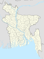
Phulpur may refer to: Phulpur Upazila, upazila in Mymensingh district, Bangladesh Phulpur, Mymensingh, town in Mymensingh Division, Bangladesh Phulpur...
416 bytes (82 words) - 17:27, 4 July 2023
Phulpur (Bengali: ফুলপুর) is an upazila of Mymensingh District in the Division of Mymensingh, Bangladesh. In 2011, Phulpur had a population of 601,766...
8 KB (495 words) - 15:25, 23 October 2024
Phulpur (Bengali: ফুলপুর) is a town and municipality in Mymensingh District in the division of Mymensingh, Bangladesh. It is the administrative headquarters...
3 KB (38 words) - 03:04, 6 November 2024
Bangladesh. According to the Bangladesh Bureau of Statistics and the Ministry of Local Government, Rural Development and Co-operatives of Bangladesh,...
20 KB (1,010 words) - 13:25, 23 December 2024
The road network of Bangladesh consists of national highways (designated by a number preceded by "N"), regional highways (R numbers) and zilla or district...
90 KB (225 words) - 12:54, 27 December 2024
upazila. Prior to this, Tarakanda was a part of Phulpur Upazila. According to the 2011 Census of Bangladesh, Tarakanda Upazila had 65,838 households and...
7 KB (424 words) - 15:26, 23 October 2024
Upazila (redirect from Subdistricts of Bangladesh)
['upɘdʒeːlaː]), formerly called thana, is an administrative division in Bangladesh, functioning as a sub-unit of a district. It can be seen as an analogous...
31 KB (757 words) - 20:01, 26 November 2024
List of constituencies of the Jatiya Sangsad (redirect from List of Parliamentary constituencies in Bangladesh)
national legislature of Bangladesh. Each constituency is represented by a single Member of Parliament. The Jatiya Sangsad of Bangladesh consists of 350 seats...
28 KB (246 words) - 14:54, 2 January 2025
bodies of the cities and towns in Bangladesh. There are 330 such municipal corporations in eight divisions of Bangladesh. A municipal corporation serving...
67 KB (1,565 words) - 23:15, 24 November 2024
হালুয়াঘাট) is an upazila of Mymensingh District in the Division of Mymensingh, Bangladesh. Haluaghat is located at 25°07′30″N 90°21′00″E / 25.1250°N 90.3500°E...
7 KB (434 words) - 15:21, 23 October 2024
Ishwarganj Upazila (redirect from Ishwarganj, Bangladesh)
Ishwarganj (Bengali: ঈশ্বরগঞ্জ) is an administrative area in north-eastern Bangladesh. It is an upazila in Mymensingh District. Bhulsoma Mosque was established...
10 KB (838 words) - 17:41, 7 December 2024
Bazlur Rahman (journalist) (category 20th-century Bangladeshi journalists)
2012 posthumously. Rahman was born on 3 August 1941 in Charniamatpur, Phulpur Upazila, Mymensingh District, East Bengal, British Raj. He graduated from...
5 KB (445 words) - 20:42, 10 November 2024
joined Indian National Congress and contested 2014 Loksabha election from Phulpur in Uttar Pradesh, and lost to Keshav Prasad Maurya of the BJP. After his...
15 KB (1,380 words) - 15:09, 3 January 2025
is an upazila of the Netrokona District in the Mymensingh Division of Bangladesh. Durgapur is located at 25°07′30″N 90°41′15″E / 25.1250°N 90.6875°E...
10 KB (818 words) - 15:27, 23 October 2024
কেন্দুয়া) is an upazila of Netrokona District in the Division of Mymensingh, Bangladesh. Kendua is located at 24°39′00″N 90°50′30″E / 24.6500°N 90.8417°E /...
8 KB (498 words) - 15:28, 23 October 2024
Karamakhanda, is an upazila of Netrokona District in the Division of Mymensingh, Bangladesh. Kalmakanda is located at 25°05′00″N 90°53′30″E / 25.0833°N 90.8917°E...
9 KB (617 words) - 23:38, 12 November 2024
নান্দাইল) is an upazila of Mymensingh District in the division of Mymensingh, Bangladesh, and roughly 46 kilometers from Mymensingh City. During the rule of Alauddin...
10 KB (894 words) - 07:54, 26 December 2024
is an upazila of Mymensingh District. in the Division of Mymensingh, Bangladesh. It is known for sweets which are made here, called "Monda". It is also...
11 KB (848 words) - 22:06, 13 December 2024
upazila of the Jamalpur District, located in the Mymensingh Division of Bangladesh. Islampur is located at 25°05′00″N 89°47′30″E / 25.0833°N 89.7917°E...
11 KB (1,084 words) - 16:23, 8 December 2024
Mymensingh-2 (category Parliamentary constituencies in Bangladesh)
Sangsad (National Parliament) of Bangladesh since 2014 by Sharif Ahmed of the Awami League. The constituency encompasses Phulpur Upazila and Tarakanda Upazila...
16 KB (401 words) - 16:47, 10 October 2024
সরিষাবাড়ী) is an upazila of Jamalpur District in the Division of Mymensingh, Bangladesh. Sarishabari is located at 24°44′30″N 89°50′00″E / 24.7417°N 89.8333°E...
7 KB (436 words) - 11:49, 28 October 2024
শ্রীবরদী) is an upazila of Sherpur District in the Division of Mymensingh, Bangladesh. Sreebardi is located at 25°09′00″N 89°54′10″E / 25.1500°N 89.9028°E...
7 KB (467 words) - 15:19, 23 October 2024
নকলা) is an upazila of Sherpur District in the Division of Mymensingh, Bangladesh. Nakla is located at 24°59′00″N 90°11′00″E / 24.9833°N 90.1833°E /...
6 KB (449 words) - 15:20, 23 October 2024
বকশীগঞ্জ) is an upazila of Jamalpur District in the Division of Mymensingh, Bangladesh. Bakshigonj Thana was converted into an upazila in 1983. The area of the...
7 KB (492 words) - 15:16, 23 October 2024
খালিয়াজুড়ি) is an upazila (sub-district) of the Netrokona District in Bangladesh, part of the Mymensingh Division. Until the middle of the fourteenth century...
9 KB (692 words) - 15:27, 23 October 2024
গফরগাঁও) is an upazila of Mymensingh District in the Division of Mymensingh, Bangladesh. Gafargaon is located at 24°25′00″N 90°33′00″E / 24.4167°N 90.5500°E...
14 KB (1,241 words) - 22:51, 7 November 2024
division of Bangladesh. It is one of the 10 upazilas of Netrakona district. Mohanganj is largely known as the capital of Lower Bangladesh as it is the...
9 KB (688 words) - 15:28, 23 October 2024
an upazila located in the Mymensingh District of Bangladesh. According to the 2011 Census of Bangladesh, Gouripur Upazila had 72,047 households and a population...
7 KB (389 words) - 15:22, 23 October 2024
Sherpur District in the Division of Mymensingh, Bangladesh. According to the 2011 Census of Bangladesh, Sherpur Sadar Upazila had 122,280 households and...
8 KB (559 words) - 04:38, 29 November 2024
smallest upazila of Netrokona District, in the Division of Mymensingh, Bangladesh. When the Baro-Bhuiyans were in power in Bengal, Atpara was a part of...
9 KB (689 words) - 15:26, 23 October 2024


