
The Municipal District of Ranchland No. 66 is a municipal district (MD) in southwest Alberta, Canada. Containing no urban communities of any kind, its...
11 KB (637 words) - 17:45, 23 June 2024

the adjacent ID No. 6 was carved up with portions going to the MD of Pincher Creek No. 9 on December 31, 1994, the MD of Ranchland No. 66 on January 1,...
24 KB (1,581 words) - 11:21, 27 April 2024

and then crosses it before entering the Municipal District of Ranchland No. 66, there are no significant communities in this area. The highway winds to the...
27 KB (1,950 words) - 05:34, 27 August 2024

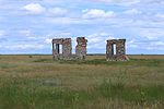
Lille, Alberta (category Municipal District of Ranchland No. 66)
buildings and equipment were dismantled and moved elsewhere. By 1916, Lille was no longer populated. The village was dissolved in 1919. Although Lille was declared...
10 KB (854 words) - 23:25, 21 August 2024

Creek No. 9, M.D. of Ranchland No. 66, M.D. of Starland County Taber, M.D. of Vulcan County Warner No. 5, County of Wheatland County Willow Creek No. 26...
9 KB (531 words) - 06:00, 6 July 2024

Chain Lakes Reservoir (category Municipal District of Ranchland No. 66)
Lakes Reservoir Chain Lakes Reservoir Location Municipal District of Ranchland No. 66, Alberta Coordinates 50°14′47″N 114°12′34″W / 50.24639°N 114.20944°W...
2 KB (11 words) - 08:22, 2 October 2020

List of municipal districts in Alberta (redirect from Shepard No. 220, Alberta)
populated municipal districts are Rocky View County and the MD of Ranchland No. 66 with populations of 36,461 and 79 respectively. 437 elected officials...
70 KB (1,217 words) - 02:52, 7 August 2024

District (MD) of Ranchland No. 66 with 41,028 and 110 respectively, while its largest and smallest by land area are the MD of Greenview No. 16 and the MD...
122 KB (3,541 words) - 05:16, 1 September 2024

Highway 940; the 900 series in Alberta is used for temporary names. There is no signed connection between the Kananaskis Trail section and the Forestry Trunk...
15 KB (472 words) - 00:07, 3 September 2024
List of coulees in Alberta (category County of Warner No. 5)
Ranchland No. 66 49°59′50″N 114°02′45″W / 49.99722°N 114.04583°W / 49.99722; -114.04583 (Dry Coulee) IABPG Dunbar Coulee Patricia Special Area No...
28 KB (24 words) - 06:51, 5 May 2024

Chain Lakes Provincial Park (category Municipal District of Ranchland No. 66)
Chain Lakes Provincial Park in Alberta Location Municipal District of Ranchland No. 66, Alberta Canada Nearest city Nanton Coordinates 50°12′24″N 114°11′47″W...
2 KB (173 words) - 01:23, 7 November 2022

Foothills No. 31, Municipal District of Willow Creek No. 26, Municipal District of Pincher Creek No. 9, Municipal District of Ranchland No. 66, Vulcan County...
22 KB (577 words) - 20:39, 12 June 2024
Pincher Creek No. 9 2017-01-20 49°25′53″N 114°23′36″W / 49.4314°N 114.3933°W / 49.4314; -114.3933 Chain Lakes Provincial Park Ranchland No. 66 1969-12-23...
45 KB (1,946 words) - 22:09, 11 June 2024

Ranchland No. 66, M.D. of Improvement districts Improvement District No. 8 Improvement District No. 9 (Banff National Park) Improvement District No....
5 KB (322 words) - 13:18, 24 January 2024
Statistics. 1961. Morgan, O. 1948. Bighorn and Saunders. Western Miner, vol. 21, no. 8, p. 96. Ninth Census of Canada, 1951 (PDF). Vol. SP-7 (Population: Unincorporated...
26 KB (626 words) - 02:44, 3 May 2024

734, while the northernmost segment between Highway 40 and Highway 43 is no longer named Forestry Trunk Road. Two segments of Forestry Trunk Road remain...
12 KB (544 words) - 06:18, 27 August 2024

View County; and the municipal districts of Bighorn No. 8, Pincher Creek No. 9 and Foothills No. 31, had declared states of emergency on June 20 due...
64 KB (5,555 words) - 17:31, 12 September 2024

least-populated county in the United States Municipal District of Ranchland No. 66 - the least-populated rural municipality in neighbouring Alberta, with...
15 KB (1,039 words) - 00:52, 6 December 2023
Indian Reserve #176, Gregoire Lake Indian Reserve #176A, Improvement District No. 24 (Wood Buffalo), Janvier Indian Reserve #194, Kananaskis Improvement District...
108 KB (2,911 words) - 03:49, 24 December 2023

that area. As a result of Section 79 being repealed, summer villages can no longer be formed in Alberta. Essentially, summer villages were once formed...
26 KB (8,135 words) - 16:26, 26 January 2024

conducted by the Town of Swan Hills and the Municipal District of Greenview No. 16. Some municipalities achieved population milestones as a result of their...
42 KB (1,206 words) - 16:54, 28 June 2023

Bonnyville No. 87 Yes Improvement District No. 40 Municipal District of Pincher Creek No. 9 Yes Improvement District No. 6 Municipal District of Ranchland No. 66...
290 KB (379 words) - 02:10, 6 July 2023

in the valley, a location with more space. Laemmle leased Providencia ranchland in the San Fernando Valley in 1912. If it was a city, it was a haphazard...
22 KB (2,136 words) - 13:29, 15 August 2024

Upland, California (section Historic Route 66)
that present-day Upland occupies was little more than an uninhabited ranchland and a place to pass through until the arrival of George Chaffey in 1882...
58 KB (6,196 words) - 16:17, 2 September 2024
decades. Late in life, Singleton became one of the largest holders of ranchland in the United States. Henry Singleton was raised on a small ranch near...
29 KB (3,868 words) - 18:18, 12 August 2024

corn, beets, cabbage and a variety of other green vegetables. Farm and ranchland acreage increased from 75 in 1939 to 518 in 1946. Waimea saw many soldiers...
16 KB (1,411 words) - 16:04, 20 July 2024

Township is also home to Pine Ridge, Pocono Mountain Lake Estates, Pocono Ranchlands and Saw Creek, four private communities. These private communities provide...
10 KB (533 words) - 21:15, 11 May 2024

North Fork is finally allowed to flow freely across sparsely populated ranchland as the canyon continues to deepen and widen. Where the North Fork crosses...
6 KB (529 words) - 19:02, 14 July 2024

Trans-Pecos (category Pages using infobox settlement with no coordinates)
the vast majority of the Trans-Pecos region consists of privately owned ranchland. However, most of the region's population reside in the El Paso metropolitan...
17 KB (1,158 words) - 23:30, 29 January 2024

University of Arizona as a land-grant college on what was overgrazed ranchland between Tucson and Fort Lowell. In 1890, Asians made up 4.2% of the city's...
170 KB (17,346 words) - 04:01, 6 September 2024