
Route 123 is a state highway running 7.8 miles (12.6 km) in the U.S. state of Rhode Island. Its western terminus is at Route 116 in Lincoln, and its eastern...
6 KB (400 words) - 23:12, 30 April 2023
city and town in Rhode Island, except for New Shoreham (Block Island), has at least one numbered route. State highways in Rhode Island are signed with...
34 KB (179 words) - 17:27, 14 August 2024
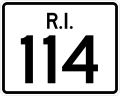
Route 114 is a 45.7-mile-long (73.5 km) numbered state highway in the U.S. state of Rhode Island. It connects the city of Newport to the city of Woonsocket...
22 KB (1,495 words) - 07:09, 10 February 2024

Route 146 is a 16.24-mile (26.14 km) north-south state highway in the U.S. state of Rhode Island, maintained by the Rhode Island Department of Transportation...
16 KB (1,061 words) - 03:37, 12 August 2024

Route 126 is a 14.3-mile-long (23.0 km) state highway in the U.S. state of Rhode Island. Route 126 is a heavily traveled route in Pawtucket. Its southern...
8 KB (553 words) - 01:30, 14 August 2023

Route 103A Route 104 Route 107 Route 108 Route 114 Route 114A Route 115 Route 116 Route 117 Route 120 Route 121 Route 122 Route 123 Route 126 Route 128...
23 KB (1,797 words) - 15:10, 26 April 2024

Route 122 is a numbered state highway running 14.2 miles (22.9 km) in Rhode Island, United States. Its southern terminus is at U.S. Route 1 (US 1) in...
6 KB (229 words) - 01:18, 6 March 2023

Route 152 is a state highway in the U.S. states of Rhode Island and Massachusetts. The highway begins at U.S. Route 1A (US 1A) and Route 114 in East Providence...
9 KB (706 words) - 19:04, 14 September 2024

Route 246 is a numbered state highway running 8 miles (13 km) in the U.S. state of Rhode Island. The Old Louisquisset Pike portion of the road was laid...
6 KB (413 words) - 01:27, 11 March 2023

County, Rhode Island, United States. The population was 31,931 at the 2020 census. South Kingstown is the second largest town in Rhode Island by total...
27 KB (2,224 words) - 20:31, 28 July 2024
Westerly is a town on the southwestern coastline of Washington County, Rhode Island, United States, first settled by English colonists in 1661, and incorporated...
26 KB (2,262 words) - 14:41, 20 September 2024

across the states of Connecticut, Rhode Island, and Massachusetts. Route 199 was also incorporated into the new route, connecting with the New York state...
56 KB (4,055 words) - 11:36, 20 September 2024

highways along the way. Route 123 is a continuation of R.I. Route 123, which crosses the state line between Cumberland, Rhode Island and Attleboro. In the...
11 KB (640 words) - 12:07, 3 July 2024
123 (former) Prince Edward Island Route 123 Saskatchewan Highway 123 National Route 123 4–123 (part of Circuito Norte) 5–123 (part of Circuito Norte) Las...
5 KB (353 words) - 13:28, 21 September 2024

of Rhode Island and Massachusetts; its largest city is Providence, Rhode Island. With an estimated population of 1,622,520, exceeding that of Rhode Island...
18 KB (1,083 words) - 03:25, 20 August 2024
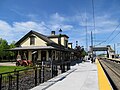
Corridor in the village of West Kingston, in the town of South Kingstown, Rhode Island. It was built at this location in 1875 by the New York, Providence and...
18 KB (1,766 words) - 15:39, 9 August 2024

census-designated place (CDP) in the town of Smithfield in Providence County, Rhode Island, United States. The population was 8,658 at the 2010 census. The CDP...
18 KB (1,507 words) - 04:46, 10 July 2024

an extension of Rhode Island Route 138, which is itself an extension of Connecticut Route 138. Route 138's northern terminus is at Route 28 in Milton. Running...
9 KB (457 words) - 15:27, 22 August 2024

New England road marking system (redirect from New England Interstate Route 17)
Rhode Island. Route 1 immediately intersected the southern end of Route 1A on entering Rhode Island. Route 1A followed a shorter, more inland route between...
158 KB (6,445 words) - 17:10, 1 February 2024

Tiverton, Rhode Island where it connects with Rhode Island Route 24, and runs north to an interchange with I-93/U.S. Route 1 (US 1) in Randolph. Route 24 is...
15 KB (1,050 words) - 16:08, 25 July 2024

Moshassuck River (category Rivers of Providence County, Rhode Island)
(RI 246) Rhode Island State Route 146 Wilbur Road (same crossing as RI 146) Sherman Avenue Breakneck Hill Road (RI 123) Great Road (RI 123) (Twice) Manchester...
7 KB (696 words) - 12:59, 4 July 2024

Greater Boston (redirect from Boston-Worcester-Manchester, Massachusetts-Rhode Island-New Hampshire CSA)
Route 58 Route 60 Route 62 Route 97 Route 106 Route 109 Route 110 Route 113 Route 114 Route 115 Route 117 Route 122 Route 123 Route 125 Route 126 Route 128...
73 KB (3,388 words) - 12:05, 26 September 2024

Boston Post Road (category Historic trails and roads in Rhode Island)
alignments were the Lower Post Road (now U.S. Route 1 (US 1) along the shore via Providence, Rhode Island), the Upper Post Road (now US 5 and US 20 from...
33 KB (3,745 words) - 19:12, 16 August 2024

S. Route 6 (US 6) within the state of Connecticut runs for 116.33 miles (187.21 km) from the New York state line near Danbury to the Rhode Island state...
28 KB (1,461 words) - 11:57, 22 July 2024

Route 1A Route 18 Route 24 Route 79 Route 81 Route 88 Route 104 Route 105 Route 106 Route 118 Route 120 Route 123 Route 136 Route 138 Route 140 Route 152...
41 KB (2,771 words) - 17:27, 15 September 2024

at this point, however, follows 7th Street to Rhode Island Avenue. The route maintains a northerly routing as it passes through northern Washington DC and...
23 KB (2,188 words) - 19:41, 4 September 2024

Blackstone River (category Rivers of Providence County, Rhode Island)
and Rhode Island. It is 48 mi (77 km) long with a drainage area of 475 mi2 (1229 km2). It drains into the Pawtucket River at Pawtucket, Rhode Island. Its...
20 KB (1,599 words) - 14:24, 28 August 2024

portion of Route 1A appeared between Attleboro and the Rhode Island state line. In 1934, two changes were made to the route. In Revere, the route was realigned...
17 KB (1,092 words) - 01:34, 2 July 2023

Nelson W. Aldrich (category Republican Party members of the Rhode Island House of Representatives)
the Republican Party in the United States Senate, where he represented Rhode Island from 1881 to 1911. By the 1890s, he was one of the "Big Four" key Republicans...
24 KB (2,460 words) - 22:49, 14 August 2024
List of highways numbered 403 (redirect from Route 403)
Route 403 Puerto Rico Highway 403 Rhode Island Route 403 South Carolina Highway 403 Virginia State Route 403 Washington State Route 403 This article includes...
2 KB (136 words) - 22:25, 4 April 2024