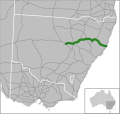
Riverina Highway is a 220-kilometre (140 mi)-long state highway located in the Riverina region of New South Wales, Australia. The road was constructed...
13 KB (946 words) - 09:31, 26 August 2024
The Riverina (/ˌrɪvəˈriːnə/) is an agricultural region of southwestern New South Wales, Australia. The Riverina is distinguished from other Australian...
84 KB (8,259 words) - 20:00, 23 November 2024
Cobb Highway is a state highway in the western Riverina and the far western regions of New South Wales, with a short section in Victoria, Australia, designated...
18 KB (1,551 words) - 00:29, 9 September 2024
the Newell Highway – between 26 per cent and 52 per cent of all traffic, depending on the point along the highway. At one point in the Riverina region of...
30 KB (2,352 words) - 23:07, 7 November 2024
(B94), Snowy Mountains Highway (B72), Sturt Highway (A20), Olympic Highway (A41), Riverina Highway (B58), Murray Valley Highway (B400), Great Alpine Road...
94 KB (10,496 words) - 03:20, 29 October 2024
(the first part of the Riverina Highway east from Albury as far as what is now Old Sydney Road was until then the Hume Highway). On the southern side...
12 KB (1,107 words) - 14:15, 29 August 2024
Olympic Highway is a 317-kilometre (197 mi) rural road in the central western and south-eastern Riverina regions of New South Wales, Australia. It services...
19 KB (1,510 words) - 14:30, 22 June 2024
Kings Highway is an interstate highway located within the Australian Capital Territory and New South Wales, Australia. The highway connects Canberra with...
19 KB (1,680 words) - 05:47, 12 September 2024
Berrigan, New South Wales (category Towns in the Riverina)
Berrigan /ˈbɛriɡən/ is a town on the Riverina Highway in the Riverina region of New South Wales, Australia. Berrigan is in the Berrigan Shire local government...
11 KB (844 words) - 01:08, 25 August 2024
The present highway network in New South Wales, Australia was established in August 1928 when the Main Roads Board (the predecessor of the Department...
9 KB (366 words) - 05:39, 12 August 2024
grassland near the Murrumbidgee River Riverina Highway, in Riverina, NSW, AUS Anglican Diocese of Riverina Riverina Football Netball League, a competition...
948 bytes (171 words) - 14:15, 6 March 2021
The following highways are numbered 58: European route E58 Riverina Highway Alberta Highway 58 Highway 58 (Ontario) Saskatchewan Highway 58 Finnish national...
6 KB (385 words) - 16:08, 27 August 2024
Sturt Highway is an Australian national highway in New South Wales, Victoria, and South Australia. It is an important road link for the transport of passengers...
38 KB (3,120 words) - 06:39, 13 August 2024
Mid-Western Highway, sometimes Mid Western Highway, is a 518-kilometre (322 mi) state highway located in the central western and northern Riverina regions...
17 KB (1,361 words) - 06:40, 13 August 2024
Finley, New South Wales (category Towns in the Riverina)
kilometres (87 mi) west of Albury on the intersection of the Newell Highway and Riverina Highways. Europeans first settled the area around Finley in the early...
7 KB (678 words) - 13:04, 22 September 2024
Kamilaroi Highway is a 605-kilometre (376 mi) state highway located in the north-western region of New South Wales, Australia, and links Bourke via Walgett...
17 KB (1,407 words) - 06:37, 13 August 2024
30 km deviation of the Hume Highway. The Highway originally ran east out of Albury, along what is now the Riverina Highway, then turned north through Thurgoona...
78 KB (8,580 words) - 06:00, 16 November 2024
Murray Valley Highway is a 663-kilometre (412 mi) rural highway located in Victoria (with a short western tail in New South Wales), Australia, between...
32 KB (1,957 words) - 06:14, 13 August 2024
Illawarra Highway is a short state highway in New South Wales, Australia. It connects Wollongong to the Southern Highlands and links Princes Highway and Hume...
11 KB (834 words) - 00:34, 9 September 2024
Oxley Highway is a rural highway in New South Wales, Australia, linking Nevertire, Gilgandra, Coonabarabran, Tamworth, and Walcha to Port Macquarie, on...
16 KB (1,281 words) - 06:02, 13 August 2024
Barrier Highway is a highway in South Australia and New South Wales, and is designated part of route A32. The name of the highway is derived from the...
13 KB (695 words) - 06:00, 13 August 2024
Monaro Highway is a 285-kilometre-long (177 mi) highway in Victoria, New South Wales, and the Australian Capital Territory, in Australia, linking Cann...
49 KB (4,378 words) - 18:30, 23 November 2024
Barton Highway is a highway in New South Wales and the Australian Capital Territory. It connects Canberra to Hume Highway at Yass, and it is part of the...
18 KB (1,472 words) - 06:44, 13 August 2024
The Division of Riverina (/rɪvəˈriːnə/) is an Australian electoral division in the state of New South Wales. It includes the city of Wagga Wagga. Since...
16 KB (460 words) - 00:56, 23 October 2024
Gwydir Highway is a 568-kilometre (353 mi) state highway in northern New South Wales, Australia. The highway was named after the Gwydir River, which in...
14 KB (913 words) - 09:46, 20 October 2024
Silver City Highway is a 683-kilometre-long (424 mi) highway that links Buronga, New South Wales to the Queensland border via Wentworth, Broken Hill, and...
24 KB (2,158 words) - 01:11, 9 September 2024
The Federal Highway is a highway in New South Wales and the Australian Capital Territory. It is a part of a motorway-standard link between Sydney and Canberra...
17 KB (1,156 words) - 00:40, 9 September 2024
Castlereagh Highway is a 790-kilometre (490 mi) state highway located in New South Wales and Queensland, Australia. From north to south the highway traverses...
21 KB (1,602 words) - 06:36, 13 August 2024
In New South Wales, Highway 1 is a 1,351-kilometre (839 mi) long route that crosses the state, from the Queensland/New South Wales border near Tweed Heads...
11 KB (667 words) - 10:04, 22 August 2023
New England Highway is an 883-kilometre (549 mi) long highway in Australia running from Yarraman, north of Toowoomba, Queensland, at its northern end...
41 KB (2,871 words) - 23:58, 1 November 2024


