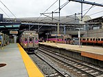
Roxbury Crossing station is a rapid transit station in Boston, Massachusetts. It serves the MBTA Orange Line, and is located on Tremont Street in the...
9 KB (935 words) - 00:56, 22 June 2024
Roxbury (/ˈrɒksbəri/) is a neighborhood within the City of Boston, Massachusetts, United States. Roxbury is a dissolved municipality and one of 23 official...
92 KB (10,209 words) - 06:47, 8 August 2024
MBTA crosstown bus routes (section Station listing)
station, Andrew station, and D Street. The November 2022 revised plan rerouted the replacement route via Brookline Avenue, Roxbury Crossing station,...
11 KB (756 words) - 20:05, 26 September 2024
Bay Transportation Authority (MBTA) bus station located in Nubian Square (formerly Dudley Square) in the Roxbury neighborhood of Boston, Massachusetts,...
13 KB (1,250 words) - 17:49, 27 October 2024
Mission Hill, Boston (category Roxbury, Boston)
Huntington Avenue. It is served by several stations on the MBTA's Green Line E branch, as well as Roxbury Crossing station on the Orange Line. Mission Hill is...
54 KB (6,613 words) - 23:26, 7 August 2024
in 1899 during the construction of South Station, and in Pawtucket and Central Falls in 1916 for grade crossing elimination. The line became part of the...
28 KB (2,300 words) - 15:54, 30 March 2024
(Bellevue), and West Roxbury all opened with the branch. A new brick station building was constructed in 1876. A grade crossing elimination project in...
5 KB (374 words) - 06:08, 15 March 2024
through West Roxbury (now part of Boston) in 1834. Monterey station was open by 1849.: 154 It was renamed Mount Hope around 1857. A small station building...
10 KB (1,007 words) - 02:17, 1 July 2024
Roxbury Egleston Square Fort Hill Franklin Park (extends into Jamaica Plain and Dorchester) Nubian Square (formerly Dudley Square) Roxbury Crossing South...
19 KB (1,622 words) - 01:15, 16 July 2024
the Roxbury, Fenway–Kenmore, and Mission Hill neighborhoods meet. It is surrounded by the campus of Northeastern University. Ruggles is a station stop...
27 KB (2,479 words) - 01:57, 2 November 2024
the existing stations at Roxbury Crossing, Jamaica Plain, and Forest Hills were replaced with new elevated stations, while new stations were built at...
12 KB (1,218 words) - 20:30, 18 July 2024
Roxbury Railroad opened from South Street at McBride Street in Jamaica Plain (1,900 feet (580 m) north of Forest Hills station) to Roxbury Crossing in...
27 KB (2,580 words) - 22:50, 27 September 2024
Dudley Street to Nubian station, then west on Malcolm X Boulevard to Roxbury Crossing and north on Tremont Street to Ruggles station. Night and weekend service...
52 KB (5,357 words) - 02:09, 8 October 2024
politicians began planning for a grade crossing elimination project on the busy B&P mainline through Roxbury and Jamaica Plain.: 21 The B&P began property...
15 KB (1,654 words) - 23:18, 5 May 2024
Fort Hill, Boston (redirect from Roxbury Highlands Historic District)
along the west side of Fort Hill, stops at Jackson Square and Roxbury Crossing. Nubian station is a major hub for MBTA bus services, including the Silver...
14 KB (1,559 words) - 17:03, 22 June 2024
The following is a list of historic Old Colony Railroad (OCRR) stations, at the time of the 1893 lease by the New York, New Haven and Hartford Railroad...
58 KB (105 words) - 03:59, 10 January 2024
Orange Line (MBTA) (redirect from River's Edge (MBTA station))
the Southwest Corridor southwest in a cut through Roxbury and Jamaica Plain to Forest Hills station. The Orange Line operates during normal MBTA service...
63 KB (5,975 words) - 12:35, 2 November 2024
Washington Street (Boston) (redirect from Washington Street (Roxbury))
from the border with Roxbury (then a separate town) to the fortification near the present-day East Berkeley Street MBTA station. This was done in honor...
28 KB (2,888 words) - 10:37, 27 March 2024
District E-5 in West Roxbury, Boston EMS Ambulance 17 is stationed in Roslindale, and the Boston Fire Department has a station on Canterbury Street which...
11 KB (1,169 words) - 01:25, 31 October 2024
part of Roxbury. The community seceded from Roxbury during the formation of West Roxbury in 1851 and became part of Boston when West Roxbury was annexed...
63 KB (7,041 words) - 11:34, 2 September 2024
dangerous grade crossings. The project involved the replacement of the five NYNH&H stations in Roxbury and Jamaica Plain; the new elevated stations opened on...
12 KB (1,096 words) - 14:21, 9 May 2024
Route 128 station (sometimes titled Route 128/University Park) is a passenger rail station located at the crossing of the Northeast Corridor and Interstate...
39 KB (3,442 words) - 15:50, 6 October 2024
Midland Branch (Dorchester Branch) through Readville in 1855, crossing over the B&P. Its station there was originally named Blue Hill, but later renamed Readville...
46 KB (4,568 words) - 13:48, 17 October 2024
Needham Line (section West Roxbury Branch)
running west from downtown Boston, Massachusetts through Roxbury, Jamaica Plain, Roslindale, West Roxbury, and the town of Needham. The second-shortest line...
20 KB (1,711 words) - 02:42, 2 July 2024
Silver Line (MBTA) (redirect from Design Center station)
Nubian station (at Nubian Square in Roxbury) and Downtown Boston. The SL5 terminates at Downtown Crossing and the SL4 on the surface at South Station. The...
112 KB (11,122 words) - 15:55, 31 October 2024
Line from South Station) without the need to transfer to the Red Line. Until replaced with the CharlieCard Store at Downtown Crossing on August 13, 2012...
28 KB (2,492 words) - 20:13, 18 October 2024
dangerous grade crossings. The project involved the replacement of the five NYNH&H stations in Roxbury and Jamaica Plain; the new elevated stations opened on...
9 KB (859 words) - 20:54, 28 July 2024
Washington Street Elevated (section Stations)
November 22, 1909, with an intermediate station at Egleston to transfer passengers from streetcars serving Roxbury and Dorchester. Although the elevated...
13 KB (1,296 words) - 12:50, 16 August 2024
Hynes Convention Center station is an underground light rail station on the Massachusetts Bay Transportation Authority (MBTA) Green Line. It is located...
41 KB (4,018 words) - 19:04, 30 August 2024
2017. Grillo, Thomas (August 17, 2010). "T seeks builder for Roxbury commuter station". Boston Herald – via MBTA. Dumcius, Gintautas (December 2, 2010)...
13 KB (1,125 words) - 21:55, 20 May 2024


