
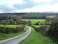
The Shropshire Way Main Route is a waymarked long distance footpath running through the English county of Shropshire. It runs 202 miles (325 km) around...
3 KB (359 words) - 18:35, 6 August 2023

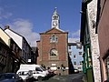
market town in the civil parish of Whitchurch Urban, in the north of Shropshire, England. It lies 2 miles (3 km) east of the Welsh border, 2 miles south...
44 KB (4,910 words) - 16:22, 25 August 2024
Bishop's Castle (redirect from Bishop's Castle, Shropshire)
Welcome Town", gaining the award in 2008. The long distance footpath the Shropshire Way runs through the town and Offa's Dyke is only a few miles to the west...
19 KB (2,307 words) - 13:30, 3 September 2024

Wild Edric's Way is a waymarked long distance footpath running wholly within the county of Shropshire in England. The path runs for 49 miles (79 km), mostly...
2 KB (145 words) - 19:10, 4 September 2021

Shropshire Council, known between 1980 and 2009 as Shropshire County Council and prior to 1980 as Salop County Council, is the local authority for the...
16 KB (1,260 words) - 18:59, 18 July 2024
Wenlock Edge (category Hills of Shropshire)
Shipton Hall and waymarked walks such as the Shropshire Way and bridleways such as the Jack Mytton Way. It is a popular area for hillwalking, cycling...
8 KB (933 words) - 22:19, 2 August 2024

Shropshire Blue is a cow's milk cheese made in the United Kingdom. The cheese was first made in the 1970s at the Castle Stuart dairy in Inverness, Scotland...
3 KB (343 words) - 16:06, 12 April 2024

Clun (redirect from Clun, Shropshire)
Clun /ˈklʌn/ (Welsh: Colunwy) is a town in south west Shropshire, England, and the Shropshire Hills Area of Outstanding Natural Beauty. The 2011 census...
21 KB (2,335 words) - 18:50, 13 June 2024
"Shropshire Way Association". shropshireway.org.uk. "The Staffordshire Way - Official Guide" (PDF). Staffordshire County Council. "St Edmund Way". LDWA...
96 KB (2,055 words) - 11:32, 20 August 2024
town of Clun. The B4368 runs through the village, on its way between Craven Arms in Shropshire to Newtown in Powys. The village has a community hall, a...
4 KB (370 words) - 16:19, 6 September 2022

Shrewsbury (redirect from Shrewsbury, Shropshire, England)
/ˈʃruːz-/ SHROOZ-) is a market town, civil parish and the county town of Shropshire, England. It is sited on the River Severn, 33 miles (53 km) northwest...
179 KB (17,131 words) - 21:33, 11 September 2024
Battlefield is a village and suburb of the town of Shrewsbury in Shropshire, England. It is 3 miles (5 km) north of the town centre. The village is today...
5 KB (466 words) - 13:37, 15 May 2024

Benthall Hall (category Country houses in Shropshire)
church of St. Bartholomew, built 1667–68, stands close by the Hall. The Shropshire Way, a waymarked long-distance footpath, passes through the extensive woodland...
3 KB (272 words) - 21:42, 31 August 2022

Ludford is a small village and civil parish in south Shropshire, England. The parish is situated adjacent to the market town of Ludlow and was, until 1895...
22 KB (2,538 words) - 14:54, 8 January 2024

A49 road (category Roads in Shropshire)
and back into Cheshire East. The road enters into Shropshire and is crossed by the South Cheshire Way near Hinton. The Whitchurch bypass begins with a...
16 KB (1,657 words) - 13:19, 3 September 2024

Wem (redirect from Wem, Shropshire)
Wem is a market town and civil parish in Shropshire, England, 9 miles (14 km) north of Shrewsbury and 9 miles (14 km) south of Whitchurch. The name is...
75 KB (7,674 words) - 02:27, 6 August 2024

town of Telford and a civil parish in the borough of Telford and Wrekin, Shropshire, England. It is situated 3 miles (4.8 km) north-west of Telford town centre...
25 KB (2,882 words) - 13:15, 23 July 2024

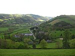
Long Mynd (category Hills of Shropshire)
Hirfynydd) is a heath and moorland plateau that forms part of the Shropshire Hills in Shropshire, England. The high ground, which is common land and designated...
29 KB (3,700 words) - 01:23, 1 September 2024
The Wrexham, Shropshire & Midlands Railway (WSMR) is a proposed open-access train operator in the United Kingdom, to operate passenger train services between...
10 KB (892 words) - 21:21, 31 July 2024

Maelor Way is a key long distance footpath, running 38 kilometres / 24 miles from the Offa's Dyke Path National Trail at Bronygarth to the Shropshire Way, Sandstone...
2 KB (187 words) - 18:43, 19 May 2020

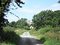
Dorrington is a large village in Shropshire, England, it is located 6 miles (9.7 km) south of Shrewsbury. The population of the village was estimated as...
5 KB (536 words) - 18:59, 13 August 2024

in Shropshire, England. It lies 7 miles (11 km) north-east of Telford town centre, 12 miles (19 km) west of Stafford, and is near the Shropshire-Staffordshire...
50 KB (5,778 words) - 09:16, 21 July 2024

Bucknell is a village and civil parish in south Shropshire, England. The village lies on the River Redlake, within 660 yards (600 m) of the River Teme...
11 KB (1,193 words) - 11:04, 4 February 2024

Anchor is a remote hamlet in southwest Shropshire, England. The hamlet is the most westerly place in Shropshire. Anchor lies only 400 yards away from the...
4 KB (505 words) - 21:50, 14 January 2024

Tong is a village and civil parish in Shropshire, also bordering Staffordshire in England. It is located between the towns of Shifnal, Newport and Brewood...
12 KB (1,359 words) - 06:44, 9 January 2024

The Wrekin (category Hills of Shropshire)
in east Shropshire, England. It is located some five miles (8 km) west of Telford, on the border between the unitary authorities of Shropshire and Telford...
17 KB (1,936 words) - 21:25, 23 February 2024

Oswestry (redirect from Oswestry, Shropshire)
Croesoswallt) is a market town, civil parish and historic railway town in Shropshire, England, close to the Welsh border. It is at the junction of the A5,...
65 KB (6,776 words) - 17:21, 9 August 2024

The Jack Mytton Way is a long distance footpath and bridleway for horseriders, hillwalkers and mountain bikers in mid and south Shropshire, England. It typically...
2 KB (150 words) - 19:33, 4 September 2021

Titterstone Clee Hill (category Hills of Shropshire)
English county of Shropshire, rising at the summit to 533 metres (1,749 ft) above sea level. It is one of the Clee Hills, in the Shropshire Hills Area of...
13 KB (1,715 words) - 15:31, 30 August 2024
The Shropshire Star is reputedly the twelfth biggest-selling regional newspaper in the UK. It is based at Grosvenor House, Telford where it covers the...
9 KB (862 words) - 11:53, 26 July 2024