
A spatial reference system (SRS) or coordinate reference system (CRS) is a framework used to precisely measure locations on the surface of Earth as coordinates...
15 KB (1,570 words) - 00:35, 6 September 2024

The National Spatial Reference System (NSRS), managed by the National Geodetic Survey (NGS), is a coordinate system that includes latitude, longitude,...
6 KB (555 words) - 18:29, 12 August 2024

coordinate system – also called a projected coordinate reference system, planar coordinate system, or grid reference system – is a type of spatial reference system...
21 KB (2,803 words) - 22:28, 19 June 2024

It is the simplest, oldest and most widely used of the various spatial reference systems that are in use, and forms the basis for most others. Although...
22 KB (2,491 words) - 18:52, 1 October 2024
The Military Grid Reference System (MGRS) is the geocoordinate standard used by NATO militaries for locating points on Earth. The MGRS is derived from...
15 KB (2,133 words) - 06:55, 13 February 2024
reference systems (WKT or WKT-CRS) is a text markup language for representing spatial reference systems and transformations between spatial reference...
10 KB (1,044 words) - 01:05, 26 September 2022
spatial databases also support the storage of raster data. Because all geographic locations must be specified according to a spatial reference system...
22 KB (2,037 words) - 06:47, 14 June 2024
The Geodetic Reference System 1980 (GRS80) consists of a global reference ellipsoid and a normal gravity model. The GRS80 gravity model has been followed...
7 KB (1,078 words) - 12:07, 24 August 2024

Earth-fixed coordinate system (acronym ECEF), also known as the geocentric coordinate system, is a cartesian spatial reference system that represents locations...
9 KB (904 words) - 15:59, 18 September 2024

Geodetic datum (redirect from Geodetic reference system)
datum or geodetic system (also: geodetic reference datum, geodetic reference system, or geodetic reference frame, or terrestrial reference frame) is a global...
31 KB (3,346 words) - 06:28, 11 August 2024
Georeferencing (redirect from Spatial referencing)
geographic space (usually a scanned map or aerial photograph) to a spatial reference system, thus locating the digital data in the real world. It is thus the...
13 KB (1,902 words) - 11:59, 6 September 2024
EPSG Geodetic Parameter Dataset (category Spatial databases)
(also EPSG registry) is a public registry of geodetic datums, spatial reference systems, Earth ellipsoids, coordinate transformations and related units...
5 KB (450 words) - 10:37, 21 July 2024
commentaries for their derivation have also been given. The WGS 84 spatial reference system describes Earth as an oblate spheroid along north-south axis with...
17 KB (2,844 words) - 21:04, 2 October 2024
The European Terrestrial Reference System 1989 (ETRS89) is an ECEF (Earth-Centered, Earth-Fixed) geodetic Cartesian reference frame, in which the Eurasian...
6 KB (611 words) - 09:24, 3 July 2024

Earth ellipsoid (redirect from Reference ellipsoid)
geographic applications, a geodesic reference ellipsoid is the mathematical model used as foundation by spatial reference system or geodetic datum definitions...
19 KB (2,379 words) - 05:58, 11 September 2024
88 was affirmed as the official vertical datum in the National Spatial Reference System (NSRS) for the Conterminous United States and Alaska. (see Federal...
7 KB (732 words) - 16:18, 31 January 2024
The Global Area Reference System (GARS) is a standardized geospatial reference system developed by the National Geospatial-Intelligence Agency (NGA) for...
3 KB (470 words) - 12:54, 13 December 2022

Local tangent plane coordinates (redirect from Local ellipsoidal system)
Local tangent plane coordinates (LTP) are part of a spatial reference system based on the tangent plane defined by the local vertical direction and the...
6 KB (729 words) - 05:16, 11 August 2024
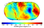
Geoid (redirect from Reference geoid)
solar system. Weinheim: Wiley-VCH. p. 704. ISBN 9783527408566. Chicaiza, E.G.; Leiva, C.A.; Arranz, J.J.; Buenańo, X.E. (14 June 2017). "Spatial uncertainty...
29 KB (3,435 words) - 19:57, 9 September 2024
Geomatics (redirect from Spatial science)
Geographic information systems (GIS), spatial database management and geographic information technology (GeoIT) Spatial analysis, spatial data mining and knowledge...
16 KB (1,588 words) - 08:38, 2 September 2024

Spatial Reference System, NAD 83, along with North American Vertical Datum of 1988 (NAVD 88), are set to be replaced with a new geometric reference frame...
13 KB (1,613 words) - 23:36, 12 September 2024
webpage for WGS 84 Geodesy for the Layman, Chapter VIII, "The World Geodetic System" Spatial reference for EPSG:4326 ANTEX (.atx) files that define IGS20...
24 KB (2,843 words) - 13:14, 5 October 2024
The Irish grid reference system is a system of geographic grid references used for paper mapping in Ireland (both Northern Ireland and the Republic of...
7 KB (753 words) - 17:04, 28 July 2024
conditions, aviators may determine aircraft attitude by reference to an attitude indicator. Spatial disorientation can occur in other situations where visibility...
32 KB (3,014 words) - 16:32, 19 July 2024

Triangulation station (category Articles needing additional references from July 2012)
Geodetic Survey (NGS) and predecessor agencies manages the National Spatial Reference System (NSRS), which includes permanent survey marks for horizontal position...
15 KB (1,722 words) - 00:50, 26 September 2024
a short period of time. There are two basic types of reference locality – temporal and spatial locality. Temporal locality refers to the reuse of specific...
16 KB (2,326 words) - 01:24, 19 November 2023
Pokémon Go. Reference frames: realization and densification of the terrestrial reference frames in the framework of Global Geodetic Observing System. Co-location...
179 KB (18,697 words) - 00:53, 12 October 2024
Ordnance Survey National Grid (redirect from British national grid reference system)
Survey National Grid reference system (OSGB), also known as British National Grid (BNG), is a system of geographic grid references, distinct from latitude...
19 KB (2,177 words) - 07:38, 19 August 2024
Legenda, or the MKRC Legenda system, is a Soviet satellite targeting system mated to the SS-N-19 missile. It consisted of the US-P SIGINT satellites and...
2 KB (173 words) - 14:45, 20 October 2023
release the new spatial reference system and new zones in 2025. As with earlier systems, the name of the new system, State Plane Coordinate System of 2022, indicates...
7 KB (965 words) - 15:06, 26 February 2024