Tahuya is an unincorporated community in Mason County, Washington, United States. It is located on the Hood Canal at the mouth of the Tahuya River. Tahuya...
4 KB (298 words) - 04:59, 7 June 2023
Creek Indian Creek Deschutes River Kennedy Creek Sherwood Creek Union River Tahuya River Skokomish River Dewatto River Hamma Hamma River Duckabush River Dosewallips...
15 KB (1,143 words) - 18:32, 19 September 2024

of Hood Canal. Washington State Route 300 begins in Belfair and runs along the north shore of Hood Canal, providing access to Tahuya and Dewatto Bay...
8 KB (557 words) - 21:57, 6 July 2024
Washington, officially the State of Washington, is the northernmost state in the Pacific Northwest region of the United States. It is often referred to...
243 KB (18,570 words) - 23:48, 27 September 2024

The Tahuya River is a stream in the U.S. state of Washington. It originates at Tahuya Lake in western Kitsap Peninsula and flows south, emptying into...
4 KB (176 words) - 02:36, 23 May 2024

Skokomish Union Eldon Harstine Island Lake Cushman Lilliwaup Matlock Potlatch Tahuya District 1 (North Mason) - Randy Neatherlin, elected 2013 District 2 (West...
18 KB (1,340 words) - 18:43, 31 August 2024

Kitsap Peninsula (category Landforms of Kitsap County, Washington)
Port Orchard Poulsbo Purdy Retsil Seabeck Silverdale Southworth Suquamish Tahuya Tracyton Agate Pass Anderson Cove Appletree Cove Big Beef Harbor Burke Bay...
6 KB (593 words) - 02:37, 2 January 2024

Forest, Washington State Department of Natural Resources Hike of the Week: Green Mountain, The Olympian (2011) Plans for Green Mountain, Tahuya state forests...
6 KB (481 words) - 21:47, 23 September 2023

Nathaniel J. Sargent (category People from Kitsap County, Washington)
the 2010s. On October 27, 2022, the Washington State Committee on Geographic Names renamed a lake north of Tahuya "Nathaniel Sargent Lake" in his honor...
6 KB (510 words) - 03:43, 22 May 2024
This is a list of unincorporated communities in the U.S. state of Washington which are not incorporated municipalities. Incorporated municipalities in...
84 KB (169 words) - 18:31, 25 August 2024
The U.S. state of Washington has over 140 state parks that are managed by the Washington State Parks and Recreation Commission. These include 19 marine...
50 KB (529 words) - 20:37, 10 July 2024

Rodney White (pioneer) (category African-American history of Washington (state))
Rodney White (died August 27, 1913) was a Black pioneer in Washington who settled in Tahuya. After his death, the swamp where he built his homestead was...
5 KB (482 words) - 06:00, 26 October 2023
Washington contains 11 state forests. These sites are managed by the Department of Natural Resources. List of U.S. National Forests...
2 KB (21 words) - 12:43, 25 May 2022

Skokomish people (category Native American tribes in Washington (state))
Duckabush, Hoodsport, Skokomish (Skoko'bsh), Ctqwəlqweli ("Vance Creek"), Tahuya, and Duhlelap (Tule'lalap) communities. Within these nine communities there...
4 KB (423 words) - 01:08, 16 April 2024

Hood Canal (category Fjords of Washington (state))
emptying into Hood Canal from the Kitsap Peninsula include the Union River, Tahuya River, and Dewatto River. Hood Canal and the rest of Puget Sound were created...
21 KB (2,515 words) - 19:54, 5 August 2024

Fairhaven (or Fairhaven Village) was a settlement in Washington state founded in 1883 by Dan Harris. In 1903, it became part of the city of Bellingham...
9 KB (934 words) - 13:27, 17 April 2024

districts in Washington that are listed on the National Register of Historic Places. There are at least three listings in each of Washington's 39 counties...
10 KB (567 words) - 00:19, 18 August 2024

recreation area on Cape Disappointment, located southwest of Ilwaco, Washington, on the bottom end of Long Beach Peninsula, the northern headlands where...
8 KB (659 words) - 05:59, 1 August 2023

Gifford Pinchot National Forest is a National Forest located in southern Washington, managed by the United States Forest Service. With an area of 1.32 million...
18 KB (1,477 words) - 05:58, 5 September 2024

Olympic National Park (redirect from Olympic Park (Washington State))
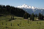
Olympic National Park is a national park of the United States located in Washington, on the Olympic Peninsula. The park has four regions: the Pacific coastline...
41 KB (3,704 words) - 00:54, 22 September 2024
centers in the state of Washington. List of nature centers in the United States Environmental Education Association of Washington Map of nature centers...
8 KB (39 words) - 11:29, 25 September 2024

Lewis and Clark National Historical Park (category State parks of Washington (state))
cooperative effort of the National Park Service and the states of Oregon and Washington. The National Historical Park was dedicated on November 12, 2004. After...
10 KB (768 words) - 10:05, 4 December 2023
Mount Baker–Snoqualmie National Forest (redirect from Washington National Forest)
The Mount Baker–Snoqualmie National Forest in Washington is a National Forest extending more than 140 miles (230 km) along the western slopes of the Cascade...
13 KB (1,252 words) - 18:40, 4 October 2023
other mineral. The hills contain the headwaters of the Union River and Tahuya River, draining into Hood Canal south and southwest respectively. A number...
33 KB (2,602 words) - 23:27, 1 June 2024

Twana (category Native American tribes in Washington (state))
Dabop, Quilcene, Dosewallips, Duckabush, Hoodsport, Skokomish, Vance Creek, Tahuya, and Duhlelap. By 1860 there were 33 settlements in total, with the Skokomish...
15 KB (1,506 words) - 02:56, 22 April 2024

Mount Spokane (redirect from Mount Spokane State Park, Washington)
mountain in the northwest United States, located northeast of Spokane, Washington. Its summit is the highest point in Spokane County, and it is one of the...
8 KB (353 words) - 00:45, 29 September 2023
Beacon Rock State Park (redirect from Hamilton Mountain (Washington))
in the Columbia River Gorge National Scenic Area in Skamania County, Washington, United States. The park takes its name from Beacon Rock, an 848-foot...
8 KB (651 words) - 19:24, 6 November 2023

Mount Rainier National Park (redirect from Mount Rainier National Park, Washington)
States located in southeast Pierce County and northeast Lewis County in Washington state. The park was established on March 2, 1899, as the fourth national...
49 KB (3,957 words) - 17:02, 14 September 2024

de Fuca just north of Discovery Bay in northeastern Jefferson County, Washington, United States. The island has a land area of 379 acres (153 ha). It is...
7 KB (567 words) - 02:34, 13 August 2024

Whitman Mission National Historic Site (redirect from Waiilatpu, Washington)
United States National Historic Site located just west of Walla Walla, Washington, at the site of the former Whitman Mission at Waiilatpu. On November 29...
5 KB (401 words) - 18:27, 15 September 2024