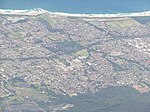
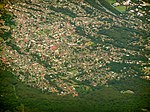
Tarrawanna is a northern suburb of Wollongong, New South Wales, Australia, extending westward from the Princes Highway over the Illawarra Escarpment. Tarrawanna's...
3 KB (188 words) - 08:13, 30 July 2024
YOU-nən-derr-ə) is a suburb of Wollongong in New South Wales, Australia. It is located approximately 6 km south-west of the Wollongong CBD. It is bordered...
4 KB (400 words) - 14:47, 30 July 2024
northern suburb of Wollongong, New South Wales, Australia. It is the northernmost point of the Illawarra coastal strip and lies south of Sydney's Royal National...
14 KB (1,618 words) - 07:34, 30 July 2024
Dapto is a suburb of Wollongong in the Illawarra region of New South Wales, Australia, located on the western side of Lake Illawarra and covering 7.15...
16 KB (1,736 words) - 14:02, 21 November 2024
Figtree is an inner western suburb of Wollongong, New South Wales, Australia. It is south-west of West Wollongong and connected to Wollongong by the Princes...
7 KB (771 words) - 01:10, 15 August 2024
Mount Pleasant is a hilly suburb in the city of Wollongong, New South Wales, Australia. It is situated on the northern flank of Mount Keira extending...
3 KB (221 words) - 14:03, 29 July 2024
BULL-eye) is a northern suburb of Wollongong situated on the south coast of New South Wales, Australia. Bulli is possibly derived from an Aboriginal word...
12 KB (1,523 words) - 23:56, 26 August 2024
local government areas that comprise the Wollongong Metropolitan Area, New South Wales, Australia. Although it is surrounded by a 'green belt' of farms, Albion...
8 KB (849 words) - 09:47, 20 July 2024
of Mount Warrigal in the west, Barrack Heights and Barrack Point in the south and Lake Illawarra in the north. Warilla was officially granted township...
4 KB (310 words) - 19:53, 9 November 2024
New South Wales State Heritage Register. Department of Planning & Environment. H01269. Retrieved 18 May 2018. Text is licensed by State of New South Wales...
32 KB (4,116 words) - 06:16, 21 October 2024
Illawarra region of New South Wales, Australia, in the Municipality of Kiama. It has a station (opened 1891) on the NSW TrainLink South Coast Line. The Minnamurra...
4 KB (351 words) - 13:58, 29 July 2024
Warrawong is a suburb of Wollongong in the Illawarra region of New South Wales, Australia. It is situated on the northeast corner of Lake Illawarra. Warrawong...
4 KB (262 words) - 23:37, 12 October 2024
village of Wollongong on the south coast of New South Wales, Australia. It sits in the northern Illawarra region, south of Stanwell Park and immediately...
8 KB (694 words) - 09:54, 20 July 2024
kilometres (11 mi) north of Wollongong along the Princes Highway in New South Wales, Australia. It is part of the City of Wollongong and lies between Wombarra...
4 KB (369 words) - 15:57, 21 July 2024
Wollongong (redirect from Woollongong, New South Wales)
Dharawal: Woolyungah) is a city located in the Illawarra region of New South Wales, Australia. The name is believed to originate from the Dharawal language...
74 KB (7,759 words) - 19:38, 19 November 2024
bordered to the north by Corrimal, the west by Fernhill and Tarrawanna, and to the south by Fairy Meadow. The Pacific Ocean can be found to the east....
7 KB (764 words) - 14:43, 30 July 2024
Clifton is a village on the coast of New South Wales, Australia, between Sydney and Wollongong. Along with nearby Coalcliff, the village began life as...
6 KB (662 words) - 15:50, 21 July 2024
Port Kembla is a suburb of Wollongong 10 km south of the CBD and part of the Illawarra region of New South Wales. The suburb comprises a seaport, industrial...
23 KB (2,408 words) - 07:09, 30 July 2024
a suburb north of Wollongong, New South Wales, Australia, south of Sydney. It is served by Woonona Station on the South Coast Line, and by the Princes...
7 KB (1,007 words) - 15:57, 30 July 2024
Windang is a suburb of Wollongong in New South Wales on the southern tip of the peninsula guarding the ocean entrance to Lake Illawarra. Windang is popular...
4 KB (303 words) - 16:07, 30 July 2024
Census QuickStats. Retrieved 24 July 2024. "Fernhill". Geographical Names Board of New South Wales. New South Wales Government. Retrieved 16 July 2017....
2 KB (53 words) - 19:23, 23 July 2024
Coalcliff is a town on the coast of New South Wales, Australia, between Sydney and Wollongong. In 1796 William Clark and others trekking north to Port...
11 KB (1,229 words) - 06:04, 23 July 2024
East Corrimal is a northern seaside suburb of Wollongong, New South Wales, Australia. Predominantly residential, the suburb includes Corrimal High School...
3 KB (215 words) - 21:07, 9 August 2024
in the Illawarra region of New South Wales, Australia. It has a railway station (opened 1889) on the NSW TrainLink South Coast Line. Bellambi is situated...
15 KB (1,690 words) - 13:04, 20 July 2024
generally fairly mild throughout the year, much like the majority of the New South Wales coast. Day temperatures average between 24 °C and 29 °C in the summer...
13 KB (1,389 words) - 11:23, 29 October 2024
Corrimal is a suburb north of the city of Wollongong, New South Wales, Australia. Corrimal's CBD is situated on the Princes Highway, and several streets...
8 KB (1,043 words) - 10:50, 4 November 2024
Coniston (/kɒnɪstən/ CON-ist-ən), is a suburb of Wollongong in New South Wales, Australia. At the 2021 census, it had a population of 2,267. Coniston...
4 KB (402 words) - 21:10, 29 September 2024
Shellharbour Village) is a suburb located in the Illawarra region of New South Wales, Australia. It also gives its name to the local government area, City...
8 KB (644 words) - 07:24, 30 July 2024
Yallah is a western suburb in the City of Wollongong, New South Wales, Australia, located on the western shore of Lake Illawarra. It contains a mixture...
4 KB (289 words) - 11:08, 18 May 2024
Balgownie (/bælɡaʊni/) is a small suburb of Wollongong, New South Wales, Australia. Balgownie lies to the north-west of the Wollongong CBD. It stretches...
4 KB (275 words) - 10:26, 20 July 2024


