
The Tavern on Mutton Hill, also known locally (and incorrectly) as the 1812 Tavern, is a historic former public accommodation on Church Hill Road in Charlotte...
3 KB (360 words) - 04:51, 31 May 2022

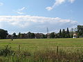
Shelburne Farms (category Coordinates on Wikidata)
sustainability, 1,400-acre (570 ha) working farm, and National Historic Landmark on the shores of Lake Champlain in Shelburne, Vermont. The property is nationally...
5 KB (392 words) - 12:26, 18 May 2024

fertile agricultural land. A future competitor would be the Tavern on Mutton Hill of Nathaniel Newell. The city of Charlotte was larger than Burlington...
8 KB (707 words) - 15:21, 3 July 2024

Masonic Temple (Burlington, Vermont) (category Clubhouses on the National Register of Historic Places in Vermont)
Burlington was Burlington Lodge No. 100 which met at the Oddfellows Hall on North Avenue. In June, 2016, Burlington Lodge #100 consolidated with Washington...
4 KB (298 words) - 18:00, 16 June 2024

Round Church (Richmond, Vermont) (category Coordinates on Wikidata)
The Round Church, also known as the Old Round Church, is a historic church on Round Church Road in Richmond, Vermont. Built in 1812–1813, it is an extraordinarily...
6 KB (662 words) - 13:46, 24 March 2024
Mad River Glen (category Coordinates on Wikidata)
skiing that emphasizes snow preservation on narrow trails with little grooming instead of man-made snow on wide boulevards. It has one of only two single...
11 KB (1,193 words) - 16:49, 17 July 2024
Mount Philo State Park (category Infobox mapframe without OSM relation ID on Wikidata)
picnic area and built a ranger cabin and camping sites. The park was listed on the National Register of Historic Places in 2001 for its importance in the...
5 KB (471 words) - 15:24, 21 May 2024

Church Street Marketplace (category Coordinates on Wikidata)
on the Church Street Marketplace in 1976. The mall is anchored by a Macy's department store. In 2014, another flagship, an LL Bean store, opened. On February...
10 KB (1,158 words) - 21:13, 2 June 2024

Ticonderoga (steamboat) (category Coordinates on Wikidata)
1950 the steady decline in business threatened her future. Ralph Nading Hill saved Ticonderoga from the scrap heap when he persuaded Electra Havemeyer...
9 KB (791 words) - 12:55, 12 August 2023
Fort Ethan Allen (category Coordinates on Wikidata)
institutions, and residential areas. The former grounds of Fort Ethan Allen stand on the north side of Vermont Route 15, roughly divided in half between southeastern...
6 KB (655 words) - 13:09, 24 January 2023

Charlotte Center Historic District (category Coordinates on Wikidata)
as a stop on the stagecoach route between Burlington and Troy, New York when Hezekiah Barnes, the village's first settler, built a tavern in 1800. The...
3 KB (366 words) - 17:34, 9 January 2024

Pearl Street Historic District (Burlington, Vermont) (category Coordinates on Wikidata)
on the Winooski River, bypassing a deep ravine (since filled in) to the south. The street was named for Stephen Pearl, a farmer who operated a tavern...
4 KB (440 words) - 05:48, 8 August 2023
National Register of Historic Places listings in Chittenden County, Vermont (category Commons category link is on Wikidata)
Vermont. This is intended to be a complete list of the properties and districts on the National Register of Historic Places in Chittenden County, Vermont, United...
45 KB (328 words) - 03:50, 10 June 2023

Old Mill (University of Vermont) (category Coordinates on Wikidata)
2010. The History of University of Vermont Buildings: 1800–1947 The J.L. Hills papers. Burlington, Vermont: Special Collections Department, University...
6 KB (577 words) - 20:14, 15 June 2024

Old Stone House (Winooski, Vermont) (category Coordinates on Wikidata)
oldest building. It has served as a tavern, and as residences, and is now in use as professional offices. It was listed on the National Register of Historic...
3 KB (298 words) - 04:50, 31 May 2022

Galusha House (category Coordinates on Wikidata)
States. It was listed on the National Register of Historic Places in 1978 as the Galusha House, qualifying for designation based on its "architectural excellence"...
23 KB (2,960 words) - 01:56, 17 June 2024

Ethan Allen Homestead (category Coordinates on Wikidata)
state. It is open to the public annually from May to October. It was listed on the National Register of Historic Places in 1986. Ethan Allen (1738-1789)...
3 KB (328 words) - 04:47, 31 May 2022

Burlington Traction Company (category Coordinates on Wikidata)
Company is located in Burlington's Old North End neighborhood, on a triangular parcel bounded on the north by Riverside Avenue and the southeast by North Winooski...
3 KB (315 words) - 14:32, 13 June 2024

Winterbotham Estate (category Coordinates on Wikidata)
period country estate, with many later additions. The property was listed on the National Register of Historic Places in 1975, at which time it housed...
3 KB (342 words) - 04:51, 31 May 2022

Martin Chittenden House (category Coordinates on Wikidata)
The Martin Chittenden House is a historic house on Vermont Route 117 in Jericho, Vermont. Built in the 1790s, it is one of the highest-style Federal period...
4 KB (379 words) - 16:06, 30 June 2024

Follett House (category Coordinates on Wikidata)
the state's finest examples of Greek Revival architecture. It was listed on the National Register of Historic Places in 1972. It has seen commercial and...
3 KB (362 words) - 04:48, 31 May 2022

Moquin's Bakery (category Coordinates on Wikidata)
on the east side of Rose Street between Cedar Street and Manhattan Drive. It is a large two-story brick building, with single-story extensions on both...
3 KB (341 words) - 03:01, 3 July 2024

Lucy Ruggles House (category Coordinates on Wikidata)
home to a non-profit senior living facility, operating on the premises since 1932. It was listed on the National Register of Historic Places in 2005. The...
4 KB (427 words) - 04:49, 31 May 2022

Porter Screen Company (category Coordinates on Wikidata)
listed on the National Register of Historic Places in 1979. The former Porter Screen Company mill is located northeast of downtown Winooski, on a triangular...
3 KB (316 words) - 18:35, 4 July 2024

Wells-Richardson Complex (category Coordinates on Wikidata)
College, and St. Paul Streets just west of City Hall Park, the architecture on this one city block represents nearly a century's worth of development. It...
4 KB (389 words) - 18:03, 16 June 2024

Martin L. Kelsey House (category Coordinates on Wikidata)
elements of the Second Empire, Queen Anne, and Stick styles on display. It was listed on the National Register of Historic Places in 1983, and now forms...
3 KB (418 words) - 04:49, 31 May 2022
Duplex at 22-26 Johnson Street (category Coordinates on Wikidata)
It was listed on the National Register of Historic Places in 2012. 22-26 Johnson Street is a 2-1/2 story wood frame building, set on the east side of...
3 KB (318 words) - 12:03, 30 January 2022

North Street Historic District (Burlington, Vermont) (category Coordinates on Wikidata)
as the neighborhood's commercial center for over 150 years. It was listed on the National Register of Historic Places in 2001. Burlington's Old North End...
3 KB (359 words) - 01:36, 8 August 2023

Apartment Building at 27 and 31 Peru Street and 29 Johnson Street (category Coordinates on Wikidata)
local example of vernacular Queen Anne Victorian architecture. It was listed on the National Register of Historic Places in 2014. The building at the southwest...
3 KB (329 words) - 12:00, 30 January 2022

Fletcher Free Library (category Coordinates on Wikidata)
in 1902 with funding support from Andrew Carnegie. The building was listed on the National Register of Historic Places in 1976. The Fletcher Free Library...
5 KB (479 words) - 02:05, 17 June 2024