
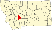
Toston is a census-designated place (CDP) in Broadwater County, Montana, United States. The population was 108 at the 2010 census. Thomas Toston settled...
7 KB (551 words) - 05:45, 14 July 2023
Toston may refer to: Keith Toston (born 1987), footballer Roosevelt Toston, journalist Toston, Montana Toston Bridge Toston Dam Tostones Tostón Lighthouse...
231 bytes (52 words) - 16:51, 30 December 2019
Toston Dam is a hydroelectric gravity dam located on the Missouri River in Broadwater County, Montana. The dam is 705 feet (215 m) long and 56 feet (17 m)...
8 KB (917 words) - 03:20, 25 June 2019

land area of Montana (82,000 square miles (210,000 km2)). Nearly one-third of the Missouri River in Montana lies behind 10 dams: Toston, Canyon Ferry...
265 KB (24,357 words) - 00:56, 8 July 2024
List of populated places along the Missouri River (category Montana populated places on the Missouri River)
Yankton Toston, Montana Townsend, Montana Cascade, Montana Ulm, Montana Great Falls, Montana Black Eagle, Montana Fort Benton, Montana Loma, Montana Fort...
12 KB (748 words) - 19:59, 10 April 2022
Dam, Tongue River Reservoir, Montana Department of Natural Resources and Conservation Toston Dam, Toston Reservoir, Montana Department of Natural Resources...
3 KB (343 words) - 15:12, 2 March 2024
The Toston Formation is a geologic formation in Montana. It preserves fossils dating back to the Paleogene period. Earth sciences portal Paleontology...
1 KB (55 words) - 15:07, 22 October 2022

Missouri River, on an abandoned segment of old U.S. Route 287, at Toston, Montana. It was added to the Register on July 20, 2005. It is a steel, three-span...
2 KB (131 words) - 16:47, 1 December 2023

County, Montana, 46°17′21″N 112°33′48″W / 46.28917°N 112.56333°W / 46.28917; -112.56333 (Schurchs Tunnel), el. 7,424 feet (2,263 m) Toston Canal Tunnel...
10 KB (1,718 words) - 16:44, 20 March 2022

suitable form of control. There have been tested areas in Larslan and Toston, Montana, where two different fungi found in particular soil have reduced the...
15 KB (1,788 words) - 18:58, 25 April 2024
– $12,016 Toston, Montana – $11,945 Basin, Montana – $11,878 Knife River, Montana – $11,865 Herron, Montana – $11,779 Camp Three, Montana – $11,767 Simms...
18 KB (1,026 words) - 07:36, 9 March 2022

Montana Rail Link (reporting mark MRL) (now operated by BNSF as the MRL Subdivision) is a former privately held Class II railroad in the United States...
14 KB (1,340 words) - 00:23, 2 July 2024

southeast of Toston, at the site of the ghost town of Lombard. Sixteen Mile Creek is one of the more historically important areas in Montana. Its name derives...
3 KB (270 words) - 22:52, 23 April 2022

classification of state highway maintained by the Montana Department of Transportation (MDT) in the US state of Montana. Secondary highways first appeared on the...
118 KB (3,042 words) - 18:44, 18 August 2023
places in Montana. Contents: A B C D E F G H I J K L M N O P Q R S T U V W X Y Z List of cities and towns in Montana List of counties in Montana List of...
40 KB (84 words) - 12:06, 4 July 2023

land area of Montana (82,000 square miles (210,000 km2)). Nearly one-third of the Missouri River in Montana lies behind 10 dams: Toston, Canyon Ferry...
76 KB (6,151 words) - 20:09, 11 July 2024

(secondary coordinates) This is a list of properties and historic districts in Montana that are listed on the National Register of Historic Places. The state's...
59 KB (640 words) - 01:42, 14 July 2024
Wheat Montana Bakery were the largest private employers according to the 2000 Census. Townsend (county seat) Radersburg Spokane Creek The Silos Toston Wheatland...
13 KB (891 words) - 23:16, 25 April 2024
Northwestern Energy. Retrieved 2020-11-19. "Toston Dam (Broadwater-Missouri) Factsheet" (PDF). Montana Department of Natural Resources and Conservation...
27 KB (1,070 words) - 17:26, 17 April 2024

(US 287) is a north-south United States Numbered Highway in the state of Montana. It extends approximately 281.2 miles (452.5 km) from Yellowstone National...
17 KB (1,110 words) - 06:18, 15 July 2024

(CDPs) in the U.S. state of Montana. As of 2018, there were a total of 235 census-designated places in Montana. "Montana: 2010 - Census Bureau" (PDF)...
20 KB (49 words) - 05:32, 12 July 2023
fossil-bearing stratigraphic units in the state of Montana, U.S. Paleontology portal Paleontology in Montana "Geolex — Wiota publications". Wikisource has...
6 KB (54 words) - 23:59, 14 November 2023

Missouri River (category Rivers of Gallatin County, Montana)
20, 2013. Retrieved January 19, 2012. "Toston Dam (Broadwater-Missouri)" (PDF). Water Projects Bureau. Montana Department of Natural Resources and Conservation...
189 KB (18,105 words) - 13:07, 8 June 2024
Archived from the original on January 1, 2009. Retrieved December 1, 2008. Montana Department of Transportation County Maps "Snowden Bridge, Spanning Missouri...
28 KB (127 words) - 09:25, 26 December 2023
Memorial Bridge Toston Bridge Yellowstone River Bridge List of bridges documented by the Historic American Engineering Record in Montana List of bridges...
101 KB (9,296 words) - 16:44, 23 June 2024

along the Missouri River that were not part of the Sloan–Pick program are Toston Dam (1940), Hauser Dam (1907), Holter Dam (1908), Black Eagle Dam (1927)...
14 KB (1,678 words) - 18:59, 22 March 2024
Bernard Joseph Topel (category Carroll College (Montana) alumni)
Returning to Helena in 1934, he served at the missions in Toston, Montana, and Wolf Creek, Montana. In 1937, Topel served as a faculty member teaching mathematics...
10 KB (864 words) - 12:35, 9 January 2024

tunnels on the National Register of Historic Places in the U.S. state of Montana. Map all coordinates using OpenStreetMap Download coordinates as: KML GPX...
12 KB (55 words) - 20:31, 14 May 2024