
State Route 210 (SR-210) is a state route in the U.S. state of Utah that is the access road for Little Cottonwood Canyon and the ski resorts of Alta and...
7 KB (692 words) - 15:40, 16 February 2024
A large number of minor routes in Utah, United States, were deleted by the State Legislature in 1969. This was by far the largest mass-decommissioning...
72 KB (9,240 words) - 17:15, 27 July 2024
from I-215 south and east to Wasatch Boulevard (Utah State Route 210 [SR-210]), was removed from the state highway system. In its place was a proposed limited...
11 KB (1,065 words) - 15:39, 16 February 2024

U.S. Route 89 (US 89) in the U.S. state of Utah is a north-south United States Highway spanning more than 502 miles (807.891 km) through the central part...
66 KB (4,556 words) - 23:02, 25 August 2024

Mount Superior (category Mountains of Utah)
Uinta-Wasatch-Cache National Forest in Salt Lake County, Utah, United States. With prominent visibility from Utah State Route 210 in Little Cottonwood Canyon, and being...
4 KB (392 words) - 18:21, 26 August 2023

State Route 171 (SR-171) is a state highway in the Salt Lake City metropolitan area in northern Utah that runs from SR-111 in Magna in the west side of...
10 KB (982 words) - 15:39, 16 February 2024
Route 210 Pennsylvania Route 210 South Carolina Highway 210 Tennessee State Route 210 Texas State Highway 210 Texas State Highway Loop 210 Utah State...
3 KB (202 words) - 22:59, 4 April 2024

State Route 152 (SR-152) is a state highway in the suburbs of Salt Lake City, Utah connecting SR-71 in Murray to I-215 and city-maintained Highland Drive...
9 KB (943 words) - 15:40, 16 February 2024
The U.S. state of Utah, the Utah Department of Transportation (UDOT) operates a system of state routes that serve all portions of the state. In official...
106 KB (718 words) - 15:33, 27 July 2024

State Route 209 (SR-209) is a state highway in the U.S. state of Utah, following 9000 South and other east–west streets south of Salt Lake City. It connects...
7 KB (542 words) - 15:39, 16 February 2024

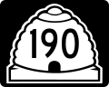
city). State Route 190 and State Route 210 run near the eastern edge of the city and provide access to the canyons; they are the only state routes that...
10 KB (648 words) - 06:27, 6 February 2024

north–south in the U.S. state of Utah through the southwestern and central portions of the state, passing through most of the state's population centers,...
83 KB (7,733 words) - 00:53, 5 August 2024

through Arizona State Route 389. Utah State Route 7, also known as Southern Parkway, when finished with construction, will begin at State Route 9 just south...
20 KB (1,975 words) - 04:13, 20 August 2024

State Route 54 is a short highway completely within the town of Mona in Juab County in northern Utah that connects Main Street (old US-91) to I-15 in a...
3 KB (188 words) - 15:42, 16 February 2024
Twin Peaks Wilderness (category Protected areas of Salt Lake County, Utah)
The Lone Peak Wilderness is directly to the south and separated by Utah State Route 210. Elevations in the wilderness range from under 5,000 feet (1,500 m)...
2 KB (128 words) - 18:53, 6 August 2024

State Route 211 is a state route in Utah that is an access road for Newspaper Rock State Historic Monument and the Needles district of Canyonlands National...
5 KB (455 words) - 07:23, 22 June 2023
Route 89 Utah State Route 37 Utah State Route 39 Utah State Route 79 Utah State Route 97 Utah State Route 108 Utah State Route 126 Utah State Route 134...
28 KB (2,103 words) - 05:34, 28 August 2024

The Nevada portion crosses the center of the state, serving the cities of Tonopah and Ely, en route to Utah and points further east. Like US 50 to the north...
18 KB (1,405 words) - 18:23, 25 July 2024
Cottonwood Canyon in 1933 along with the narrow gauge route up the canyon. Segments of Utah State Route 210 follow the former railroad grade up the canyon....
33 KB (3,735 words) - 12:29, 2 May 2024

Utah Lake is a shallow freshwater lake in the center of Utah County, Utah, United States. It lies in Utah Valley, surrounded by the Provo-Orem metropolitan...
63 KB (7,568 words) - 22:47, 13 May 2024

Interstate 215 (California) (redirect from California State Route 215)
north of SR 210 in San Bernardino only has two lanes in each direction (while I-15 has four), its co-designation with SR 60 and routing through Riverside...
26 KB (2,116 words) - 18:19, 25 August 2024
Tennessee, Utah, Vermont, Virginia, Washington, Wisconsin, and West Virginia. Ohio has the most of any state, with eight active routes total. Below...
61 KB (3,200 words) - 21:18, 27 June 2024
Some of the state designated routes overlap with the federal designations. The Utah Department of Transportation has signed both the state and federal...
11 KB (233 words) - 01:08, 5 August 2024

following is a list of state routes in Nevada shorter than one mile (1.6 km) in length. Most of these highways are short state-maintained sections of...
57 KB (4,522 words) - 05:31, 20 June 2024

Interstate 17 (redirect from Arizona State Route 79 (1950-1968))
of the highway south of Cordes Lakes was built along the alignment of State Route 69 (SR 69), while the northern part was built along old SR 79's alignment...
26 KB (1,456 words) - 17:20, 27 August 2024

Interstate 15 in California (redirect from California State Route 15)
Route 15, consisting of the contiguous segments of State Route 15 (SR 15) and Interstate 15 (I-15), is a major north–south state highway and Interstate...
59 KB (4,223 words) - 10:34, 21 August 2024

and State Route 30 was connected to Utah in northeastern Nevada. Additionally, several suffixed highways, branching from the original parent route, were...
20 KB (309 words) - 15:38, 14 June 2024

Little Cottonwood Canyon (category Canyons and gorges of Utah)
quarried from the Little Cottonwood Stock near the mouth of the canyon. State Route 210 is the primary access road to the canyon, running from the canyon mouth...
12 KB (1,386 words) - 19:50, 10 March 2024

animals were covered with blood from the bites. The route from Fort Bridger to Fort Hall is about 210 miles (340 km), taking nine to twelve days. At Soda...
42 KB (5,907 words) - 13:44, 12 June 2024

to Las Vegas. Utah State Route 153 heads east from Beaver across the Tushar Mountains 40 mi (64 km) to Junction, and Utah State Route 21 runs west through...
24 KB (2,194 words) - 00:17, 17 July 2024