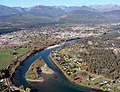
The Kootenay River or Kootenai River is a major river of the Northwest Plateau in southeastern British Columbia, Canada, and northern Montana and Idaho...
96 KB (10,722 words) - 08:42, 21 May 2024

The Vermilion River, in Kootenay National Park, is headwatered at Vermilion Pass and flows through Vermilion Valley in British Columbia, Canada. Its tributaries...
3 KB (90 words) - 11:02, 1 November 2023

including parts of the Kootenay and Park mountain ranges, the Kootenay River and the entirety of the Vermilion River. While the Vermilion River is completely contained...
37 KB (3,799 words) - 10:44, 18 May 2024
British Columbia Highway 93 (redirect from Kootenay Highway)
of Kootenay National Park. Through the park, the highway travels northeast along the Kootenay and Vermilion rivers for 93 km (58 mi) to Vermilion Pass...
10 KB (645 words) - 22:55, 22 September 2022
River, in Kootenay National Park, is a tributary of Vermilion River flowing through Simpson Valley. Named tributaries include the North Simpson River...
1 KB (102 words) - 17:40, 1 April 2023

Vermilion Peak is a 2,647-metre (8,684-foot) mountain summit located in the Vermilion River Valley of Kootenay National Park, in British Columbia, Canada...
4 KB (365 words) - 22:08, 29 June 2024

the Kootenay River Beaverfoot Range Hughes Range Stanford Range Vermilion Range "Kootenay Ranges". Bivouac.com. Retrieved 2021-06-28. "Kootenay Ranges"...
2 KB (120 words) - 18:48, 19 September 2022

469-foot) mountain summit located on the western border of Kootenay National Park in the Vermilion Range, which is a sub-range of the Canadian Rockies in...
5 KB (428 words) - 12:32, 28 September 2023
Banff–Windermere Highway (category Kootenay National Park)
(Alberta Highway 1A) on the north side of the Bow River. The corridor along the Kootenay and Vermilion Rivers had been used as a first nations travel route...
13 KB (999 words) - 05:40, 27 August 2024

Foster Peak (category Kootenay Land District)
mountain summit located on the western border of Kootenay National Park. It is the highest point in the Vermilion Range, a sub-range of the Canadian Rockies...
6 KB (480 words) - 22:19, 29 June 2024

River Kootenay River Elk River Bull River Vermilion River Clark Fork River Clearwater River Coeur d'Alene River Salmon River Snake River Malad River Payette...
4 KB (308 words) - 15:34, 30 December 2023

Mount Drysdale (category Kootenay Land District)
619-foot) mountain summit located on the western border of Kootenay National Park in the Vermilion Range, which is a sub-range of the Canadian Rockies of...
5 KB (419 words) - 22:20, 29 June 2024

Mount Selkirk (category Kootenay Land District)
(9,610-foot) mountain summit located in the Vermilion River Valley along the eastern border of Kootenay National Park. Park visitors can see the peak...
4 KB (323 words) - 22:17, 29 June 2024

Numa Falls (category Kootenay National Park)
Numa Falls is a waterfall of the Vermilion River located in Kootenay National Park, British Columbia, Canada.51°07′57″N 116°07′55″W / 51.132362°N 116...
951 bytes (93 words) - 08:47, 20 April 2024

Tumbling Peak (category Kootenay National Park)
318-foot) mountain summit located on the western border of Kootenay National Park in the Vermilion Range, which is a sub-range of the Canadian Rockies of...
4 KB (340 words) - 12:34, 28 September 2023
Bow River Elbow River Oldman River Crowsnest River Red Deer River Columbia River Flathead River Kootenay River Elk River Fording River Vermilion River Simpson...
2 KB (162 words) - 21:33, 30 October 2022

Mount Verendrye (category Kootenay Land District)
drains west to the Kootenay River via Whitetail Creek, and east into Verendrye and Serac Creeks which are tributaries of the Vermilion River. Mount Verendrye...
7 KB (598 words) - 12:27, 28 September 2023

Floe Peak (category Kootenay Land District)
drains east into Floe Creek, a tributary of the Vermilion River, or west into tributaries of the Kootenay River. Mountains portal Geology of the Rocky Mountains...
4 KB (305 words) - 22:19, 29 June 2024

Limestone Peak (British Columbia) (category Kootenay National Park)
Peak is situated on the western boundary of Kootenay National Park at the northern end of the Vermilion Range, which is a sub-range of the Canadian Rockies...
5 KB (407 words) - 13:11, 29 October 2023

Mount Wardle (category Kootenay Land District)
Wardle Creek which is a tributary of the Vermilion River, and west into Lost Creek, a tributary of the Kootenay River. The first ascent of the summit was made...
5 KB (494 words) - 12:28, 28 September 2023
Mount Ball (category Kootenay National Park)
mountain located on the Continental Divide, on the borders of Banff and Kootenay national parks in Western Canada. Mt. Ball is the highest peak of the Ball...
6 KB (409 words) - 01:10, 14 August 2024

Mount Shanks (category Kootenay Land District)
slopes flows into tributaries of the Simpson River, whereas the west slope drains into the Vermilion River. Topographic relief is significant as the summit...
5 KB (398 words) - 14:26, 3 July 2023

Hewitt Peak (category Kootenay National Park)
drains east into Numa Creek, a tributary of the Vermilion River, or west into tributaries of the Kootenay River. "Topographic map of Hewitt Peak". opentopomap...
6 KB (447 words) - 18:45, 10 March 2024

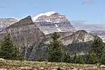
The Vermilion Range is a mountain range of the Canadian Rockies, in British Columbia, Canada. The range is west of the Vermilion River and east of the...
3 KB (109 words) - 08:49, 21 July 2023

(British Columbia, Washington, Idaho; see below for sub-tributaries) Kootenay River (British Columbia, Idaho, Montana; see below for sub-tributaries) Hugh...
23 KB (1,609 words) - 19:52, 22 March 2024

from Saskatchewan River Crossing, and Banff Windermere Parkway leads from Castle Junction (south of Lake Louise) through the Kootenay National Park to...
7 KB (624 words) - 02:38, 14 August 2024

Crowsnest Pass (category Regional District of East Kootenay)
three intermediary creeks into the Elk River, which feeds into the Kootenay River, and finally into the Columbia River to the Pacific. Before the arrival...
11 KB (1,172 words) - 05:39, 25 July 2024

(in the Bow River valley) The Southern Continental Ranges run along the British Columbia-Alberta border from Banff down to Fernie Kootenay Ranges Beaverfoot...
6 KB (536 words) - 00:50, 5 August 2023
Echo, Comox Valley Record Cranbrook – Cranbrook Townsman, East Kootenay Weekly, Kootenay News Advertiser| Creston – Creston Valley Advance Delta – Delta...
49 KB (2,639 words) - 21:44, 26 August 2024

British Columbia Highway 95 at Radium Hot Springs, through Kootenay National Park and Vermilion Pass across the Continental Divide, to the junction of the...
18 KB (1,011 words) - 05:39, 27 August 2024