
Vermont Route 30 (VT 30) is a 111.870-mile-long (180.037 km) north–south state highway in the U.S. state of Vermont. VT 30 runs from U.S. Route 5 (US...
11 KB (546 words) - 02:03, 26 July 2024

water. Middlebury is crossed by U.S. Route 7, Vermont Route 23, Vermont Route 30, Vermont Route 116, and Vermont Route 125. It is bordered by the towns of...
26 KB (2,439 words) - 03:10, 21 August 2024

Dorset, U.S. Route 7 runs as a Super 2 freeway. It also parallels I-89 between Burlington and the Canada–U.S. border. Vermont Route 30 is a 111.870-mile-long...
219 KB (21,844 words) - 13:02, 5 September 2024
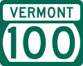
Vermont Route 100 (VT 100) is a north–south state highway in Vermont in the United States. Running through the center of the state, it travels nearly the...
14 KB (496 words) - 02:29, 27 June 2024

U.S. Route 5 ("Connecticut River Byway") Vermont Route 9 ("Molly Stark Trail") Vermont Route 30 Vermont Route 119 Vermont Route 142 Vermont Route 9 runs...
60 KB (6,306 words) - 14:12, 3 September 2024

New England road marking system (redirect from Route 30 (New England))
then U.S. Route 4, Vermont Route 30, U.S. Route 7, U.S. Route 2, and Vermont Route 225. Route 30A was superseded by Vermont Route 22A, and Route 30B was...
158 KB (6,445 words) - 17:10, 1 February 2024

terminating at Route 30 in Sudbury. Vermont Route 149 is an east–west highway extending from the New York state line for only 1.3 miles to Vermont 30 in Pawlet...
30 KB (2,991 words) - 21:25, 5 September 2024

Super-2 freeway. They are: U.S. Route 7 (Exit 4 serves the town) Historic VT Route 7A Vermont Route 30 Vermont Route 11 Green Mountain Community Network's...
23 KB (2,051 words) - 17:25, 29 July 2024

The entire route is in Chittenden County. Vermont Route 2B (VT 2B) is an alternate route of US 2 between Danville and St. Johnsbury. The route begins across...
25 KB (1,463 words) - 01:41, 5 August 2024

in the western and southern parts of the town, respectively, along Vermont Route 30 in a valley between two portions of the Taconic Range. 3,230-foot (980 m)...
17 KB (1,780 words) - 20:53, 23 June 2024

Highways, and Vermont routes. Routes in Vermont are abbreviated as "VT #" by VTrans and also abbreviated as "VT Route #" and "Route #" in common usage...
62 KB (1,082 words) - 17:43, 14 August 2024

Treat Williams (category People from Manchester, Vermont)
Williams was involved in a motorcycle crash on Vermont Route 30, in Dorset. According to the Vermont State Police, a 2008 Honda Element in the southbound...
56 KB (4,049 words) - 16:00, 18 August 2024

S. Route 7 Vermont Route 12A Vermont Route 17 Vermont Route 22A Vermont Route 23 Vermont Route 30 Vermont Route 53 Vermont Route 73 Vermont Route 74 Vermont...
24 KB (2,069 words) - 15:05, 26 April 2024
West and Rock rivers flow through the town. Newfane is crossed by Vermont Route 30. The West River in Newfane yielded the largest gold nugget ever found...
13 KB (1,129 words) - 14:44, 3 September 2024

the exit sits on the border of Dummerston and Putney), U.S. Route 5 and Vermont Route 30. It is bordered by Brattleboro to the south, Marlboro and Newfane...
13 KB (1,160 words) - 14:17, 3 September 2024

tributary of Lake Champlain. The town is crossed by Vermont Route 30, Vermont Route 31, and Vermont Route 140. The village of Poultney is located entirely...
17 KB (1,623 words) - 12:44, 23 August 2024

Vermont Route 7A (VT 7A) is a 27.8-mile-long (44.7 km) north–south state highway in Bennington County, Vermont, in the United States. It is an alternate...
7 KB (464 words) - 20:17, 25 May 2024

The northeast corner of town is crossed by Vermont Route 30, following the Mettawee River. Vermont Route 153 runs north–south through the western part...
12 KB (1,026 words) - 03:32, 11 May 2024

Vermont Route 9 (VT 9) is a state highway in the U.S. state of Vermont. The highway runs 46.957 miles (75.570 km) from the New York state line in Bennington...
11 KB (994 words) - 01:46, 5 August 2024

Interstate 91 (redirect from Interstate 91 (Vermont))
miles (89 km) in Massachusetts, and 177 miles (285 km) in Vermont. I-91 parallels US Route 5 (US 5) for all of its length, and many of the exits along...
84 KB (5,152 words) - 01:42, 7 September 2024

Vermont Route 73 (VT 73) is a 36.674-mile-long (59.021 km) east–west state highway in central Vermont, United States. It extends from VT 74 in Shoreham...
6 KB (335 words) - 03:16, 19 March 2023
Burlington is the most populous city in the U.S. state of Vermont and the seat of Chittenden County. It is located 45 miles (72 km) south of the Canada–United...
80 KB (8,204 words) - 03:11, 28 August 2024

Vermont Route 125 (VT 125) is a 35.901-mile-long (57.777 km) east–west state highway in Addison County, Vermont, United States. The route begins at an...
14 KB (1,360 words) - 02:29, 19 March 2023

(275 km) from Montpelier, Vermont, beginning at US 2, to Portland, Maine, at U.S. Route 1. It passes through the states of Vermont, New Hampshire and Maine...
25 KB (1,430 words) - 22:28, 4 August 2024

Windham County is a county located in the U.S. state of Vermont. As of the 2020 census, the population was 45,905. The shire town (county seat) is Newfane...
28 KB (2,323 words) - 19:02, 30 April 2024

U.S. Route 7 (US 7) is a north–south highway extending from southern Connecticut to the northernmost part of Vermont. In Vermont, the route extends for...
20 KB (959 words) - 01:15, 4 August 2024

U.S. Route 4 (US 4) in the U.S. state of Vermont extends for 66.059 miles (106.312 km) between the New York state line at Fair Haven and the New Hampshire...
17 KB (1,142 words) - 23:31, 26 April 2024

Weybridge to the north. Otter Creek forms the town border with Salisbury. Vermont Route 30, also known as the "Seth Warner Memorial Highway" and named for notable...
15 KB (844 words) - 04:00, 11 May 2024

Vermont Route 142 (VT 142) is a 10.847-mile-long (17.457 km) north–south state highway in Vermont, United States. It runs from the state border with Massachusetts...
4 KB (347 words) - 03:28, 19 March 2023

through the town. Jamaica is crossed by Vermont Route 30 (in part concurrent with Vermont Route 100). Like all Vermont towns, Jamaica has an annual town meeting...
16 KB (1,541 words) - 14:38, 3 September 2024