of the former state routes in Arizona, including mileage tables and maps. Between the establishment of Arizona's numbered state highway system in 1927 and...
93 KB (8,932 words) - 08:41, 16 April 2025

State Route 89 (SR 89) is a 104.53-mile (168.22 km) state highway in the U.S. state of Arizona. It is part of the former route of U.S. Route 89 (US 89)...
6 KB (293 words) - 23:50, 4 March 2025
state of Arizona's State Routes are usually abbreviated as SR. The Arizona State Highway system was introduced on September 9, 1927, by the State Highway...
51 KB (1,442 words) - 02:26, 15 April 2025

State Route 79 (SR 79), also known as the Pinal Pioneer Parkway, is a 58.40 mi (93.99 km) long state highway in the U.S. state of Arizona. It serves as...
19 KB (1,921 words) - 23:49, 4 March 2025

State Route 89A (SR 89A) is an 83.85-mile (134.94 km) state highway that runs from Prescott north to Flagstaff in the U.S. state of Arizona. The highway...
28 KB (2,141 words) - 16:19, 9 April 2025
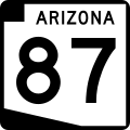
(26 km) toward Coolidge, passing by the town of Eloy. In Coolidge, State Route 87 is known as Arizona Boulevard. The highway leaves Coolidge heading northwest...
12 KB (731 words) - 23:49, 4 March 2025

Arizona State Route 202 (SR 202) or Loop 202 (202L) is a semi-beltway circling the eastern and southern areas of the Phoenix metropolitan area in central...
45 KB (3,311 words) - 14:56, 14 April 2025
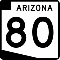
State Route 80 (SR 80) is a 120.20-mile (193.44-kilometre) long, roughly arc-shaped highway lying in southeastern Arizona. Starting in downtown Benson...
15 KB (1,571 words) - 01:32, 25 March 2025

State Route 66 (SR 66) is a surface road in the U.S. state of Arizona in Mohave, Coconino, and Yavapai Counties. In 1914, the road was designated as part...
10 KB (772 words) - 20:44, 19 March 2025

Arizona State Route 101 (SR 101) or Loop 101 is a semi-beltway looping around the Phoenix Metropolitan Area in central Arizona, United States. It connects...
25 KB (1,773 words) - 17:43, 16 April 2025
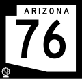
Arizona State Route 76 (SR 76) was a short state highway in eastern central Arizona, United States that connected State Route 77 to the San Manuel Copper...
21 KB (2,023 words) - 06:46, 14 January 2025

State Route 77 (SR 77) is a 253.93-mile (408.66-kilometre) long state highway in Arizona that traverses much of the state's length, stretching from its...
23 KB (1,878 words) - 06:46, 14 January 2025

160 near Cortez, Colorado along the routes of State Route 14, U.S. Route 89, Arizona State Route 98, U.S. Route 160, the current US 163, the new road...
16 KB (1,632 words) - 02:39, 1 February 2025

U.S. Route 93 (US 93) is a United States Numbered Highway in the state of Arizona that begins in Wickenburg and heads north to the Nevada state line at...
30 KB (3,174 words) - 05:43, 14 April 2025

State Route 85 (SR 85) is a 128.86-mile-long (207.38 km) state highway in the U.S. state of Arizona. The highway runs from the United States–Mexico border...
22 KB (1,765 words) - 05:39, 14 April 2025

State Route 72 (SR 72) is a 36.74-mile-long (59.13 km) state highway in the U.S. state of Arizona. It runs from SR 95 near Parker southeast to U.S. Route...
10 KB (914 words) - 23:48, 4 March 2025

State Route 88 is a long state highway in the U.S. state of Arizona. It runs from U.S. Route 60 (US 60) in Apache Junction through desert terrain to SR...
14 KB (1,145 words) - 23:49, 4 March 2025

Arizona is a state in the Southwestern region of the United States, sharing the Four Corners region of the western United States with Colorado, New Mexico...
164 KB (14,010 words) - 18:20, 16 April 2025

Interstate 17 (redirect from Arizona State Route 79 (1950-1968))
entirely within the US state of Arizona. I-17's southern terminus lies in Phoenix, at I-10/US 60 and its northern terminus is in Flagstaff, at Milton Road...
27 KB (1,471 words) - 20:44, 18 April 2025

via Arizona Memory Project. Arizona State Highway Commission; Larls, W.B. (1927). Official State Routes and State Highways of the State of Arizona (Map)...
43 KB (2,515 words) - 20:37, 18 April 2025

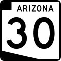
State Route 30 (formerly State Route 801), also known as the I-10 Reliever, is a planned state highway in the southwest parts of Phoenix, Arizona and nearby...
16 KB (1,523 words) - 17:22, 6 November 2024
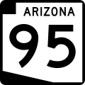
State Route 95 (SR 95) is a north–south state highway along the western edge of Arizona that is split into two sections. The southern segment begins in...
10 KB (581 words) - 19:41, 28 March 2025

State Highway Department Road Map of Arizona (Map). 1:1,267,200. Arizona State Highway Department. Retrieved June 21, 2023 – via AARoads. U.S. Route Numbering...
13 KB (1,260 words) - 04:29, 14 April 2025

U.S. Route 191 (US 191) is a north–south U.S. Highway in eastern Arizona. The highway runs for 516.50 miles (831.23 km), making it Arizona's longest numbered...
47 KB (4,555 words) - 23:59, 20 February 2025

State Route 69 (SR 69) is a highway that serves as the main road to Prescott, Arizona, from Interstate 17. The highway mainly consists of four-lanes (two...
7 KB (581 words) - 23:48, 4 March 2025

suburbs of Phoenix to planned ones in northwestern Pinal County. It is the lowest-numbered state route in Arizona. The first mile from Loop 202 to Ellsworth...
18 KB (1,662 words) - 19:50, 12 April 2025
entire route is in Maricopa County. Roads and freeways in metropolitan Phoenix Arizona State Route 24 Arizona State Route 202 Arizona State Route 303 "MAJOR...
13 KB (1,075 words) - 16:02, 16 April 2025

U.S. Route 89 (US 89) is a U.S. Highway in the U.S. state of Arizona that begins in Flagstaff and heads north to the Utah border northwest of Page. US 89...
22 KB (1,946 words) - 22:49, 28 March 2025
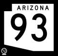
Arizona State Route 93, abbreviated SR 93, was a state highway in Arizona that existed from 1946 to 1991. The route was co-signed with other highways...
26 KB (2,185 words) - 00:29, 15 February 2025
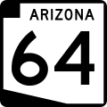
State Route 64 (SR 64) is a 108.31-mile-long (174.31 km) state highway in the northern part of the US state of Arizona. It travels from its western terminus...
8 KB (664 words) - 06:46, 14 January 2025