
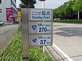
National Route 157 is a national highway of Japan connecting Kanazawa, Ishikawa and Gifu in Japan, with a total length of 202.6 km (125.89 mi). "一般国道の路線別、都道府県別道路現況"...
1 KB (71 words) - 02:33, 22 March 2024
National Route 58 (国道58号, Kokudō Gojūhachi-gō) is a Japanese national highway connecting the capital cities Kagoshima and Naha of Kagoshima Prefecture...
30 KB (1,850 words) - 10:12, 8 May 2024
National Route 8 (国道8号, Kokudō hachi-gō) is a major highway in the Hokuriku and Kansai regions of central Japan. The 574.1-kilometer (356.7 mi) highway...
8 KB (524 words) - 05:01, 8 June 2024
National Route 21 (国道21号, Kokudō Nijūichi-gō) is a national highway connecting Mizunami, Gifu Prefecture and Maibara, Shiga Prefecture in Japan. Length:...
3 KB (168 words) - 02:05, 18 March 2024
National Route 22 (国道22号, Kokudō Nijūni-gō) is a national highway connecting Nagoya, Aichi Prefecture, and Gifu, Gifu Prefecture in Japan. The route follows...
3 KB (213 words) - 02:05, 18 March 2024
National Route 4 (国道4号, Kokudō Yongō) is a major national highway in eastern Honshū, Japan. Measuring 738.5 kilometers long (458.9 mi), it is the longest...
70 KB (1,026 words) - 05:01, 8 June 2024

National Route 7 (国道7号, Kokudō Nanagō) is a major north-south national highway on the Sea of Japan side of the island of Honshū, Japan. It traverses four...
35 KB (473 words) - 12:04, 26 June 2024

National Route 281 (国道281号, Kokudō Nihyaku hachi-juichigō) is a national highway of Japan that traverses the prefecture of Iwate in a southwest–northeast...
9 KB (575 words) - 00:57, 18 March 2024
National Route 101 (国道101号, Kokudō Hyakuichigō) is a national highway of Japan connecting the capitals of Aomori and Akita prefectures, Aomori and Akita...
20 KB (1,279 words) - 08:34, 8 May 2024

Retrieved 1 March 2019. "高速自動車国道等の最高速度" (in Japanese). Retrieved 4 July 2023. "道路交通法施行令" (in Japanese). Retrieved 19 May 2024. 刑集第23巻12号1625頁 "自動車の走行速度を規定する要因に関する調査研究"...
19 KB (1,502 words) - 17:25, 19 May 2024

while traveling on Route 353 through Nakanojō" 【歌詞付】いつも何度でも【メロディーロード】群馬県中之条町国道353号. YouTube. Archived from the original on 2021-12-22. Retrieved June 10, 2020...
14 KB (738 words) - 08:07, 30 March 2024
National Route 119 (国道119号, Kokudō Hyakujūkyū-gō) is a national highway located entirely within Tochigi Prefecture, Japan. It connects the city of Nikkō...
17 KB (1,298 words) - 11:50, 13 June 2024

Kagoshima and Kagoshima, Kagoshima in Japan, with a total length of 157.4 km (97.8 mi). "一般国道の路線別、都道府県別道路現況" [Road statistics by General National Highway route...
1 KB (72 words) - 22:25, 17 March 2024
Aichi and Aoi-ku, Shizuoka in Japan, with a total length of 157.2 km (97.68 mi). "一般国道の路線別、都道府県別道路現況" [Road statistics by General National Highway route...
1 KB (73 words) - 21:17, 20 March 2024

connecting Karatsu and Sasebo in Japan, with a total length of 157 km (97.56 mi). "一般国道の路線別、都道府県別道路現況" [Road statistics by General National Highway route...
1 KB (69 words) - 18:09, 20 March 2024

with a total length of 250.1 km (155.4 mi). Japan portal Roads portal "一般国道の路線別、都道府県別道路現況" [Road statistics by General National Highway route and prefecture]...
2 KB (75 words) - 03:18, 26 December 2022
of 248.8 km (154.6 mi). Much of the route is concurrent with Route 159. "一般国道の路線別、都道府県別道路現況" [Road statistics by General National Highway route and prefecture]...
1 KB (81 words) - 23:34, 17 March 2024

2015. "国頭林道2ヵ所、台風で土砂崩れ 東村国道、復旧進まず". Ryūkyū Shimpō (in Japanese). July 28, 2015. Retrieved December 23, 2015. 平成27年台風第12号による大雨等に係る被害状況等について (PDF) (Report)...
30 KB (3,048 words) - 23:32, 23 August 2023

with a total length of 213.3 km (132.5 mi). Japan portal Roads portal "一般国道の路線別、都道府県別道路現況" [Road statistics by General National Highway route and prefecture]...
1 KB (75 words) - 02:33, 22 March 2024

death, 32 injuries; national highway 212 blocked (四川省广元市青川县6.1级余震造成1人死亡32人受伤 国道212线中断)". CEA. August 6, 2008. Archived from the original on August 6, 2008...
162 KB (16,049 words) - 00:39, 23 June 2024

a total length of 76.2 kilometers (47.3 mi). Japan portal Roads portal "一般国道の路線別、都道府県別道路現況" [Road statistics by General National Highway route and prefecture]...
1 KB (77 words) - 05:05, 8 June 2024
Japan, with a total length of 64.8 km (40.3 mi). Japan portal Roads portal "一般国道の路線別、都道府県別道路現況" [Road statistics by General National Highway route and prefecture]...
1 KB (76 words) - 21:55, 19 June 2022

reconnecting the two sections. 天津地铁2号线7月1日起分段开通试运营 公交接驳地铁方便出行 Archived 22 December 2015 at the Wayback Machine "天津地铁2号线_资讯中心_中国网". www.china.com.cn. Archived...
9 KB (220 words) - 12:45, 25 June 2024

c.nishinippon.co.jp (in Japanese). Retrieved 2020-05-09. "昭和46年8月洪水". 八代河川国道事務所. Retrieved 2020-06-29. "78 Dead in Storm's Wake In Japan and South Korea"...
17 KB (1,994 words) - 16:11, 9 May 2024