
Highway 33, officially named Grizzly Trail, is a north–south highway in west–central Alberta, Canada. Highway 33 begins at Highway 43 near the hamlet of...
9 KB (534 words) - 05:35, 27 August 2024

The Canadian province of Alberta has a provincial highway network consisting of over 31,400 kilometres (19,500 mi) of roads as of 2021-2022, of which 28...
157 KB (1,030 words) - 08:02, 28 August 2024
Template:Attached KML/Alberta Highway 2 KML is not from Wikidata Highway 2 (also known as the Queen Elizabeth II Highway) is a major highway in Alberta that stretches...
110 KB (7,505 words) - 06:24, 27 August 2024
Highway 1 is a major east–west highway in southern Alberta that forms the southern mainline of the Trans-Canada Highway. It runs from the British Columbia...
39 KB (2,754 words) - 05:30, 27 August 2024

Highway 1A is the designation of two alternate routes off the Alberta portion of Trans-Canada Highway 1. However, it is not the only name used for spurs...
26 KB (2,014 words) - 05:31, 27 August 2024

central Alberta, Canada that is surrounded by the County of Barrhead No. 11. It is located along the Paddle River and at the intersection of Highway 33 (Grizzly...
28 KB (2,707 words) - 00:32, 28 November 2023

Highway 3 (officially named the Crowsnest Highway) is a 324-kilometre (201 mi) highway that traverses southern Alberta, Canada, running from the Crowsnest...
77 KB (7,434 words) - 05:42, 27 August 2024

Highway 2A is the designation of six alternate routes off Highway 2 in Alberta, Canada. In general, these are original sections of Highway 2, such as the...
25 KB (1,145 words) - 05:31, 27 August 2024

Template:Attached KML/Alberta Highway 43 KML is not from Wikidata Highway 43 is a major highway in northern and central Alberta, Canada that connects...
31 KB (2,548 words) - 05:36, 27 August 2024
decomissioned or retired highways that have since been replaced with newer highways within Alberta's provincial highway network. These are highways or alternate routes...
59 KB (996 words) - 08:03, 28 August 2024

The Crowsnest Highway is an east-west highway in British Columbia and Alberta, Canada. It stretches 1,161 km (721 mi) across the southern portions of...
21 KB (1,532 words) - 05:40, 27 August 2024

Highway 93 is a north–south highway in Alberta, Canada. It is also known as the Banff-Windermere Parkway south of the Trans-Canada Highway (Highway 1)...
18 KB (1,011 words) - 05:39, 27 August 2024
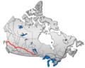
Alberta is one of the thirteen provinces and territories of Canada. It is a part of Western Canada and is one of the three prairie provinces. Alberta...
163 KB (14,517 words) - 02:36, 14 August 2024
Mackenzie Highway is a Canadian highway in northern Alberta and the Northwest Territories. It begins as Alberta Highway 2 at Mile Zero in Grimshaw, Alberta. After...
12 KB (666 words) - 05:40, 27 August 2024
following highways are numbered 33: AH33 Asian Highway 33 E33 European route E33 South Arm Highway (Tasmania) Alberta Highway 33 British Columbia Highway 33 Bedford...
8 KB (548 words) - 15:51, 27 August 2024

Template:Attached KML/Alberta Highway 41 KML is not from Wikidata Highway 41, officially named Buffalo Trail, is a 686-kilometre (426 mi) north-south highway in eastern...
17 KB (560 words) - 05:36, 27 August 2024

Template:Attached KML/Alberta Highway 28 KML is not from Wikidata Highway 28 is a 293-kilometre (182 mi) highway in north-central Alberta, Canada that connects...
14 KB (643 words) - 05:35, 27 August 2024

Highway 21 is a north–south highway in Alberta, Canada that parallels Highway 2 between Calgary and Edmonton. It is approximately 328 kilometres (204 mi)...
20 KB (1,347 words) - 05:34, 27 August 2024

Highway 18 is a 161-kilometre (100 mi) highway in Alberta, Canada. It stretches from Highway 43 at the hamlet of Green Court, through the towns of Barrhead...
8 KB (568 words) - 05:34, 27 August 2024

Rocky View County (redirect from Rocky View, Alberta)
Rocky View County is a municipal district in southern Alberta, Canada that is named for its views of the nearby Rocky Mountains to the west. It surrounds...
21 KB (1,519 words) - 22:35, 17 July 2024
British Columbia, Alberta, Saskatchewan, and Manitoba and is part of the Trans-Canada Highway system and the larger National Highway System, but should...
15 KB (1,618 words) - 00:12, 29 March 2024

Alberta Provincial Highway No. 881, commonly referred to as Highway 881, is a highway split into two sections in northeast Alberta, Canada. Each section...
11 KB (353 words) - 06:21, 27 August 2024

Highway 16A is the designation of three alternate routes off Alberta Highway 16 (the Yellowhead highway) in Alberta, Canada. The Evansburg – Entwistle...
13 KB (735 words) - 05:33, 27 August 2024

Highway 734 is a highway in western Alberta, Canada that travels through the forested foothills of the Rocky Mountains. It used to be part of Forestry...
12 KB (549 words) - 06:18, 27 August 2024

Highway 22X is a highway in and around Calgary in the Canadian province of Alberta, extending 54 kilometres (34 mi) to the east from Highway 22. It is...
7 KB (453 words) - 05:34, 27 August 2024

Grande Prairie (redirect from Grand Prairie, Alberta)
northwest Alberta, Canada within the southern portion of an area known as Peace River Country. It is located at the intersection of Highway 43 (part of...
68 KB (6,737 words) - 02:07, 21 August 2024

of Highway 1 (British Columbia, Alberta, Saskatchewan, and Manitoba), Highways 17 and 417 (Ontario), Autoroutes 40, 25, 20, and 85 (Quebec), Highway 2...
69 KB (8,114 words) - 23:47, 21 August 2024

Highway 20 is a highway in central Alberta, Canada, west of Highway 2. Highway 20 begins Highway 11 and travels north for 4 km (2 mi) along the east side...
9 KB (530 words) - 05:34, 27 August 2024

Strathcona County (redirect from Scotford, Alberta)
a specialized municipality in the Edmonton Metropolitan Region within Alberta, Canada between Edmonton and Elk Island National Park. It forms part of...
39 KB (2,468 words) - 20:30, 13 June 2024

town in central Alberta, Canada. It is at the intersection of Highway 14 (Poundmaker Trail) and Highway 36 (Veterans Memorial Highway), approximately...
13 KB (622 words) - 01:46, 24 June 2024