
Arkansas Highway 224 (AR 224, Hwy. 224) is a designation for two east–west state highways in Jackson County, Arkansas. A northern route of 8.25 miles...
5 KB (367 words) - 22:03, 28 May 2024
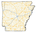
of state highways in the U.S. state of Arkansas. The state does not use a numbering convention. Generally, the two-digit odd numbered highways run north–south...
244 KB (1,779 words) - 09:22, 17 August 2024
Highway 224 China National Highway 224 National Route 224 Japan National Route 224 U.S. Route 224 Arkansas Highway 224 California State Route 224 (former)...
3 KB (183 words) - 23:26, 4 April 2024

Scranton is a city in Logan County, Arkansas, United States. The population was 224 at the 2010 census. It was named after Scranton, Pennsylvania. Scranton...
7 KB (561 words) - 13:14, 15 May 2024

U.S. Route 167 (redirect from Arkansas Highway 115 (1926))
north-south United States Highway within the U.S. states of Louisiana and Arkansas. It runs for 500 miles (800 km) from Ash Flat, Arkansas at U.S. Route 62/U...
71 KB (4,569 words) - 01:22, 30 August 2024

Interstate highways are located in Jackson County, two United States highways (U.S. Route 67 (US 67) and US 167) and fifteen Arkansas state highways run in...
19 KB (1,340 words) - 19:57, 18 September 2024

Highway 14 (AR 14, Ark. 14, and Hwy. 14) is an east–west state highway in Arkansas. The route of 227.35 miles (365.88 km) begins at Boat Dock Road near...
41 KB (3,521 words) - 02:41, 16 March 2024

In Arkansas, the highway runs from the Louisiana state line near Doddridge to the Missouri state line near Bella Vista. In Texarkana, the highway runs...
41 KB (3,028 words) - 02:16, 30 August 2024

settlement in the state of Arkansas. The town is contiguous with Blue Eye, Missouri on the north side of the border. Arkansas Highway 21 ends at the border...
8 KB (629 words) - 12:15, 26 August 2024

Interstate 30 (redirect from Interstate 30 (Arkansas))
Interstate 30 (I-30) is a major Interstate Highway in the southern states of Texas and Arkansas in the United States. I-30 travels 366.76 miles from I-20...
52 KB (2,402 words) - 06:41, 11 September 2024

Highway 230 (AR 230, Ark. 230, and Hwy. 230) is a designation for four state highways in Arkansas. One route of 8.15 miles (13.12 km) begins at Highway 14/Highway 25...
12 KB (772 words) - 02:26, 16 March 2024

Missouri Route 43 (redirect from Missouri State Highway 43)
City), Arkansas, and Oklahoma where it continues down the Arkansas/Oklahoma state line as both Arkansas Highway 43 and Oklahoma State Highway 20. North...
6 KB (347 words) - 01:17, 7 May 2024

Arkansas Highway 367 (AR 367 or Hwy. 367) is a designation for two north–south state highways in Arkansas. A southern route of 15.03 miles (24.19 km)...
11 KB (423 words) - 20:22, 11 August 2024

Craighead County, Arkansas, United States. The population was 1,279 at the 2010 census. It is included in the Jonesboro, Arkansas Metropolitan Statistical...
9 KB (718 words) - 05:20, 23 June 2024

Arkansas Highway 226 (AR 226 and Hwy. 226) is a designation for two state highways in northeast Arkansas. The main segment of 25.28 miles (40.68 km) runs...
9 KB (555 words) - 16:29, 16 February 2024

Arkansas Highway 223 (AR 223, Hwy. 223) is a north–south state highway in north Arkansas. The route of 29.92 miles (48.15 km) runs from Highway 56 in...
4 KB (216 words) - 16:32, 16 February 2024

confluence with the North Fork River's tailwater at Norfork. Arkansas Highway 5 Arkansas Highway 177 As of the census of 2000, the population density was...
8 KB (572 words) - 16:38, 21 April 2024

Arkansas Highway 128 passes through the center of town as Main Street and leads southeast 11 miles (18 km) to Highway 9 at Holly Springs. Arkansas Highway...
15 KB (975 words) - 13:56, 4 May 2024
County, Arkansas, United States and one of the county's two seats of government. The community is located along the Arkansas River in the Arkansas River...
25 KB (2,126 words) - 02:06, 28 April 2024
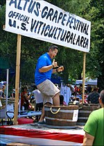
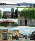
classification of the Arkansas Activities Association (AAA). Highway 64 runs through Altus, and the city limits follow the highway west from the main population...
12 KB (1,208 words) - 15:27, 21 May 2024

Cross County is a rural Northeast Arkansas county in the Arkansas Delta. Created as Arkansas's 53rd county on November 15, 1862, Cross County contains...
50 KB (4,633 words) - 18:56, 21 September 2024

town is located in southern Montgomery County at the intersection of Arkansas highways 8 and 27. It is 9 miles (14 km) south of Mount Ida, the county seat...
9 KB (746 words) - 13:30, 19 June 2024

Buffalo National River (redirect from Buffalo River (Arkansas))
National River is located in Harrison, Arkansas. Boxley Bridge – located on the upper end of the river along Arkansas Highway 21. Boxley provides access to the...
15 KB (1,479 words) - 03:29, 23 February 2024

Reyno is a city in Randolph County, Arkansas, United States. The population was 456 at the 2010 census. The town was originally called Needmore, and was...
8 KB (735 words) - 16:46, 21 April 2024

Route 67 (US 67) is a U.S. highway running from Presidio, Texas northeast to Sabula, Iowa. In the U.S. state of Arkansas, the route runs 279.15 miles...
31 KB (1,405 words) - 00:42, 30 August 2024

S. Highway 65 U.S. Highway 67 U.S. Highway 70 U.S. Highway 165 U.S. Highway 167 Highway 5 Highway 10 Highway 100 Highway 161 Highway 300 Highway 338...
22 KB (1,499 words) - 17:23, 5 September 2024

route is in Jefferson County. US Highway 79C was a city route in McNeil, Arkansas. The route was redesignated as Highway 98B in 1970. U.S. Route 79 Bypass...
16 KB (1,488 words) - 01:20, 28 February 2024

87639°N 93.91861°W / 33.87639; -93.91861 (33.876358, -93.918599). Arkansas Highway 27 runs through the center of town, leading northeast 7 miles (11 km)...
9 KB (679 words) - 16:36, 21 April 2024
2012. General Highway Map, White County, Arkansas (PDF) (Map). 1:62500. Cartography by Planning and Research Division. Arkansas State Highway and Transportation...
37 KB (3,400 words) - 17:28, 21 September 2024

Route 64 is a U.S. highway running from Teec Nos Pos, Arizona east to Nags Head, North Carolina. In the U.S. state of Arkansas, the route runs 246.35...
36 KB (2,100 words) - 05:28, 6 July 2024