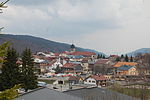
Bois-d'Amont (French pronunciation: [bwɑ damɔ̃]) is a municipality in the district of Sarine in the canton of Fribourg in Switzerland. On 1 January 2021...
7 KB (315 words) - 20:18, 25 August 2024
Lac de Joux in Switzerland. Here it reaches an altitude of 1,377 m (4,518 ft), before crossing the Orbe river upstream of Bois-d'Amont. South of Les Rousses...
11 KB (1,236 words) - 17:30, 23 January 2025
on the Swiss border. The Lac des Rousses is located northeast of the village of Les Rousses beside the road to the village of Bois d'Amont. The Lac...
6 KB (349 words) - 11:53, 22 August 2024
Arconciel (redirect from Arconciel, Switzerland)
in Switzerland. On 1 January 2021 the former municipalities of Arconciel, Ependes and Senèdes merged to form the new municipality of Bois-d'Amont. Arconciel...
18 KB (1,848 words) - 17:32, 16 January 2025
Arzier-Le Muids (redirect from Arzier, Switzerland)
Muids is a municipality in the district of Nyon in the canton of Vaud in Switzerland. The first mention of Arzier was in 1306 as the village Argie. Throughout...
21 KB (2,437 words) - 23:48, 22 November 2024
La Transjurassienne (category 1980 establishments in Switzerland)
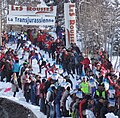
Lamoura (1120m), Prémanon, Les Rousses, Bois-d'Amont, Le Brassus (Switzerland), Bellefontaine, Chapelle-des-Bois, Le Pré Poncet, Chaux-Neuve, Petite-Chaux...
4 KB (303 words) - 14:32, 9 January 2025
Orbe (river) (category Rivers of Switzerland)
See Jura water correction. France Les Rousses Lac des Rousses Bois-d'Amont Enters Swiss territory Canton de Vaud Le Chenit Lac de Joux Le Pont underground...
3 KB (283 words) - 18:49, 11 June 2024
Senèdes (redirect from Senèdes, Switzerland)
in Switzerland. On 1 January 2021 the former municipalities of Arconciel, Ependes and Senèdes merged to form the new municipality of Bois-d'Amont. Senèdes...
14 KB (1,472 words) - 17:40, 16 January 2025
Le Chenit (redirect from Le Chenit, Switzerland)
Le Chenit is a municipality in the canton of Vaud in Switzerland, located in the district of Jura-Nord Vaudois in the Vallée de Joux. Le Chenit is first...
20 KB (2,337 words) - 23:00, 22 March 2024
This is an alphabetical list of the 2,131 municipalities of Switzerland, updated (as of January 2024[update]). "Répertoire officiel des communes de...
72 KB (50 words) - 19:02, 4 October 2024
of cross-country skiing Bois d'Amont: 52 km of cross-country skiing Cerniébaud: 60 km of cross-country skiing Chapelle-des-Bois: 110 km of cross-country...
55 KB (5,761 words) - 15:32, 27 December 2024
Épendes, Fribourg (category Pages using infobox Switzerland municipality with manual population)
Arconciel, Ependes and Senèdes merged to form the new municipality of Bois-d'Amont. The asteroid 129342 Ependes is named in its honour. Épendes is first...
15 KB (1,777 words) - 17:39, 16 January 2025
Sarine District (category Swiss populations data templates/Failure)
Arconciel, Ependes and Senèdes merged to form the new municipality of Bois-d'Amont. On 1 January 2025 the former municipalities of Grolley and Ponthaux...
21 KB (1,494 words) - 17:41, 16 January 2025
Municipalities of the canton of Fribourg (category Lists of municipalities of Switzerland)
Fribourg, Switzerland (as of January 2025[update]). Attalens Autigny Avry Bas-Intyamon Belfaux Belmont-Broye Billens-Hennens Bois-d'Amont Bösingen Bossonnens...
11 KB (1,207 words) - 15:57, 16 January 2025
Foncine-le-Haut, he won two Olympic medals. Jason Lamy-Chappuis: Originally from Bois-d'Amont, he is the Olympic champion in 2010 at the Vancouver Winter Olympics...
47 KB (3,002 words) - 20:34, 12 January 2025
This is a list of former municipalities of Switzerland, i.e. municipalities of Switzerland (German: Gemeinden, French: communes, Italian: comuni, Romansh:...
162 KB (93 words) - 08:44, 21 October 2024
region in eastern France, about 13 km (8 mi) from the border with Switzerland. It is one of the two subprefectures of the department. Montbéliard is...
17 KB (1,498 words) - 00:44, 7 December 2024
department in the Bourgogne-Franche-Comté region in eastern France near the Swiss border. Pontarlier occupies the ancient Roman station of Ariolica, in Gallia...
10 KB (681 words) - 22:45, 13 January 2025
Catalunya Map of France, provided by IGN France Map of Switzerland, provided by Swisstopo, Switzerland's national mapping agency ViaMichelin online road map...
84 KB (793 words) - 23:24, 10 December 2024
national significance (class A) in the canton of Fribourg from the 2009 Swiss Inventory of Cultural Property of National and Regional Significance. It...
57 KB (175 words) - 03:02, 17 February 2023
located in the southwest of the Jura Mountain Range in France, on the French-Swiss border. The park was created February 10, 1986, and at that time comprised...
10 KB (531 words) - 02:53, 9 December 2024
department in Bourgogne-Franche-Comté in eastern France. It is near the Swiss border and is located next to the River Ain. The commune also has a shape...
3 KB (150 words) - 15:09, 4 January 2025
(1985-03-25) 25 March 1985 (age 39) Le Sentier, Switzerland Height 1.85 m (6 ft 1 in) Ski club SC Bois d'Amont World Cup career Seasons 9 – (2007–2015) Indiv...
10 KB (171 words) - 19:12, 14 October 2024
(ESWD) European Storm Forecast Experiment (ESTOFEX) Tornado Map *in German Swiss Severe Weather Database (SSWD) / Sturmarchiv Schweiz *in German Tornadoes...
280 KB (8,610 words) - 21:00, 17 January 2025
eastern France. It is located in the Jura mountains near the border with Switzerland. The area around Glay was part of Burgundy as early as 888, and came...
9 KB (989 words) - 11:18, 21 August 2024
located in Eastern France, close to the Jura Mountains and the border with Switzerland. Capital of the historic and cultural region of Franche-Comté, Besançon...
78 KB (9,831 words) - 09:01, 8 January 2025
located 30 km (19 mi) south of Pontarlier in the Jura Mountains on the Swiss border. The source of the river Doubs is 2 km (1.2 mi) from Mouthe. Mouthe...
9 KB (335 words) - 00:28, 25 August 2024
under German occupation, yet still remained a haven for Jews escaping to Switzerland due to its proximity to it (about 8 km away, as the crow flies). As a...
5 KB (490 words) - 09:33, 8 October 2024
Morre lies 4 km (2.5 mi) east of Besançon on the road to Pontarlier and Switzerland. Communes of the Doubs department "Répertoire national des élus: les...
2 KB (100 words) - 00:28, 25 August 2024
is situated in a widening of the Doubs river valley. The proximity of Switzerland (11 km to Le Locle, 21 km to La Chaux-de-Fonds) gives employment to trans-border...
8 KB (907 words) - 00:11, 4 November 2024


