
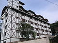
Braço do Norte is a municipality in the state of Santa Catarina in the South region of Brazil. Most known for its agriculture and square fabrics, it was...
5 KB (189 words) - 18:37, 24 November 2023

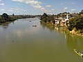
The Braço do Norte River is a river of Santa Catarina state in southeastern Brazil. List of rivers of Santa Catarina Map from Ministry of Transport v t...
953 bytes (29 words) - 13:46, 17 February 2023

Itapemirim River is formed by the Castelo River and the Braço Norte Direito and Braço Norte Esquerdo rivers, whose sources are in the Caparaó National...
3 KB (132 words) - 15:02, 17 November 2023
The Do Meio River is a river of Santa Catarina state in southeastern Brazil. It is a tributary of the Braço do Norte River. List of rivers of Santa Catarina...
1,012 bytes (38 words) - 13:44, 17 February 2023

1988) is a Brazilian model and TV presenter. Kuerten was raised in Braço do Norte, Santa Catarina. She decided to become a model when she was ten years...
3 KB (183 words) - 22:15, 5 April 2024
Braço do Trombudo is a municipality in the state of Santa Catarina in the South region of Brazil. List of municipalities in Santa Catarina IBGE 2020 "Divisão...
5 KB (154 words) - 11:39, 21 March 2022
tributary) Do Meio River (Bahia, Peruípe River tributary) Do Meio River (Braço do Norte River tributary) Do Meio River (Itajaí River tributary) Do Meio River...
610 bytes (117 words) - 14:58, 21 February 2021

Florianópolis (redirect from Costão do Santinho)
acres) Serra do Tabuleiro State Park, a mountainous area covered in lush forests. The park protects the sources of the Vargem do Braço, Cubatão and Una...
63 KB (5,977 words) - 20:32, 18 August 2024
Catarina Santo Antônio São Marcos Vila Cubatão Vila Nova Zona Industrial Norte Zona Industrial Tupy Joinville is famous for its strong German-influenced...
30 KB (2,605 words) - 04:47, 9 August 2024

Braço de Prata Railway Station (Portuguese: Estação Ferroviária de Braço de Prata) is a railway station on the Cintura Line in the city of Lisbon, Portugal...
4 KB (212 words) - 00:53, 17 March 2024
The Braço Norte do Rio Itaúnas is a river of Espírito Santo state in eastern Brazil. List of rivers of Espírito Santo Brazilian Ministry of Transport 18°17′S...
853 bytes (45 words) - 13:36, 17 February 2023
The Peruípe River (Braço Norte) is a river in Bahia state in eastern Brazil. It is one of two branches which form parts of the boundaries of Ibirapuã...
2 KB (75 words) - 12:31, 14 February 2020

Do Braço River (Santa Catarina) Braço do Norte Direito River Braço do Norte River Braço Menor do Rio Araguaia River Braço Norte do Rio Itaúnas Braço Norte...
59 KB (6,576 words) - 08:18, 24 January 2024

da Fumaça Nova Veneza Siderópolis Treviso Urussanga Tubarão Armazém Braço do Norte Capivari de Baixo Garopaba Grão Pará Gravatal Imaruí Imbituba Jaguaruna...
10 KB (519 words) - 22:51, 30 August 2024
tributary of the Hipólito River, which in turn is a right tributary of the Braço do Norte River. The river rises in the São Joaquim National Park. The upper reaches...
2 KB (96 words) - 20:57, 15 January 2022
São Mateus River (redirect from Braço Norte do Rio São Mateus)
Gerais in the municipality of São Félix de Minas, where it is known as Braço Sul do Rio São Mateus (the southern branch) or Rio Cricaré. Its principal tributary...
3 KB (246 words) - 13:53, 17 February 2023
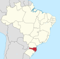
the north by the state of Paraná, to the south by the state of Rio Grande do Sul, to the east by the Atlantic Ocean, and to the west by the Argentine province...
93 KB (9,201 words) - 12:31, 4 September 2024

intermediate geographic regions. Mesoregions Grande Florianópolis Norte Catarinense Oeste Catarinense Serrana Sul Catarinense Vale do Itajaí Geography of Brazil...
10 KB (60 words) - 10:41, 11 February 2024
Itaúnas River Braço Norte do Rio Itaúnas Braço Sul do Rio Itaúnas Itauninha River Jacaraípe River Jacarandá River Jucu Braço Norte River Jucu Braço Sul River...
7 KB (540 words) - 13:54, 17 February 2023

in Santa Catarina IBGE 2020 "Divisão Territorial do Brasil" (in Portuguese). Divisão Territorial do Brasil e Limites Territoriais, Instituto Brasileiro...
5 KB (180 words) - 09:15, 24 January 2021
uncommon. Rio do Sul has a history of frequently occurring floods, as in the city there are three rivers- Itajaí-Açu, Itajaí do Norte and Itajaí do Oeste. The...
7 KB (441 words) - 21:13, 11 October 2023
Niehuesstraat in Hoogeveen) and Brazil (e.g. Rua João Teodoro Niehues in Braço do Norte), and Rua Antonio Niehues in {[Capanema - PR]}. Neuhaus (surname) Niehaus...
6 KB (606 words) - 21:39, 20 August 2024
São Paulo, Brazil Rio Pequeno (Santa Catarina), a tributary of the Braço do Norte River in southeastern Brazil Rio Pequeno (São Paulo), a tributary of...
331 bytes (79 words) - 12:58, 15 August 2020
river and Azambuja river by the right bank. The major tributary, the Braço do Norte river is, actually, larger than the Tubarão River. The Tubarão River...
4 KB (550 words) - 15:30, 13 July 2022

FILHOTE PRAIA DO MAR GROSSO LAGUNA". YouTube. "Atlas climático da Região Sul do Brasil: Estados do Paraná, Santa Catarina e Rio Grande do Sul" (PDF). EMBRAPA...
9 KB (352 words) - 02:37, 25 May 2024

Linha do Norte is the Portuguese main railway line that connects the two main Portuguese cities, Lisbon and Porto. Its length is 336.079 kilometres (208...
6 KB (240 words) - 21:33, 12 September 2024

acres) Serra do Tabuleiro State Park, a protected area created in 1975. The lushly-forested park protects the sources of the Vargem do Braço, Cubatão and...
4 KB (167 words) - 18:02, 15 December 2022

Braço do Norte, Rio Fortuna, São Martinho, Imarui e Gravatal. Área: 173,578 km² Population: 8,759 (2020) Altitude: 30 m Tourist Region: Encantos do Sul...
5 KB (205 words) - 23:35, 26 August 2024
Physical characteristics Source • location Santa Catarina state Mouth Braço do Norte River • coordinates 27°58′S 49°6′W / 27.967°S 49.100°W / -27.967;...
912 bytes (27 words) - 13:33, 17 February 2023

Retrieved December 17, 2009. "Ranking decrescente do IDH-M dos municípios do Brasil" (in Portuguese). Atlas do Desenvolvimento Humano, Programa das Nações Unidas...
8 KB (454 words) - 01:17, 23 January 2024